


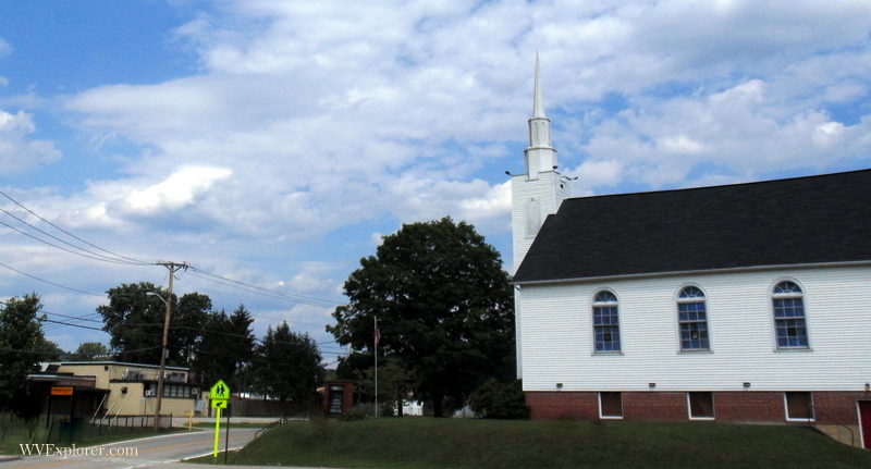
Tornado, WV (West Virginia), is an unincorporated residential community in the valley of the lower Coal River in western West Virginia. It is reputedly named for a tornadic storm that swept across the broad river bottom there sometime after the Civil War.
The community is also known as Upper Falls as a result of its location near the upper falls of the river. It has also been known as "Big Bend," as it adjoins a significant bend in the river below the falls, and "Andrews Heights," for land developer R. Carl Andrews, who served as mayor of Charleston from 1947 until 1950. Andrews Heights Elementary School is named for him.
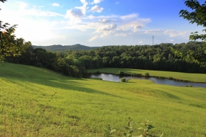
The population of Tornado in 2010 was 3,701. Despite the name Coal River, coal has never been mined in the valley near Tornado, which is chiefly residential and agricultural. The area may be best known as a recreation destination and a desirable location for second homes and vacation properties. Many property owners enjoy access to the river, a waterway popular with anglers and kayakers. Its economy is tied to that of the nearby City of Saint Albans, West Virginia, and the larger Charleston Metropolitan Statistical Area, which includes more than 250,000 residents.
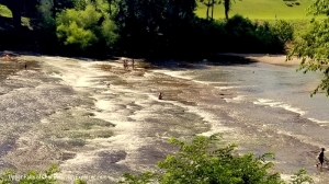
Overlooking the upper falls, the visitor center for the Coal River Water Trail is located at Meadowood Park, managed by the Kanawha County Parks and Recreation Commission. The center has become a chief destination for kayakers visiting the area. The park includes trails, natural areas, a playground, picnic areas, a small lake, and two launches for kayaks and other small watercraft. The park is also is home to one of the region's singular fields for radio-controlled small aircraft, maintained by the Mountaineer Radio Controlled Flying Club. The 18-hole Big Bend Golf Course, also managed by the county, is located in Big Bend of the Coal.
Kayaking and Tour de Coal

Tornado is the home to the Tour de Coal, an annual fundraising float-trip established to help maintain the river and its Walhonde water trail. The 11-mile float down the Coal River to its mouth has grown into one of the largest celebrations of flatwater kayaking in the U.S. More than 1,400 kayaks have been registered to launch in recent years. Thanks to the work of the Coal River Group, its partners, and communities along the way, the river is now among the cleanest in West Virginia.
History of Tornado
The first person of European ancestry believed to have seen the upper falls of the Coal River might have been John Peter Salling, who in 1742 led an expedition through the region during a journey to the Mississippi River. He reported finding coal along the river, which thereafter bore the name "Cole" or "Coal" river.
Much of Salling's route followed Native American trails, including the Paint Creek Trail, which shadowed the Coal from its mouth to a pass at the head of its Clear Fork on Paint Creek Mountain. Used by many native groups over the centuries, the trail was among the most important trans-Allegheny routes between the Atlantic seaboard and the valley of the Ohio and was traversed by Virginian heroine Mary Ingles, who in 1755 was captured by hostile Shawnee and conveyed by way of the trail into the Ohio Country.
Most native residents, who had lived in villages in the wide valley along the river, left the area in 1650 when the Iroquois of New York claimed the area as a hunting ground. These last residents may have been among groups of Eastern Sioux, though native peoples had lived permanently in the region as early as 1000 B.C. Some of the earliest groups raised mounds along the river.
Information that Ingles was able to provide the English and Cherokee following her capture inspired the Virginians to march to meet the Shawnee and Wyandotte at the Battle of Point Pleasant on the Ohio at Point Pleasant in 1774, after which colonists began to settle in the valley of the Coal in greater numbers, though attacks by the Shawnee continued until the Treaty of Greenville in 1795, after which native groups gave up their claim to the region east of the Ohio.
In about 1800, after the threat of Indian attack had passed, Joseph Thomas built a mill at the upper falls that operated until the 1930s. Beginning in about 1830, timber harvesting commenced in the valley, and logs were to be floated down the river to Saint Albans during floods. Cannel coal, or "candle coal," a kind of bituminous coal or oil shale used to produce kerosene, was also discovered on the river in marketable quantities.
The availability of both coal and timber in the watershed necessitated the construction of locks and dams that could support commercial navigability. Wooden-crib locks and dams were constructed in the 1850s, permitting steamboat traffic. However, flooding continuously wreaked havoc on the structures until in 1881 railroads supplanted the need for river traffic. Locks and dams from the period remain historical highlights on the river.
The Coal River and Western Railway, under the direction of General Cornelius Clarkson Watts, began in 1902 and was completed in 1904, and while timber extraction ended in the 1920s, but the rail line through Tornado, which is now owned by CSX Transportation, still transports bituminous coal to global markets.
Following World War II, many new residents arrived in Tornado, finding employment in the Kanawha Valley's burgeoning defense and chemical-manufacturing industries. As wealth in the region increased, the river became an attractive destination for leisure and recreation, and many affluent residents of the valley and the greater Charleston area established camps and second homes along the river.
Lodging near Tornado, West Virginia
Location
Tornado is located on Coal River Road (Kanawha County Route 9) approximately five miles southwest of Saint Albans, West Virginia, and 10 miles west of South Charleston, West Virginia.
Map of Tornado, West Virginia
Regional Information
Tornado is located in the Metro Valley Region in western West Virginia.


