(Editor’s Note: Over the next six issues of the 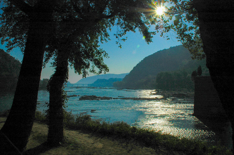 The Shenandoah River[/caption]
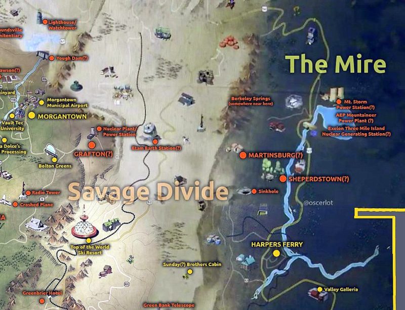
All are found in the panhandle in Morgan, Berkeley, and Jefferson counties, and all represent the region’s rich history from pre-colonial America through the Civil War. Several small battles and skirmishes dating back to the French-and-Indian War were fought here. George Washington surveyed the area as a youth and recruited soldiers from the region for some of his earliest battles.
 Shops at Shepherdstown, WV[/caption]
West Virginia is the only state to reside entirely inside the Appalachian region. The Allegheny Mountains — part of the Appalachian Mountains — run through the Eastern Panhandle and along its eastern border with Virginia. At an altitude of more than 4,000 feet, however, it’s difficult to fathom how the area could be referred to as a swampy bog.
“Mire” is a general term for four different types of wetland — bogs, swamps, marshes, and fens. Fens are actually a type of peatland and tend to be found on slopes or flats and are overgrown mostly with grasses and mosses. Arguably, The Mire sounded much more menacing than The Fen.
The Mount Weather location likely stands for the Mount Weather Emergency Operations Center just over the border from Jefferson County in Bluemont, Virginia. A top secret civilian-command facility operated in part by FEMA, Mount Weather is less than an hour by air from Washington, D.C.
Fallout 76 Coverage
- Mapping Fallout 76: John Barton explores The Savage Divide
- Mapping Fallout 76: John Barton explores The Ash Heap
- Mapping Fallout 76: John Barton explores Toxic Valley
- Mapping Fallout 76: John Barton explores Cranberry Bog
- Mapping Fallout 76: John Barton explores The Forest
- Writers track real W.Va. locations that appear in Fallout 76 map