
Editor’s note: The sixth installment in John Barton’s examination of a map of the soon-to-be-released Fallout 76 video game investigates The Forest, based principally on the large, hilly heartland of central West Virginia.
When players first set foot outside Vault 76, they’re blinded by sunlight then overwhelmed by the natural beauty that opens around them. This is vastly different from the post-apocalyptic wasteland featured in previous Fallout games.
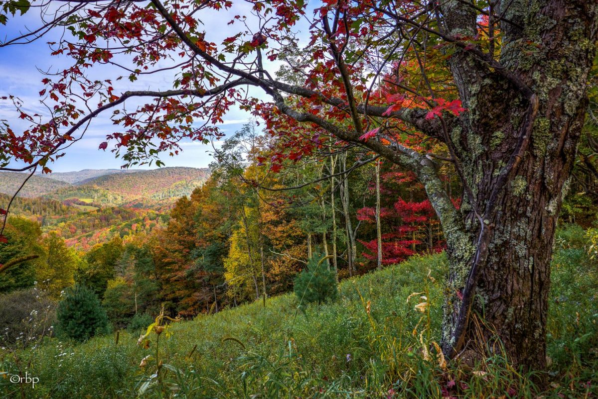
The forest that surrounds the vault in all directions is an old-growth forest filled with trees and small wildlife, not all of which had been irradiated. In every direction, hills and forest extend into the distance. It’s a vibrant, beautiful landscape. As Reclamation Day occurs mid-autumn, the hills are awash in the reds, yellows, and oranges. Such natural beauty illustrates why the Mountain State is known as “Almost Heaven.”
The Forest isn’t based on any specific location in West Virginia but is an amalgam of landscapes from the central state that extends west to 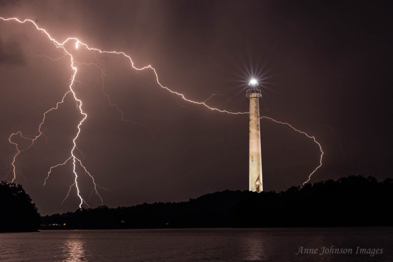 Lightning at Summersville Lake.[/caption]
This region is perhaps the largest section in the Fallout 76 map and takes up more than a quarter of the land in “Appalachia.” It also represents a much larger part of West Virginia than do other mapped sections, though many locations found here aren’t situated where one might expect to find them when traveling in real-world West Virginia. Landmarks from other areas of the state have been pulled in.
Summersville Lake, for instance, isn’t visible from the capitol at 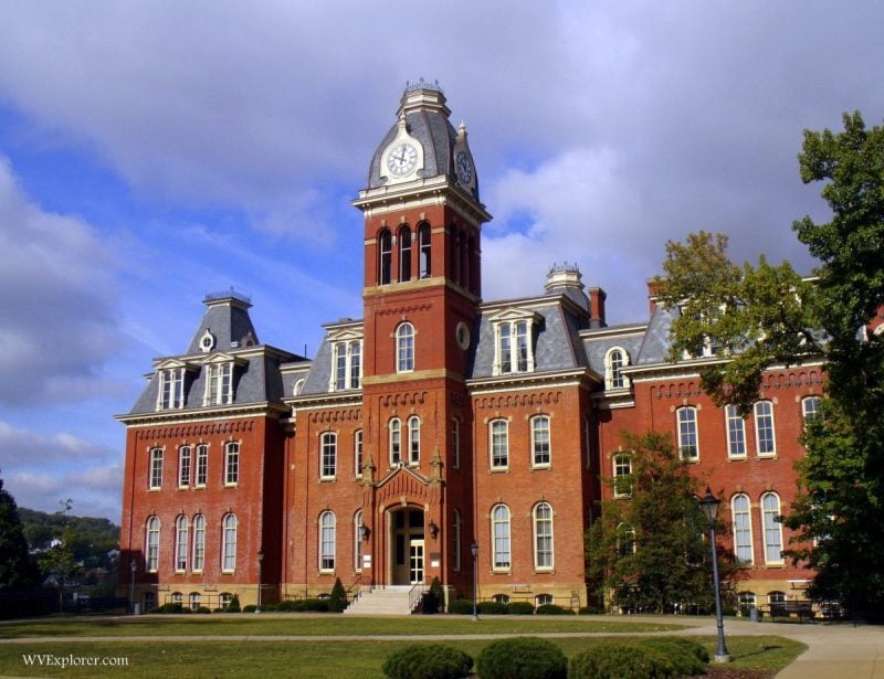 Woodburn Hall at Morgantown, WV[/caption]
Morgantown appears as well, as do many buildings from the campus there at 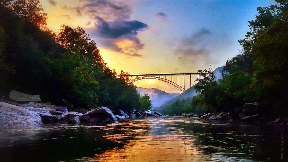 New River Gorge by Wendy Parks Scott[/caption]
The New River Gorge Bridge, completed in 1977, was until recently the longest single-span arch bridge in the world and, at 876 feet above mean river level, is one of the highest vehicular bridges in the world. Home to the annual Bridge Day celebration, during which more than 100,000 people walk out onto the span. Bridge Day is the only occasion when parachuting is permitted in a U.S. national park.

Other locations designated here include Lost World Caverns, the West Virginia Ordnance Works, the Swiss village of Helvetia, and the communities of Richwood, Grafton, Flatwoods, and Point Pleasant, the latter three of which are home to three of the state’s legendary monsters. The Mothman Museum at Point Pleasant is also a featured landmark. Also a noteworthy landmark, the Chester Teapot is in actuality located at the very northernmost tip of West Virginia.
More Fallout 76 Coverage
- Mapping Fallout 76: John Barton explores The Savage Divide
- Mapping Fallout 76: John Barton explores The Ash Heap
- Mapping Fallout 76: John Barton explores Toxic Valley
- Mapping Fallout 76: John Barton explores Cranberry Bog
- Mapping Fallout 76: John Barton explores The Mire
- Writers track real W.Va. locations that appear in Fallout 76 map