Editor’s note: The fifth installment in John Barton’s examination of a map of the soon-to-be-released Fallout 76 video game investigates The Savage Divide region, which is based on the Allegheny Mountains region and its lofty Allegheny Front.

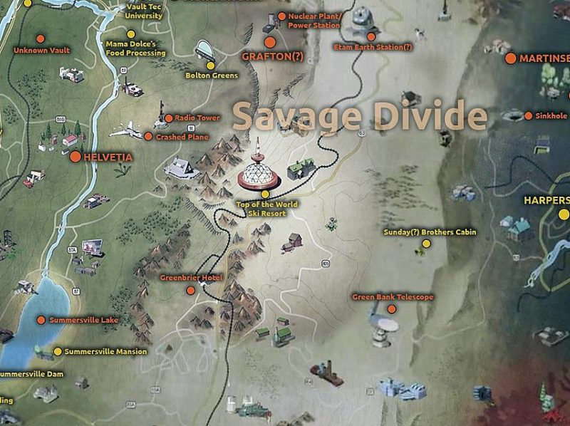
The Savage Divide cuts across what’s being called “Appalachia” in Fallout 76. The name alone suggests a unforgiving land, difficult to cross. Historically, this is an accurate depiction of the Allegheny Mountains in the early days of exploration in the U.S. Settlers didn’t appear in the region in large numbers until transportation technology improved in the late 1800s, which explains much of the state’s isolation and seclusion to this day.
The Alleghenies include the highest mountains in West Virginia and four of its ski resorts, three of which are located in its lofty Canaan Valley, as well as the dramatic cliffs at and near Seneca Rocks, and the distinctive terrain of the Dolly Sods Wilderness. The state’s highest elevation, Spruce Knob, elevation 4,863 ft. above sea level, is also located here.
The updated map by provided by Evenios includes roughly three dozen locations, but only a handful have been identified so far — The Greenbrier, Beartown State Park, Top-of-the-World, Green Bank Observatory, the Trans-Allegheny Lunatic Asylum. Of the 20 odd counties contained in the Alleghenies, only two are represented by these locations so far — Greenbrier and Pocahontas.
As other locations become known, more may be represented, though many are already represented in The Mire and Cranberry Bog, so perhaps not. A few locations mapped here in the Savage Divide, such as the Trans-Allegheny Lunatic Asylum, are located outside the Alleghenies, so the Savage Divide may be the most diverse or the least accurate as far as representing exact counties.
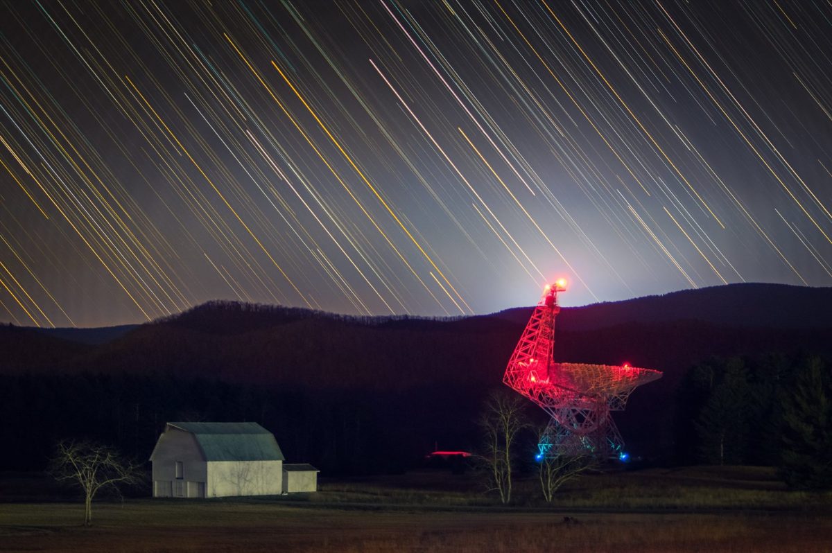
If you’re looking for Zetan aliens in Fallout 76, the most likely location to check is the Green Bank Observatory. Originally constructed in 1962 and rebuilt in 2001, the Green Bank Telescope is the world’s largest radio telescope. Green Bank was a National Radio Astronomy Observatory until 2016 when funding was cut.
Two items of note regarding Green Bank: One, numerous cave systems in the area are popular with spelunkers. Two, the telescope is near the center of the U.S. National Radio Quiet Zone, in which radio and electronic communications are limited to prevent interference with the telescope and the Sugar Grove Station. Sugar Grove is a National Security Agency (NSA) ECHELON site that gathers all international communication entering the eastern U.S. I’d expect to see Sugar Grove referenced in holotapes and notes — or else to find it in a location all its own.
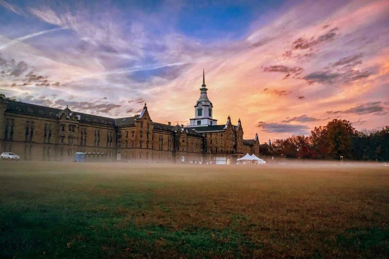
The Trans-Allegheny Lunatic Asylum, formerly known as the 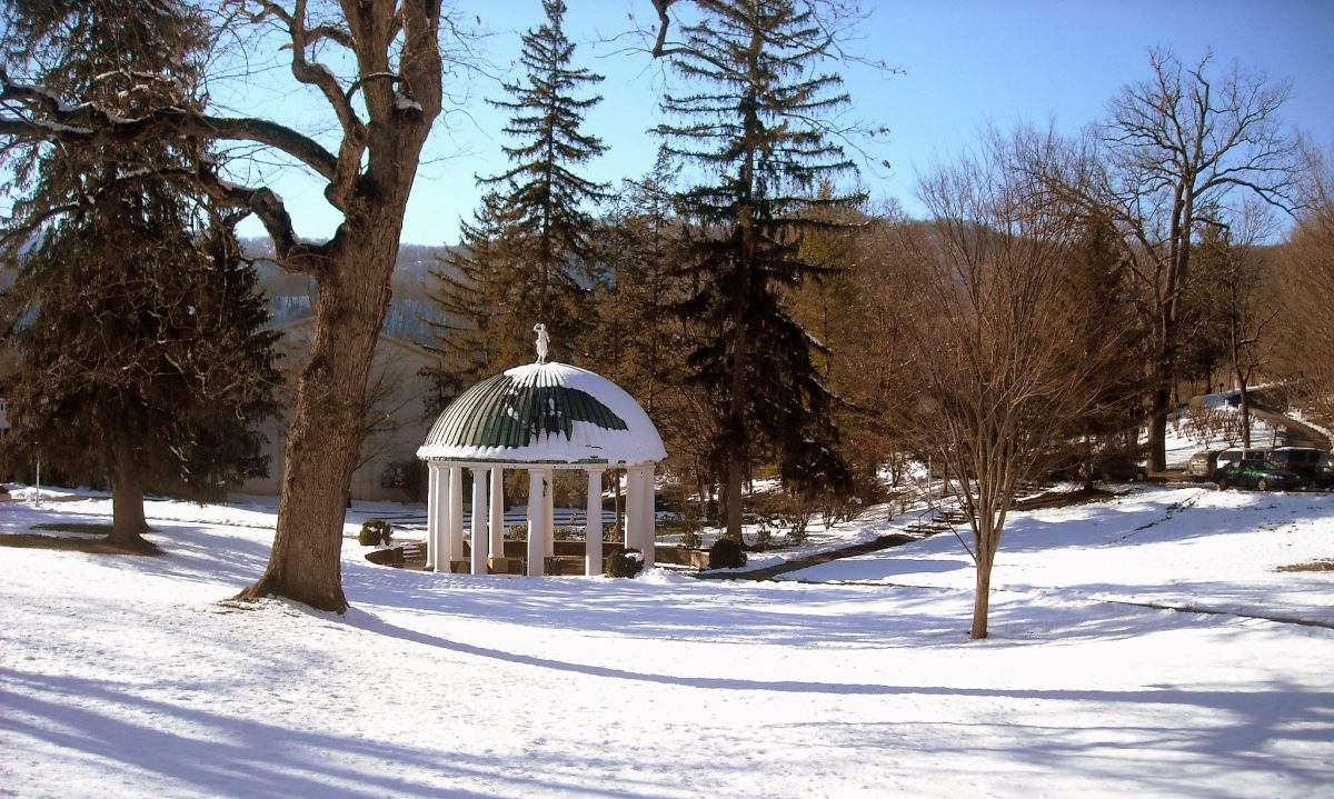 Pavilion at White Sulphur Spring[/caption]

The Greenbrier has existed in one form or another since 1778. A popular destination during the 19th century, especially following the Civil War, the hotel has a storied history. The current resort was built in 1913 by the Chesapeake & Ohio Railway, now CSX Transportation. Used as a detention center for Axis diplomats during World War II, its history lends itself to multiple in-game uses.
Perhaps one of the most interesting facts about The Greenbrier relevant to Fallout 76 is its fame as “Project Greek Island.” During renovations at the hotel in the 1950s, a secret, underground fallout shelter was opened under the hotel’s West Virginia Wing to house Congress in the case of a nuclear attack on Washington D.C.
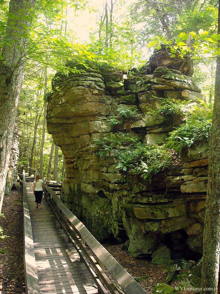
Nearby, Beartown State Park is a small, 110-acre natural park known for its unique rock formations — a labyrinth of boulders that form a kind of “bear’s town.” The park is located near Droop Mountain, the site of the last battle of the U.S. Civil War in West Virginia.
The Battle of Droop Mountain was one of the largest Civil War engagements in West Virginia, involving some 5,000 Federal troops and an estimated 1,200 Confederate soldiers. The Confederates lost 25 percent of their forces before retreating. The U.S. Army took the mountain and effectively broke Confederate resistance in West Virginia for the remainder of the war.
The large number of counties located in the Alleghenies region, and the presence of locations from outside the region included in the Savage Divide, makes it impossible to predict which other locations represented in the area might be. One trait common among the locations identified already — while these locations may not be from the Alleghenies, their unusual and often bloody history is thematically represented in the Savage Divide. West Virginia’s history and lore is rich in similar stories and locations that would fit in here.
Fallout 76 Coverage
- Mapping Fallout 76: John Barton explores The Forest
- Mapping Fallout 76: John Barton explores The Ash Heap
- Mapping Fallout 76: John Barton explores Toxic Valley
- Mapping Fallout 76: John Barton explores Cranberry Bog
- Mapping Fallout 76: John Barton explores The Mire
- Writers track real W.Va. locations that appear in Fallout 76 map