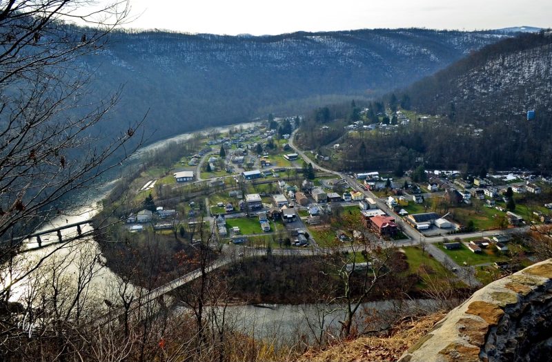
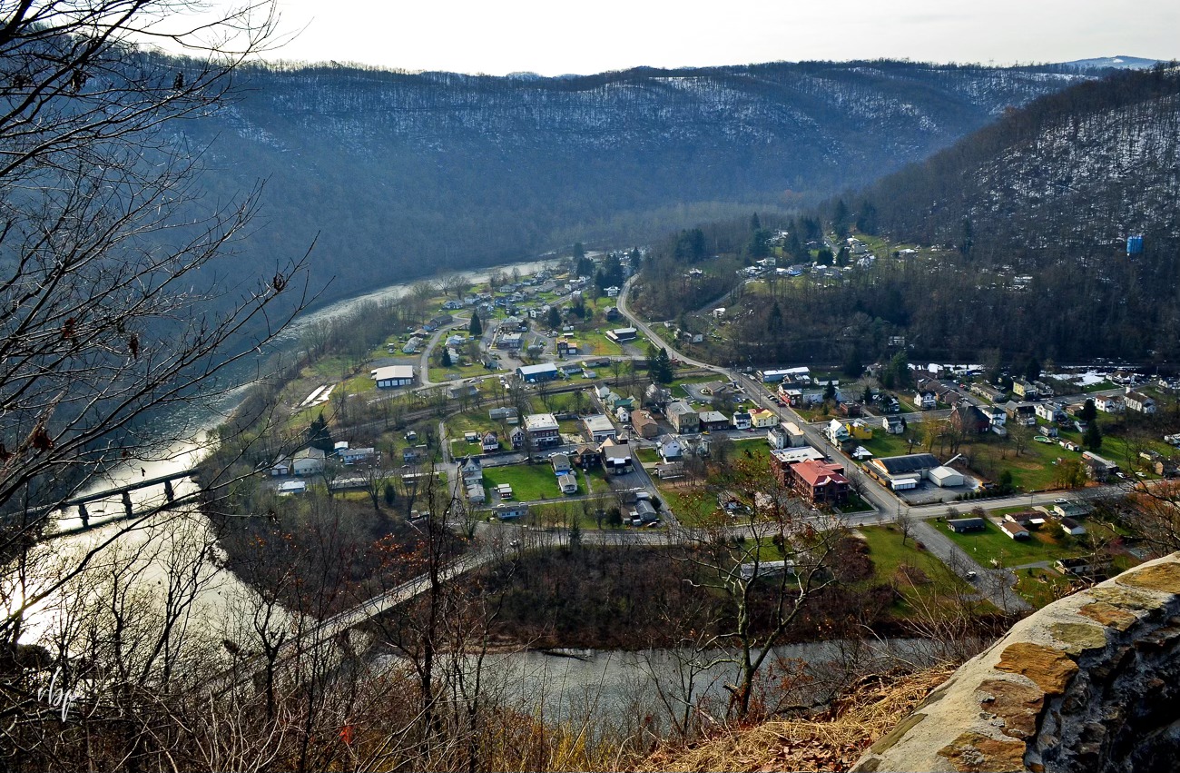
Rowlesburg, WV (West Virginia), a community on the Cheat River in southern Preston County, was chartered in 1858 and named for James Rowles, an engineer who surveyed the route of the Baltimore & Ohio Railroad. Rowlesburg is situated on a bend in the valley of the Cheat River opposite the mouth of Saltlick Creek.
Lodging near Rowlesburg, West Virginia
Parks & Public Recreation
The near reaches of the Briery Mountain Wildlife Management Area are located roughly two miles north of the community on Briery Mountain.
Location
Rowesburg is on highway WV-72, three miles north of its junction with US-50 at Macomber, West Virginia, and 13 miles south of the county seat at Kingwood, West Virginia.
Map of Rowlesburg, West Virginia
[mappress mapid=”230″]
Regional Information
Rowlesburg is located in the Monongahela Valley Region in northern West Virginia near the Allegheny Highlands Region.