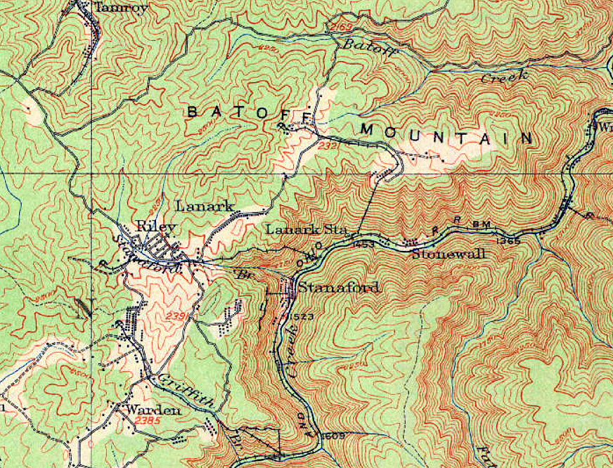
A 1913 map of the massacre area shows the towns of Riley, Lanark, and Stanaford, the locations of which have shifted over time, as is typical of mining camps, which were often moved after coal seams were mined out. Stanaford City may have been at Riley or Lanark.
Home Coal mining massacre near New River Gorge in W.Va. largely lost to history 1913 USGS Map showing Stanaford, West Virginia
1913 USGS Map showing Stanaford, West Virginia