


Why weather in the Allegheny Mountains is so different from the rest of West Virginia
CHARLESTON, W.Va. — West Virginians like to say, “If you don’t like the weather, wait five minutes.” In the Allegheny Mountains, that old line turns from a joke into a forecasting rule.
From Preston and Tucker counties south through Webster and Greenbrier and into the high ridges near Snowshoe Mountain, the Alleghenies acts like the state’s own weather machine, cooling the air, wringing out moisture, building snowpack, and sometimes flipping temperatures upside down in valleys that behave more like bowls than hollows.


Rime ice collects on the mountaintops overlooking the Canaan Valley. (Photo courtesy W.Va. Dept. of Tourism)
The result is a West Virginia that can feel like two or three states at once. Daffodils push up along the Kanawha River while rime ice still grips spruce branches in the high country. Rain drenches the lowlands while heavy upslope snow piles up along the Allegheny Front. A mild night graces the southern coalfields while Canaan Valley quietly sinks into the 20s.
Why the Alleghenies are colder and often snowier
The simplest difference is elevation. The higher you go, the cooler it gets, on average. The Allegheny highlands hold most of West Virginia’s loftiest terrain, including Spruce Knob, the state’s high point at 4,863 feet.
That vertical climb matters because mountains change the atmosphere’s “starting conditions.” Cooler air can hold less water vapor, which helps explain why the Allegheny high country so often lives under clouds and fog and why it can feel damp even on bright days.
But the bigger story in winter is geography and wind.
When cold air pours in from the northwest behind a front, it crosses the Great Lakes, picks up moisture, and then slams into the first major wall of high terrain in our region—the Allegheny Front and the ridges just west of it. Forced upward, that air cools and condenses, and the clouds can keep producing snow for hours or days.

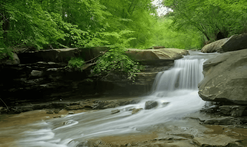
Snow blankets a red spruce forest for which the summits of the Allegheny Mountains are renowned. (Photo: Mountain River Media)
The National Weather Service office that covers much of West Virginia notes that snowfall “varies widely” across its forecast area due to terrain and elevation, with the mountains favored when conditions line up for orographic (terrain-driven) lift.
That’s why a map of West Virginia snow and rain often looks unfair. The lowlands get a cold rain or a slushy inch, while the high ridges get steady snow showers that refill the ski slopes and bury back roads.
Climate summaries for the state show the same overall precipitation pattern. West Virginia averages about 45 inches of precipitation annually, but amounts are higher across the central mountains and lower in the west along the Ohio River, a statewide signal that topography, not latitude, is the main driver.
The “Canaan effect”: valleys that trap cold like a freezer
Then there’s the twist that surprises even lifelong mountain residents: some of the coldest readings don’t happen on the peaks; they happen in the basins.
The Canaan Valley extends beyond White Grass, a cross-country skiing destination. (Photo Mountain River Media)
Canaan Valley sits around 3,200 feet above sea level in the Allegheny Mountains, but it’s its shape that makes it famous. It’s broad and partially enclosed by higher ridges, which allows dense, cold air to drain downhill at night and pool on the valley floor.
That pooling can produce strong temperature inversions—nights when it’s colder below than it is on the surrounding slopes. Accounts of Canaan Valley’s climate note that these inversions can be frequent and intense, with dramatic temperature differences over short vertical distances.
That’s a big reason the high Alleghenies can wake up to frost during months when the rest of West Virginia is thinking about tomatoes.
It also helps explain why the growing season up there can be remarkably short compared with lower elevations. It’s an important detail locals have long understood, and researchers and observers continue to document.
How the Alleghenies differ from other parts of West Virginia
The lowlands (Ohio and Kanawha valleys): Lower elevations mean warmer nights, longer growing seasons, and more winter precipitation falling as rain rather than snow. Snow does happen—sometimes in major storms—but sustained upslope snow is less common away from the high ridges. The National Weather Service’s snowfall climatology emphasizes how quickly conditions change as elevation rises from the western lowlands toward the mountains.
The Eastern Panhandle and Potomac Highlands: Weather here is shaped by a different set of mountain corridors and a closer relationship to Mid-Atlantic storm tracks. In many setups, the Allegheny highlands intercept moisture and enhance precipitation on windward slopes, while areas farther east can see sharper gradients depending on wind direction and storm path. That’s one reason West Virginia forecasting can turn into a county-by-county exercise.
The Allegheny high country: Colder averages, more fog, more high-wind days on exposed ridges, and a winter personality that can shift back to “January” well into March. In the highest elevations, snow totals can be dramatic in a typical season, particularly where persistent northwest flow keeps “feeding” the mountains.
Remarkable facts that make the Alleghenies stand out
The Allegheny Mountains aren’t just a weather boundary. They’re one of West Virginia’s most distinctive natural and cultural regions—a land where climate, ecology, and history stack up as sharply as the ridgelines.
1) West Virginia’s roof lives here.
Spruce Knob, inside the Monongahela National Forest, is the highest point in the state at 4,863 feet, offering a cooler summer feel and a glimpse of ecosystems that look more northern than Appalachian.
2) “Canada in West Virginia” is not just a slogan.
Dolly Sods Wilderness is a high plateau famous for bogs, heath barrens, wind-shaped trees, and an atypical climate that the U.S. Forest Service notes is associated with elevations from roughly 2,500 to more than 4,700 feet, supporting bog and heath communities more typical of southern Canada.
3) A wetland complex of statewide significance sits in a mountain valley.
Canaan Valley National Wildlife Refuge contains a wetlands complex of about 8,400 acres—described by the U.S. Fish and Wildlife Service as the largest wetlands system in West Virginia, perched at high elevation in the Allegheny Mountains.
4) Red spruce is making a comeback, and it matters.
West Virginia’s upland red spruce forests are closely tied to the high Alleghenies. The West Virginia Division of Natural Resources notes that these forests are emblematic of the state’s high mountains and support a unique community of plants and animals, which rebounded after heavy logging and fire in the late 19th and early 20th centuries.
5) The mountains shelter one of America’s quietest places.
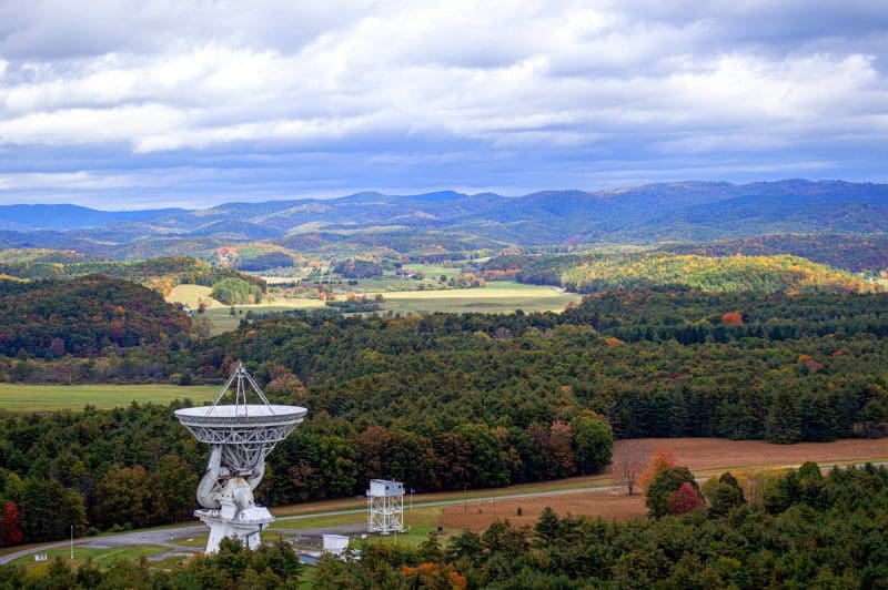
In Pocahontas County, the National Radio Quiet Zone was established to protect sensitive instruments from radio-frequency interference, creating an unusual technological landscape around the Green Bank Observatory.
What it means for travelers and for people who live there
For WVExplorer readers, the practical takeaway is simple: in the Allegheny Mountains, plan for more weather than the forecast headline suggests.

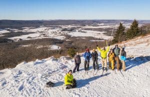
Hikers can enjoy solitude in winter and witness an environment far different than when the trees are in leaf. (Photo courtesy Elijah Hail)
A “chance of snow showers” can mean a quick dusting in Charleston and a steady upslope event on the high ridges. A calm winter night can turn into black ice by dawn in a valley that traps cold air. And a summer road trip that starts in sticky heat can end in a sweatshirt—not because the season changed, but because the elevation did.
West Virginia will always be a state of microclimates. But nowhere does the atmosphere show off quite like it does along the Allegheny spine, where mountains don’t just experience the weather; they make it.

Inside Appalachian Escapes: Themed rentals, escape rooms, and a love letter to West Virginia
FAYETTEVILLE, W.Va. — What began as a search for an affordable retirement option has turned into one of southern West Virginia’s most imaginative...
West Virginia bottler wins silver award at international water competition
BERKELEY SPRINGS, W.Va. — Le Sage Natural Water, of Lesage, has been awarded a silver medal for its purified water at the 36th annual Berkeley...
West Virginia uniquely prepared to dominate 21st-century outdoor economy
CHARLESTON, W.Va. — West Virginia is uniquely prepared to dominate in the 21st-century outdoor economy of the U.S., thanks to its unmatched...
Flood risk outpaces warnings, advocates say, as W.Va. considers changes to resiliency fund
CHARLESTON, W.Va. — As the W.Va. House of Delegates considers changes to Senate Bill 390, the West Virginia Rivers Coalition warns that the state...
We asked AI how its own data centers could pollute West Virginia. Here’s what it had to say
(The following article was generated partly by ChatGPT in response to a prompt about how data centers pollute. As ChatGPT is powered by data...
Inaugural W.Va. Outdoor Economy Summit to unite leaders around $2.1 billion growth
CHARLESTON, W.Va. — West Virginia’s outdoors are more than a scenic backdrop. They’re a strategic economic asset. That message will take...
West Virginia State Parks Foundation launches online merchandise store
HURRICANE, W.Va. — The West Virginia State Parks Foundation has launched an official online merchandise store, offering supporters a new way to...
West Virginia Travel Safety: What it means for residents and visitors in 2026
CHARLESTON, W.Va. — Travel safety in West Virginia is shaped less by headline-grabbing crime and more by geography, weather, and the realities of...
Did Abraham Lincoln and Jefferson Davis secretly meet in West Virginia?
PHILIPPI, W.Va. — Did Abraham Lincoln and Jefferson Davis secretly meet in what is now West Virginia just days after the first land battle of the...
Study finds WVU and its health system account for 17% of West Virginia’s economy
MORGANTOWN, W.Va. — West Virginia University and the WVU Health System together generate $14.3 billion in annual economic impact in West Virginia,...