


Big Sandy River
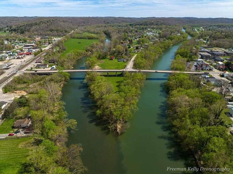
The Big Sandy River begins where its Tug and Leivisa forks join. (Photo courtesy Freeman Kelly Dronography)
The Big Sandy River drains roughly 4,140 square miles of the rugged Cumberland Mountains region of Kentucky, Virginia, and West Virginia. Nearly 23 percent of its drainage, or 940 square miles, is located in a narrow strip along the southwestern West Virginia border, an area approximately 115 miles long and eight miles wide. The river forms the boundary line between Kentucky and West Virginia.

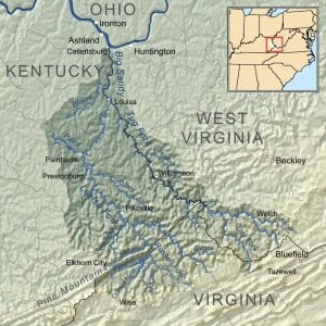
The drainage of the Big Sandy River includes more than 4,280 square miles. (Source: NationalAtlas.gov)
The Big Sandy is formed by the union of its Tug and Levisa forks, which join at Fort Gay, West Virginia. From this point, the river flows northward to empty into the Ohio River at Kenova, West Virginia. Its Tug Fork begins on the western slopes of Flat Top Mountain near the Virginia border with West Virginia.
Tug Fork flows in a northwesterly direction to its mount at Louisa. For a short distance below the boundary line of McDowell County, the fork forms the boundary line between Virginia and West Virginia; for the remainder of its length, Tug Fork forms the boundary between Kentucky and West Virginia. Levisa Fork flows northwesterly from its sources to Paintsville, Kentucky, turning northeasterly and joining the Tug Fork at Louisa. The Big Sandy and Tug also form the western border of the Hatfield & McCoy Region.
History
The formation of roads came slowly in the thick-forested areas surrounding the Big Sandy River. From the 1830s until the Norfolk & Western Railroad was built in the 1880s, steamboats traveled the entire length of the Big Sandy, providing exchange of produce, travel for passengers, and mail delivery in isolated areas. Poled wooden flats called “push boats” were executed when the river’s water was too low.
The Big Sandy was the site for multiple battles during the Civil War, the most famous being the Battle of Middle Creek in Eastern Kentucky and John’s Creek. The Hatfield-McCoy feud, which took place along Tug Fork in the 1880s, was one of the valley’s most cited events.
The Norfolk & Western Railroad was built along the Big Sandy during the late 1880s. The formation of the railroad resulted in the mining of the area’s deposits of coal, which became the primary industry of the Big Sandy watershed and remains so today.
Two popular folk tunes take their name from the Big Sandy River — “Sandy River Belle” and “Big Sandy River.” Loretta Lynn’s “Van Lear Rose” and Dwight Yoakam’s “Bury Me” also mention the Big Sandy.
Name Origin
Some sources claim the Big Sandy River was called the “Chat-ter-a-wha,” by a unidentified Native American tribe, meaning “the river of sandbars.”
Variant Names
Big Sandy Creek, Chatarrawa, Chattararawha, Chattaroi, Great Tattaroy River, Sandy Creek, Si-ke-a-ce-pe, Tateroy, Tatterio, To-ter-a, To-ter-as, To-ter-oy, Totteroi, Totteroy Creek, We-pe-pe-co-ne, We-pe-po-co-ne-ce-pe-we

Recent Articles
Inside Appalachian Escapes: Themed rentals, escape rooms, and a love letter to West Virginia
FAYETTEVILLE, W.Va. — What began as a search for an affordable retirement option has turned into one of southern West Virginia’s most imaginative...
West Virginia bottler wins silver award at international water competition
BERKELEY SPRINGS, W.Va. — Le Sage Natural Water, of Lesage, has been awarded a silver medal for its purified water at the 36th annual Berkeley...
West Virginia uniquely prepared to dominate 21st-century outdoor economy
CHARLESTON, W.Va. — West Virginia is uniquely prepared to dominate in the 21st-century outdoor economy of the U.S., thanks to its unmatched...
Flood risk outpaces warnings, advocates say, as W.Va. considers changes to resiliency fund
CHARLESTON, W.Va. — As the W.Va. House of Delegates considers changes to Senate Bill 390, the West Virginia Rivers Coalition warns that the state...
We asked AI how its own data centers could pollute West Virginia. Here’s what it had to say
(The following article was generated partly by ChatGPT in response to a prompt about how data centers pollute. As ChatGPT is powered by data...
Inaugural W.Va. Outdoor Economy Summit to unite leaders around $2.1 billion growth
CHARLESTON, W.Va. — West Virginia’s outdoors are more than a scenic backdrop. They’re a strategic economic asset. That message will take...
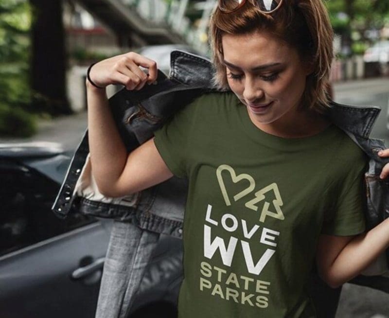
West Virginia State Parks Foundation launches online merchandise store
HURRICANE, W.Va. — The West Virginia State Parks Foundation has launched an official online merchandise store, offering supporters a new way to...
West Virginia Travel Safety: What it means for residents and visitors in 2026
CHARLESTON, W.Va. — Travel safety in West Virginia is shaped less by headline-grabbing crime and more by geography, weather, and the realities of...
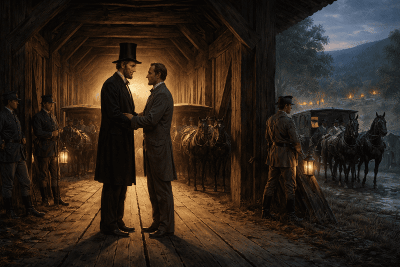
Did Abraham Lincoln and Jefferson Davis secretly meet in West Virginia?
PHILIPPI, W.Va. — Did Abraham Lincoln and Jefferson Davis secretly meet in what is now West Virginia just days after the first land battle of the...
Study finds WVU and its health system account for 17% of West Virginia’s economy
MORGANTOWN, W.Va. — West Virginia University and the WVU Health System together generate $14.3 billion in annual economic impact in West Virginia,...