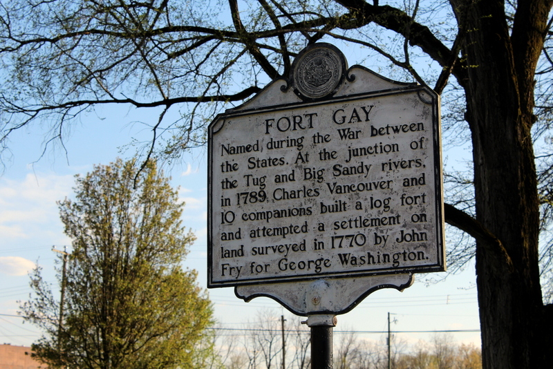
Fort Gay, WV (West Virginia), a community on the Big Sandy River in Wayne County, was chartered in 1875 as “Cassville.” Its name was changed to Fort Gay in 1932 to commemorate the location of Fort Gallup, which had been situated across the river at Louisa, Kentucky. The Tug Fork River and Louisa River join at Fort Gay to form the Big Sandy River.

Lodging near Fort Gay, West Virginia
Location
Fort Gay is located on highway US-52 approximately 16 miles southwest of the county seat at Wayne, West Virginia, and 23 miles south of the Ohio River and the I-64 expressway at Kenova, West Virginia.
Map of Fort Gay, West Virginia
Regional Information
Fort Gay is located in the Hatfield & McCoy Region in western West Virginia.