


At tip of W.Va.’s northern panhandle, “Point of Beginning” marks start of the West
EAST LIVERPOOL, Ohio — Some say that the American West begins at West Virginia— specifically at the tip of its northern panhandle—and there’s a quantifiable reason to support that claim.
Somewhere beneath the Ohio River, on what was the river’s north bank before it was dammed, Thomas Hutchens in 1786 established what’s now called the Point of Beginning, after which most lands to the west have since been mapped.

Establishing the Point of Beginning
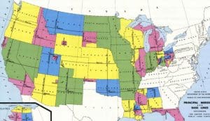
A grid system was expanded west from the Point of Beginning at the West Virginia boundary in 1786.
The Township-and-Range System, or Rectangular Survey System, commenced west of a stake there that marked the northern extent of the boundary between Pennsylvania and Virginia, now West Virginia.
The system was created by the Land Ordinance of 1785 to survey the land ceded to the U.S. by the Treaty of Paris after the end of the American Revolution, and it has been used since as the primary method for recording claims to land.
Real property to the east, and in the Appalachian Mountain region, is still most often described in “metes-and-bounds” defined by landmarks and land features such as rocks, trees, streams, and ridges.
The new system, however, laid off nearly square sections that were further subdivided into smaller nearly square units. It established the pattern of development of the new nation west of the Appalachians, across which states are often more rectangular.
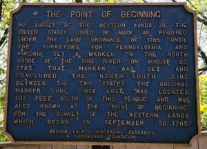
A historic marker tells the story of the Point of Beginning at the tip of northern West Virginia.
Few West Virginians seem to know about the point, seemingly because it’s located on the state line, and since the state boundary follows the opposite shore of the Ohio River, the marker is, for all intents and purposes, located in Ohio, just across the river at the eastern end of East Liverpool, Ohio.
Hutchens and his team braved Indian attacks to survey the first seven ranges, which included all or parts of 10 present-day counties in eastern Ohio.
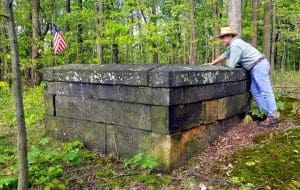
Point of Beginning Monument moved with the river inundation
As the exact Point of Beginning is now underwater, the Ohio River having been locked and dammed for navigation, a monument commemorating the site has been raised along Ohio Route 39 some 1,200 feet north of the point, which was declared a National Historic Landmark in 1965.
The commemorative marker monument may be reached from the tip of West Virginia’s northern panhandle from Chester, West Virginia, by following US-30 north into East Liverpool, then following Ohio Route 39 three miles west. There, visitors will find a collection of markers and exhibits.
READ MORE: Here’s how the northern panhandle was named.
The Point of Beginning: A Story of Beginnings in West Virginia
In the soft morning light of October 11, 1785, a thin mist curled over the Ohio River. Birds rustled in the sycamores, and the water shimmered as if aware that something important was about to begin. Just east of what is now East Liverpool, Ohio, at the tip of northern West Virginia, a small group of surveyors stood silently, their breath puffing in clouds, eyes fixed on a point marked only by a stake in the ground.
This was the Point of Beginning—the place where the orderly division of a vast wilderness would begin, the foundation of land ownership in much of the American Midwest. Before this moment, land in the West had been claimed in a messy, often unfair way, with overlapping boundaries and imprecise surveys. But now, for the first time, a new system would start here: the Public Land Survey System, created by the Land Ordinance of 1785.
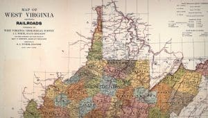
A section of the 1918 map of West Virginia Railroads represents part of the northern state and its northern panhandle.
Andrew Ellicott, a tough and brilliant surveyor, led the team. He had a mind like a compass and a resolve sharpened by years of charting wild terrain. With him stood Thomas Hutchins, the Geographer of the United States, who had pushed for this very moment—a rational, grid-like survey of the frontier that would divide land into neat townships and ranges.
To their south was the Mason-Dixon Line, already a legendary demarcation, separating the North from the South. But to their west lay the future—a vast, unmapped sea of forest and hills, claimed by none, promised to many. The Point of Beginning sat at the intersection of these worlds, tucked into a quiet bend of land in what is now northern West Virginia, where the borders of Pennsylvania, Ohio, and West Virginia converge like a knot in a rope.
The men raised their instruments—compasses, chains, and levels—and began the work. Every step westward was measured, recorded, and tied back to that original stake. The line they marked would become the First Principal Meridian, a spine from which townships and ranges would radiate across Ohio, Indiana, Illinois, and beyond. America was drawing its map—not with poetic names and sweeping borders, but with numbers, angles, and order.
But the Point of Beginning was more than a technical start. For settlers, it was a symbol of promise. Here, the idea of equal land for all—free men buying plots in a democratic system—was born. For Indigenous tribes, though, it marked something far more ominous: the edge of dispossession. As lines were drawn on maps, boundaries ignored ancient territories. The very precision of the system was its cruelty—it made the taking of land bureaucratic and efficient.
David Sibray peers into the grave of Judge John Reddick, first buried in both Virginia and Pennsylvania on the Ellicott Line.
Decades passed. Roads followed the survey lines, railroads traced them, and towns sprang up in the exact geometric patterns imagined here. The Point of Beginning, meanwhile, sat largely forgotten, marked by a small monument placed in 1881 near the riverbank, and again by a brass plate in the floor of a nearby park.
Today, you can still visit it, though it’s easy to miss. Nestled among trees and brush in northern West Virginia on the Ohio bank of the river, outside Liverpool, a granite monument quietly reminds visitors: Here began the Public Land Survey of the United States.
Stand there long enough, and you’ll feel it—the weight of history in the soil, the echo of chains pulled taut, the hum of ambition in the river’s current. This was where logic met wilderness, where a nation began to define itself by line and law. The Point of Beginning is not just a place—it is a moment, an idea, and a promise: that from a single mark in the earth, a country could grow.
And it did.
Storied West Virginia monument stands forgotten in the woods
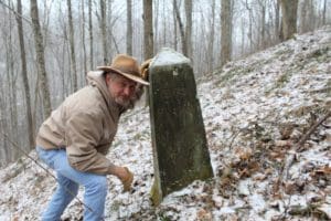
David Sibray visits the monument that marks the northern boundary of West Virginia.
GEORGE TOWN, W.Va. — Finding the monument on a map is difficult enough. Finding it in the steep woodlands is even more challenging. But on a remote hillside at the southeast corner of Marshall County stands a weathered monument that establishes West Virginia’s singular northern panhandle. Some say it’s a place that at least every panhandle resident should see. READ THE FULL STORY HERE.

Nightfall’s Value: Light pollution can diminish real estate worth in W.Va.
WINFIELD, W.Va. — An increasing number of new West Virginia residents are being drawn to its rolling hills and quiet valleys to escape brightly lit...
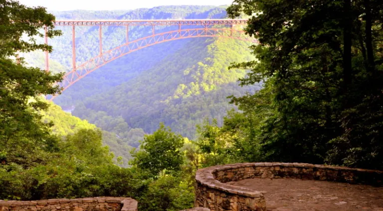
Inside Appalachian Escapes: Themed rentals, escape rooms, and a love letter to West Virginia
FAYETTEVILLE, W.Va. — What began as a search for an affordable retirement option has turned into one of southern West Virginia’s most imaginative...
West Virginia bottler wins silver award at international water competition
BERKELEY SPRINGS, W.Va. — Le Sage Natural Water, of Lesage, has been awarded a silver medal for its purified water at the 36th annual Berkeley...
West Virginia uniquely prepared to dominate 21st-century outdoor economy
CHARLESTON, W.Va. — West Virginia is uniquely prepared to dominate in the 21st-century outdoor economy of the U.S., thanks to its unmatched...
Flood risk outpaces warnings, advocates say, as W.Va. considers changes to resiliency fund
CHARLESTON, W.Va. — As the W.Va. House of Delegates considers changes to Senate Bill 390, the West Virginia Rivers Coalition warns that the state...
We asked AI how its own data centers could pollute West Virginia. Here’s what it had to say
(The following article was generated partly by ChatGPT in response to a prompt about how data centers pollute. As ChatGPT is powered by data...
Inaugural W.Va. Outdoor Economy Summit to unite leaders around $2.1 billion growth
CHARLESTON, W.Va. — West Virginia’s outdoors are more than a scenic backdrop. They’re a strategic economic asset. That message will take...
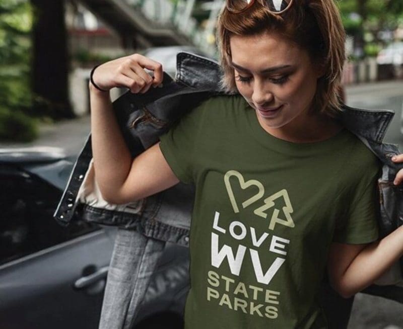
West Virginia State Parks Foundation launches online merchandise store
HURRICANE, W.Va. — The West Virginia State Parks Foundation has launched an official online merchandise store, offering supporters a new way to...
West Virginia Travel Safety: What it means for residents and visitors in 2026
CHARLESTON, W.Va. — Travel safety in West Virginia is shaped less by headline-grabbing crime and more by geography, weather, and the realities of...
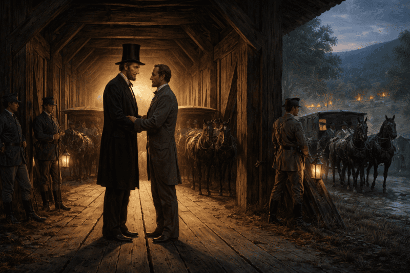
Did Abraham Lincoln and Jefferson Davis secretly meet in West Virginia?
PHILIPPI, W.Va. — Did Abraham Lincoln and Jefferson Davis secretly meet in what is now West Virginia just days after the first land battle of the...