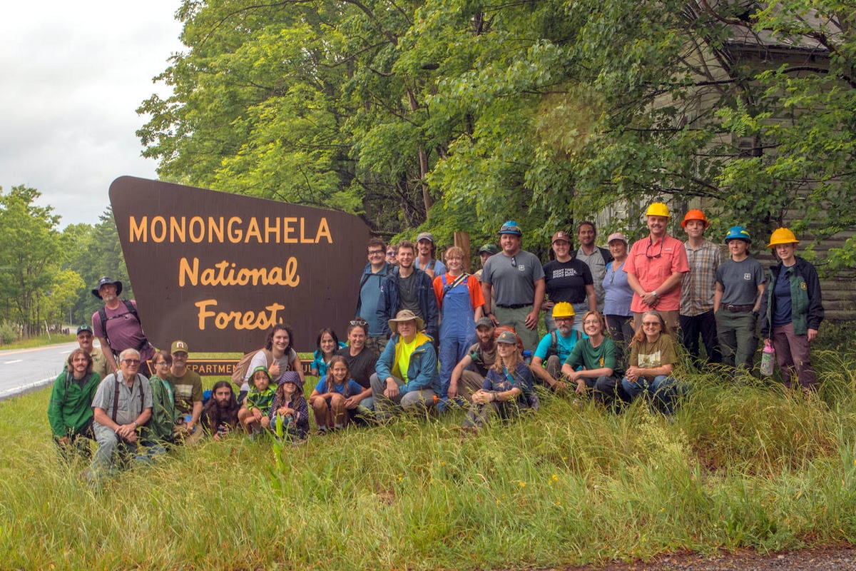
FRANKLIN, W.Va. — Nearly 30 volunteers braved rain, fog, and mud last week to begin construction of the new Peters Mountain Trail System, a project designed to improve public access to the Monongahela National Forest and strengthen connections between local communities and the region’s growing outdoor recreation economy.
The trail-building training event, held on Peters Mountain just west of Franklin in Pendleton County, brought together residents, outdoor recreation advocates, and federal land managers to learn the fundamentals of sustainable trail construction.
The project is being developed through a partnership among Mon Forest Towns, the Monongahela National Forest, and West Virginia University’s Outdoor Economic Development Collaborative.
Located beneath the imposing ridges of North Fork Mountain, Peters Mountain offers a dramatically different landscape from much of the Monongahela. The area lies within the Valley and Ridge Province, known for its rocky shale barrens, dry forests, and sweeping mountain vistas.
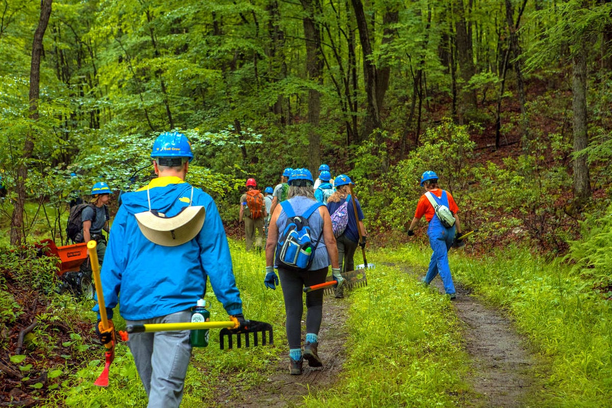
Despite persistent rain throughout much of the day, volunteers worked steadily along more than 100 feet of trail corridor, clearing vegetation, moving soil, and shaping the future route.
Organizers described the effort as an assembly-line operation, with participants shoveling, raking, tamping, and trimming brush while learning techniques to ensure the trail remains usable for generations.
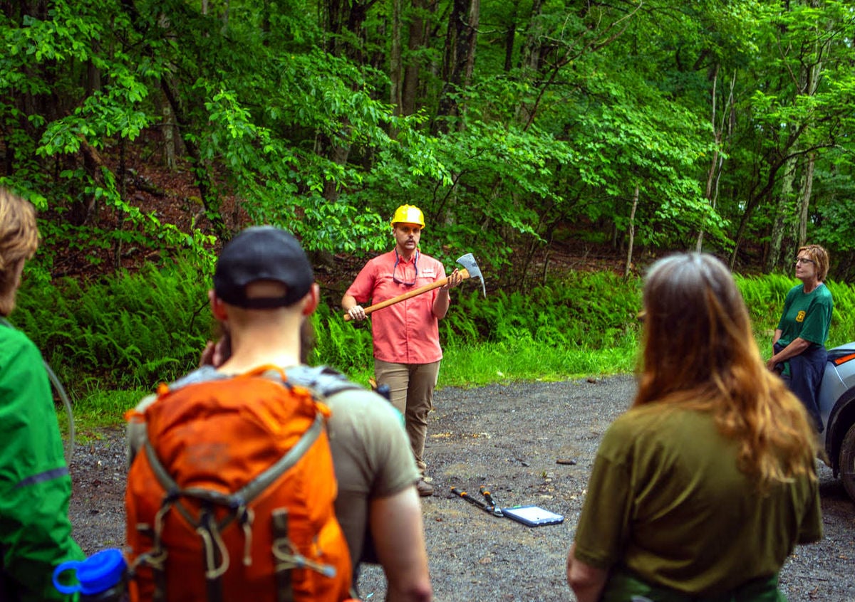
Rich Edwards and Logan Chapman of the WVU collaborative led the training alongside U.S. Forest Service personnel. Volunteers learned to use traditional trail-building tools such as loppers and rakes, as well as specialized equipment, including McLeod rakes and Pulaski tools.
Instruction emphasized trail sustainability, including methods to direct water away from trail surfaces using carefully designed grade dips and backslope angles. These features help prevent erosion and reduce maintenance needs over time.

Chapman told volunteers during the event that their work would have an impact far in the future.
“Twenty years from now, you’ll be able to hike this trail and see moss growing on the stones you put down,” he said.
Peters Mountain Trail system expands recreation opportunities
The project reflects a long-term vision for the development of outdoor recreation in Pendleton County and across the Monongahela National Forest region.
“We want the trail to look like it just dropped out of the sky,” Edwards said, emphasizing the importance of building trails that blend naturally into the landscape.
He compared today’s trail-building movement to earlier eras of public works.
“Many of the trails you see today across America are almost 100 years old and were built by the CCC and WPA, people who knew what they were doing,” Edwards said. “Now we’re in the third great trail-building renaissance; we want these trails to last a hundred years as well.”
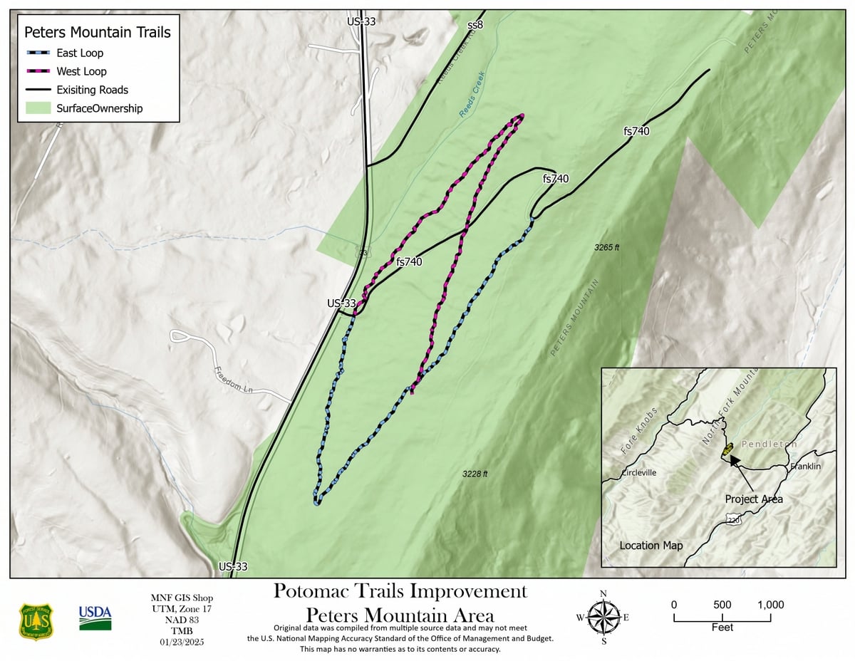
The Peters Mountain project will ultimately create a nearly three-mile shared-use trail system for residents and visitors. Organizers say the network will provide new opportunities for hiking and outdoor recreation while serving as a gateway to the forest for nearby residents.
The effort also seeks to create hands-on learning opportunities for young people interested in careers in outdoor recreation and trail construction, fields experiencing growing demand throughout Appalachia.
Annie Humes, executive director of the Pendleton County Convention and Visitors Bureau, said the Peters Mountain initiative is already having a positive effect.
“Visitors to Franklin and Pendleton County fall in love with the natural beauty here every day,” she said.
“This project is already connecting our residents to those natural spaces, giving local folks the chance to be hands-on in the responsible development of public access at the Peters Mountain trail.”
Outdoor recreation project connects forest and community
The training event followed a community meeting in Franklin, where residents discussed priorities identified through the Mon Forest Towns Partnership’s coaching and assessment programs. Those discussions focused on how outdoor recreation, business development and community planning can work together to create economic opportunities while preserving local character.
Both initiatives are supported by the partnership’s Appalachian Regional Commission POWER grant program and broader downtown connectivity efforts.
For local Mon Forest Town representative Michelle Connor, the trail carries significance beyond recreation.
She noted that the project site sits adjacent to the highly visible “Welcome to the Monongahela National Forest” sign along U.S. Route 33 and near a historic one-room schoolhouse built in 1940 through a partnership between the Forest Service and local schools.
“The location of this trail is important to our community in more than one way,” Connor said. “This school served our community for decades and is a reminder of the ongoing interdependence between our community and the National Forest.”
Connor attended the event with her two sons, ages 10 and 16, and said the project continues a long tradition of education and community engagement tied to the property.
“Over 85 years later, this same piece of property is being used to foster local learning opportunities and empower youth,” she said.
As work continues, organizers hope the Peters Mountain Trail System will become both a recreational asset and a symbol of the longstanding relationship between Pendleton County communities and the surrounding public lands.
Peters Mountain near Franklin v. Peters Mountain near Union
The Peters Mountain overlooking Franklin is not the only mountain by that name in West Virginia. A much larger Peters Mountain extends more than 50 miles along the Virginia border in Monroe County, near Union, where it rises above 4,000 feet and hosts sections of both the Appalachian Trail and the Allegheny Trail.
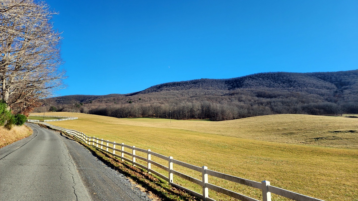
Pendleton County’s Peters Mountain is far smaller but occupies a dramatically different landscape, sitting at the foot of North Fork Mountain amid the dry shale barrens and oak forests of the Valley and Ridge Province.
The shared name is a reminder that many Appalachian landmarks were named long before modern maps standardized place names, leaving multiple mountains, ridges, and knobs bearing the same designation across the region.