
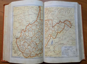
SHEPHERDSTOWN, W.Va. — The eastern panhandle of West Virginia reaches more than 100 miles across the eastern U.S. from the quiet springs of the Potomac River in central West Virginia to the urban edge of Washington, D.C.
How did this oddity come to be? More than anything else, according to a resident historian of the region, its creation is tied to one crucial piece of infrastructure—the Baltimore and Ohio Railroad.
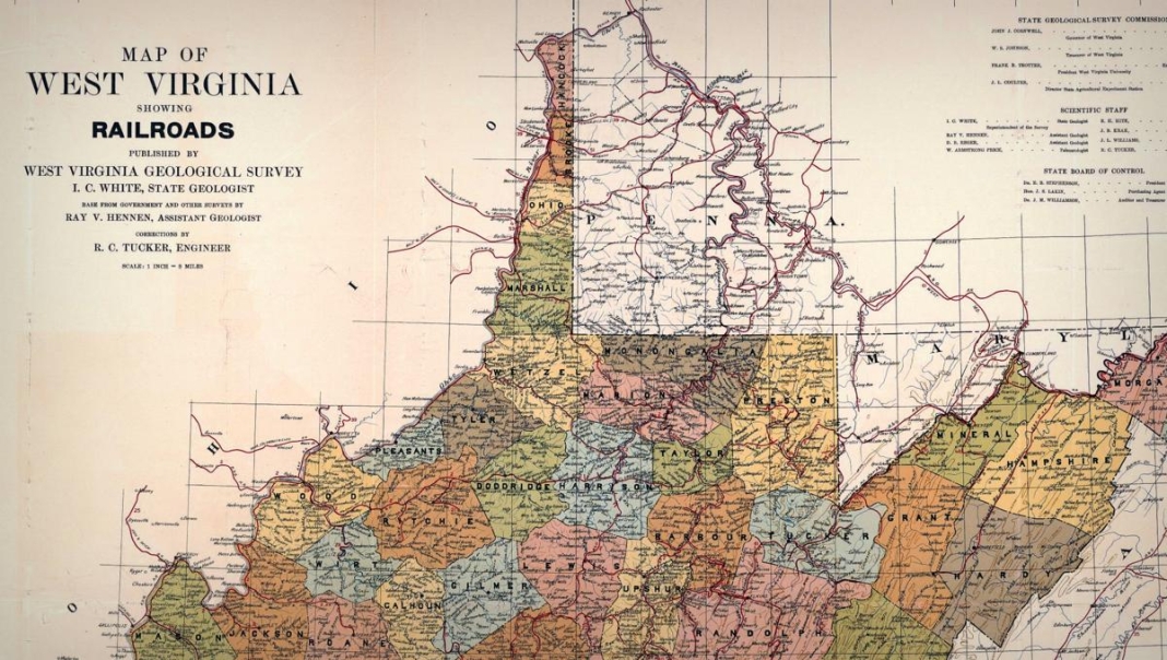
The railroad shaped the geography of the eight-county panhandle as we know it today, and specifically that of its two easternmost counties, Jefferson and Berkeley, says Benjamin Bankhurst, associate professor of history at Shepherd University in Shepherdstown, West Virginia.
Before this, however, and before the arrival of Europeans, the routes of what are now wagon roads shaped the panhandle, which includes most of the counties east of the Allegheny Front and those drained by the branches of the Potomac River — Morgan, Berkeley, and Jefferson, in the easternmost section, and Grant, Hardy, Hampshire, Mineral, and Pendleton, in its western section.
“The history of the eastern panhandle of West Virginia is tied to the movement of peoples up and down the Shenandoah Valley, which began long before the arrival of Europeans,” Bankhurst says.

“The Shenandoah is home to several prominent roads that predate the arrival of Europeans, the most famous being the Great Wagon Road of the valley, which is now Route 11 and was part of a trail system for prehistoric peoples.”
Immigrant groups of the 18th century, namely German and Scots Irish, finding lands near the larger ports already taken up, followed the Blue Ridge to settle in the Shenandoah Valley.
“The counties that make up the Shenandoah counties of West Virginia today played a really important role in helping funnel migrants into the rest of the state in the 18th century,” Bankhurst says.
Division in western Virginia boils over
By the 19th century, the Baltimore and Ohio Railroad, or the B&O, was a major employer and had significantly developed the area, eventually causing division when Virginia seceded from the Union.
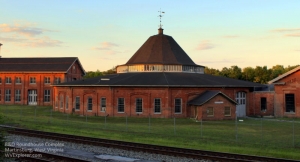
Though Jefferson and Berkeley counties broadly supported secession, Martinsburg did not, chiefly because of its ties to the railroad.
“It’s such an important piece of infrastructure, and there’s a broad acknowledgment that it’s going to be a feature that the Union is going to fight over,” Bankhurst says.
“Most of the Shenandoah Valley was not pro-Union, but it will help us understand why the eastern panhandle looks the way it does.”
In 1861, counties in the northern panhandle resisted secession. When the people of Virginia ratified the decision, the first Wheeling conventions were organized, arguing that because Virginia had committed treason, they were no longer the legitimate government of the entire state. (Read also: Unique northern panhandle of West Virginia created by historic dispute)
“The legal fiction of loyal Virginia served them well because, according to federal law, in order for a state to be carved out of another state territory, the state legislature or the state government of the territory being dismembered has to approve the decision,” Bankhurst says.
“Basically, the Wheeling government said they were the right government of West Virginia.”
While Jefferson and Berkeley counties did vote to come into the new state of West Virginia after the war, many in the region resented that vote, Bankhurst says, which culminated in a Supreme Court case Virginia v. West Virginia in 1871. Ultimately, six justices sided with West Virginia’s claims, and three voted against.
“Virginia’s argument was that those counties hadn’t been legitimately transferred to West Virginia control and therefore should be returned to the state of Virginia,” Bankhurst says.
“Most residents of the two counties preferred that as an option, but the Supreme Court sided with the State of West Virginia, and Berkeley and Jefferson remained within the state of West Virginia despite what Virginia would have liked.”
Again, the reason for this is the railroad, as the entire path of the B&O went through what had been loyal territory during the Civil War. There was an economic necessity to include those counties in the newly formed state, even if, at the time, they were largely anti-Union.
“There’s some spite here,” Bankhurst says. “Why should the Virginians, having committed treason, have those two counties back and have that critical feature, the B&O Railroad, back on their territory?
"So that’s kind of why we are the way we are. To understand why that’s the case, it’s the railroad. In Jefferson County, we’re fond of saying, ‘It’s the railroad, stupid.’ That’s why we’re here—why we’re in West Virginia.”
Eastern Panhandle of West Virginia: A Place Apart
While oftentimes remaining a place apart within the state, there is still a great enthusiasm in the eastern panhandle for the West Virginian identity that has grown over time, Bankhurst says.
One example of how different the panhandle is from the rest of the state is examining the aftermath of the mine wars, which erupted in the south-central part of the state. After the Battle of Blair Mountain, the treason trials were held in the Jefferson County Courthouse.
Predominantly agricultural, there was no real presence of the coal industry or the United Mine Workers of America, so Jefferson County was seen as objective enough to allow for a fair trial.
“That should lead people to scratch their heads,” he says. “This had occurred in Mingo and Logan counties. Why would this trial be so far away?

“If you wanted an objective trial, it was seen that Jefferson County would be the place. That speaks to how different it is. In a way, though, it’s West Virginian. It just adds this bit of flavor to the nature of the state. It’s distinct. It’s its own thing, though it is, at this point, I think, also quintessentially West Virginian.”
Bankhurst says he and his students often wrestle with the culture of the panhandle, debating if it is an inherently Southern or even a mid-Atlantic space.
“The answer to that question is both,” he says. “It’s a sort of coming together of these different histories and cultures. In a way, because of those wagon roads that brought German settlers into the valley, there’s still a very persistent Germanic cultural milieu in these parts of the state.”
Simultaneously, it is a place where there was enslavement; in 1860, anywhere from 20 to 30% of the county was enslaved.
“In that sense, the legacy of enslavement is very present, and it is a very Southern place as well,” Bankhurst says.
The panhandle’s unique ties to the national story make it stand out even more. With a concentration of Washington homes, Charles Town was named after Charles Washington, and Harewood House in Jefferson County was where Samuel Washington lived and where James and Dolley Madison were wed.
“You have this presence of the American story here, and of course, you can’t not talk about the Civil War, so that history is very present here,” Bankhurst says. “Antietam is right across the river, and that battle had repercussions where I am now; the town of Shepherdstown was a hospital site for Confederate wounded after that. It’s very present.”
Eastern Panhandle of West Virginia: A Place Between
Some in the eastern panhandle consider their identity shaped by being a place in between.
“We are very much in the gravitational order of the greater Washington area,” Bankhurst says. “Our culture is now being sculpted by new arrivals seeking housing and working in Washington.”
“We are a weird sort of gateway in which we’re the entrance to the rest of the state in many respects. We’re the point where people will first arrive in West Virginia from the East. At the same time, from the perspective of being in the state, we’re also a portal out toward the greater D.C. area. If I had to define the eastern panhandle of West Virginia, it’s a place in between.”
Here's how the northern panhandle of West Virginia was created

WEIRTON, W.Va — West Virginia's remarkable shape is partly defined by its odd northern panhandle, a finger of land that extends northward more than 60 miles from the central region of the state. Home to its first capital, at Wheeling, the origins of the northern panhandle of West Virginia date back to the 1700s and a contentious boundary dispute between Virginia and Pennsylvania that helped shape the history of the U.S. READ THE FULL STORY HERE.
Sign up to receive a FREE copy of West Virginia Explorer Magazine in your email weekly. Sign me up!
Look not relatives for in colonial Virginia, long before anything you posted here and if you look at the really older Virginia maps they went out as far as Kentucky. Right now historically 1785 is one of the houses in the families that were my ancestors but they had houses prior to that dating back to the late 1500s that is done by a historical check by the man who bought the property. I don't know who took my Bible but if I catch him they'll be arrested. But entries into it was 1682 which was probably just one of many Bibles but I had the one with 1682 with family entries into it. We are the oldest county in the state of Hampshire County being it. Romney is actually older than Shepherdstown. Back in colonial times for the town charters to be filed Romney was number 18 and .hepherdstown was number 19. But like I say the ancestors were German immigrants that came here years ago and Virginia's boundaries were far beyond what's reported in this article clear out the Kentucky according to a map I had seen elsewhere