
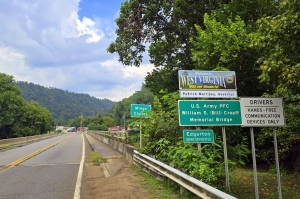
FORT GAY, W.Va. — West Virginia has reinstated its reciprocal fishing agreement with Kentucky, allowing Mountain State anglers to once again fish shared border waters with a single license.
Under the renewed agreement, West Virginia residents may use their state-issued fishing licenses to fish from the Kentucky side of the Big Sandy and Tug Fork rivers, as long as anglers comply with Kentucky fishing regulations.
The arrangement applies only to the main stems of the two rivers. Anglers who venture into embayments or tributaries on the Kentucky side must obtain a Kentucky fishing license.
West Virginia maintains similar reciprocal agreements with Ohio and Maryland for fishing on the Ohio and Potomac rivers.
According to the W.Va. Division of Natural Resources, anglers 15 years old and older are required to have a valid West Virginia fishing license and identification. A trout stamp is also required for anyone fishing for trout. Licenses and stamps can be purchased online at WVFish.com.
For more details about reciprocal agreements and fishing regulations, anglers are encouraged to consult page 35 of the state’s fishing regulations summary at WVDNR.gov/fishing-regulations.
About the Tug Fork and Big Sandy
The Tug Fork and Big Sandy rivers trace a winding course along the southern border of West Virginia, forming a natural boundary with Kentucky and, in part, Virginia. Both waterways are steeped in Appalachian history and remain vital to the region’s recreation and economy.
The Tug Fork River originates in the rugged mountains near Welch in McDowell County, West Virginia, and flows northwest through coal country, passing towns such as Williamson before joining the Levisa Fork at Louisa, Kentucky, to form the Big Sandy River.
Known for its clear pools and rocky riffles, the Tug meanders through a narrow valley framed by forested hills, offering ideal habitat for smallmouth bass, catfish, and other warm-water species. Its scenic setting and improved water quality in recent decades have made it a favorite among anglers, paddlers, and wildlife watchers.
The Big Sandy River, formed by the confluence of the Tug and Levisa forks, continues northward to meet the Ohio River near Catlettsburg, Kentucky. Wider and deeper than the Tug, the Big Sandy serves as an important navigable waterway, supporting a variety of fish, bird, and plant species. It flows through a mix of rural landscapes and small river towns, many of which have roots in the coal and timber industries that once defined the border region.
Together, the Tug Fork and Big Sandy rivers represent a meeting place of geography and culture—a shared watershed linking the communities of West Virginia and Kentucky through recreation, history, and natural beauty. Their calm pools, wooded banks, and rugged mountain backdrop make them emblematic of the Appalachian borderlands.
Fishing the Tug and Big Sandy
The Tug Fork and Big Sandy rivers are known for warm-water fishing and diverse populations of game fish. Among the most popular species caught in these rivers are smallmouth bass, prized by anglers for their fight and abundance in the Tug Fork’s rocky riffles and swift currents.
Largemouth bass also thrive in the slower pools and backwaters, especially where the rivers widen and provide ample cover, such as logs and aquatic vegetation.
Both rivers are home to strong populations of channel and flathead catfish, which attract night anglers using live bait or cut bait, while rock bass—often called “goggle-eye”—are a frequent catch around rocky outcrops and tributary mouths.
In calmer stretches and embayments, anglers often find crappie and bluegill, especially during the spring spawning season when they gather around submerged brush and woody structure.
Deeper pools and dam areas are prime territory for sauger and walleye, which are especially active in the cooler months of winter and early spring. In addition, carp and freshwater drum are common bottom-feeding species that provide variety and challenge to local anglers.
Together, these species make the Tug Fork and Big Sandy two of southern West Virginia’s most productive and versatile fisheries, supporting a blend of recreational and subsistence fishing that’s central to the region’s outdoor culture.
How the scenic "Tug Fork" in southern West Virginia got its name

WILLIAMSON, W.Va.—Of all the placenames associated with West Virginia, that of the Tug Fork of the Big Sandy River may be the subject of some of the most hotly contested debates among historians. Wandering through the state's southernmost mountains, the stream sources at the end of Great Flat Top Mountain on Big Stone Ridge and descends gradually across McDowell and Mingo counties, where it marks the border between West Virginia and Kentucky. READ THE FULL STORY HERE.
Sign up to receive a FREE copy of West Virginia Explorer Magazine in your email weekly. Sign me up!
