
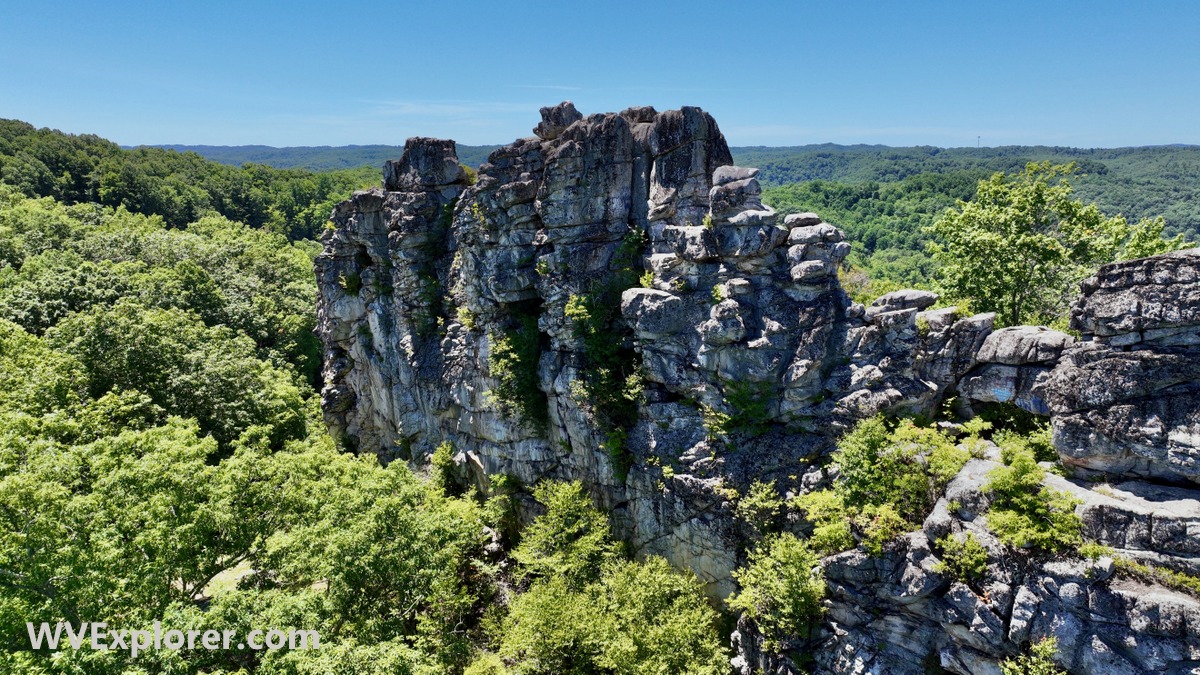
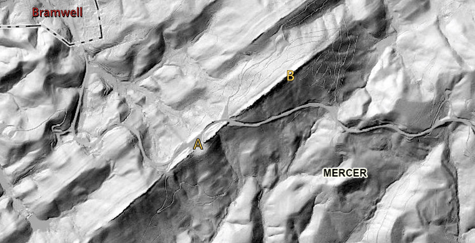
BRAMWELL, W.Va. — For nearly a century, visitors have stopped beside U.S. 52 to admire Pinnacle Rock, assuming it is an isolated sandstone tower. It isn’t. The famous landmark is only one visible fragment of a giant geologic structure that stretches more than 25 miles across southern West Virginia and into Virginia—a mountain-sized fold created hundreds of millions of years ago.
Towering above the Bluestone River valley in southern West Virginia, the legendary rock has captivated visitors for millennia. A capstone on a giant wall, it soars more than 120 feet above the spine of Black Oak Mountain in Pinnacle Rock State Park.
But there’s far more to the rocky tower than meets the eye. While tourists may be accustomed to exploring the rock near the park’s roadside picnic area, other similar outcrops are located elsewhere in the park, including “Black Rock,” an equally large section that rises higher than Pinnacle Rock itself.
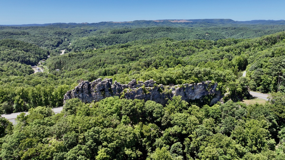
The Pinnacle Rock formation also extends far beyond the park boundary, spanning more than 25 miles across the landscape from Kegley, near Princeton, in the northeast, to Abbs Valley, Va., in the southwest. All along the line, a sharp ridge crests in sandstone.
According to geologist Nick Schaer, the remarkable formation is created by “folding,” which drives the formation of many of the long ridges that extend along the length of the Appalachian Mountains in what’s known as the Ridge-and-Valley Appalachians. The best-known of these mountains locally are Peters Mountain and the East River Mountains, which form a mountain wall along the state border with Virginia.
Here, folding has raised one of the region’s famous sandstone layers, the Stony Gap Sandstone, on its end. Perhaps best known where it’s exposed at Sandstone Falls on the New River, 40 miles to the northeast, the layer has been upended here.
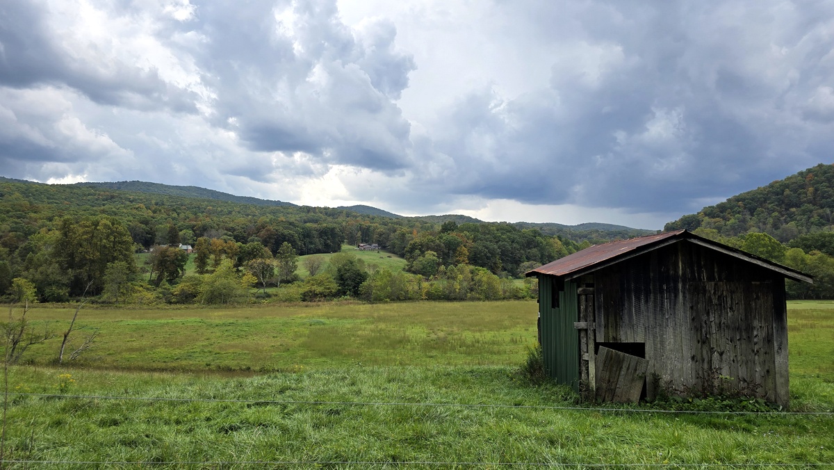
“The Stony Gap sandstone turned straight up into a hogback by the Abbs Valley Anticline,” Schaer said. The anticline is a geologic fold that, in this case, forms an elongated trough in the landscape—a scenic valley of green pastures.
“At the center of the anticline, the Stony Gap Sandstone is eroded away, exposing the Greenbrier Limestone. This is the bedrock of Abbs Valley.”

An anticline, beneath the surface, typically resembles an “A” shape, with the oldest rock layers at its core and younger layers draped over them. The layers dip away from the central axis of the fold, which is known as the hinge line, in this case at the center of the Abbs Valley.
Anticlines are often formed during mountain-building processes when tectonic plates collide and create compressive stress, forcing the rock layers to deform into an arch-like fold. Imagine a stack of paper being pushed together from both ends.
The rock at the center of the arch is often weak and apt to form valleys, while those at the sides of the fold, also known as the limbs or flanks, remain more resistant to erosion. However, Schaer said that folding and upheaval in the region are complex and an alluring puzzle for geologists.
“The flanks of the anticline have a lot of faulting that makes stratigraphy very tricky in that area,” he said.
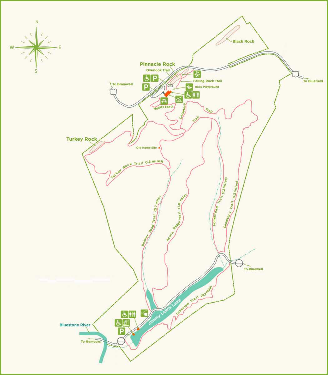
Similar but smaller rock formations can be found along the line. Turkey Rock and Black Rock are located within the park. Black Rock, to the northeast of Pinnacle Rock, is the most lofty and was first known as “The Pinnacle.” No official park trail leads to it. Turkey Rock is smaller, a half mile southwest of Pinnacle Rock, and is the focus of the park’s 1.5-mile Turkey Rock Trail.
Other smaller formations can be found along the crest of Black Oak Mountain, far beyond the park, and in places, the outcrop is no more than a sharp, stony ridgeline. Highway US-19 near Kegley notably crosses two folded ridges over which motorists must ascend and descend.
The birth of Pinnacle Rock State Park
Although Pinnacle Rock is a stunning natural landmark, its preservation required a determined fight—a fight that ultimately led to the creation of Pinnacle Rock State Park.
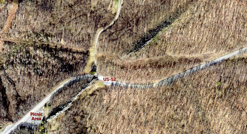
In 1931, highway engineers building US-52 proposed blasting through the rock. And while the new road promised to improve commerce, community leaders recognized the rock’s value as a tourist attraction.
Among the first to act was entrepreneur and politician Hugh Ike Shott, who sent a letter to Governor William G. Conley urging action. Conley intervened, and engineers decided to raise the roadbed rather than destroy the rock.
Inspired by Shott’s success, civic leaders soon began developing plans for a park, and in 1938, the West Virginia Conservation Commission and the Bluefield Chamber of Commerce announced the acquisition of 28 acres.
Development began in 1939, with the construction of trails, walkways, and picnic facilities, including a pavilion and restrooms. Funded with more than $13,000 from President Franklin D. Roosevelt’s Works Progress Administration, federal workers used locally sourced stone and timber to build the enduring structures that remain a beloved feature of the picnic.
Today, Pinnacle Rock State Park encompasses more than 370 acres, including the mountaintop and its rock outcrops as well as mountainside forest and Jimmy Lewis Lake, a five-acre fishing lake and wetland. More than six miles of hiking trails now wind through the park, and a system of stairs leads to an observation area at the top of Pinnacle Rock.
Though Pinnacle Rock’s rugged sandstone face would seem to be a magnet for rock climbers, climbing is not permitted due to the stone’s fragmentation. Photographers, however, will find the rocks, picnic area, and remote reaches of the park an invaluable source of subject matter.
Native animal species, including deer, wild turkey, and the occasional bear, roam the park, as do smaller animals such as raccoons, opossums, squirrels, and ground squirrels.
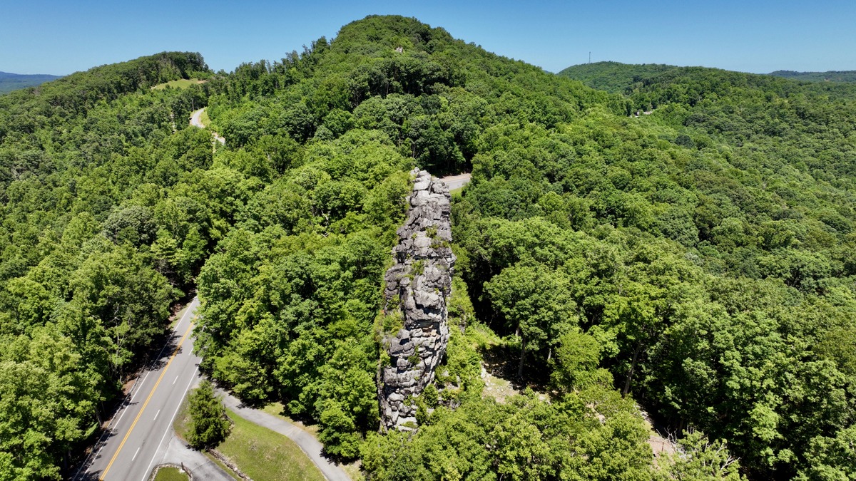
Pinnacle Rock State Park offers a mix of natural beauty, recreational opportunities, and a glimpse into Appalachian geology. For those passing through southern West Virginia, it’s a destination that promises both inspiration and tranquility.
For more information on the park, visit the park website. For more information on visiting the region, explore Visit Mercer County.
Read also: Extraordinary rock “castle” being rediscovered in West Virginia town