
CHARLESTON, W.Va. — The destructive flooding that swept across West Virginia this month arrived amid conditions that have long made summer thunderstorms particularly dangerous in the Mountain State—intense rainfall, steep terrain, and communities concentrated in narrow river valleys.

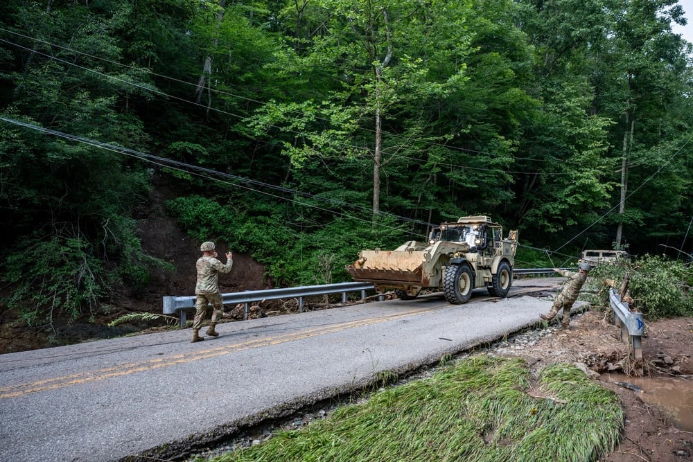
Slow-moving storms moved across West Virginia from Aug. 16 through Aug. 18, producing excessive rainfall that triggered flash flooding and mudslides and damaged homes, businesses, public infrastructure, and essential services. Some areas received near-record rainfall in a matter of hours, according to the governor’s office.
A state of emergency was declared for all 55 counties, giving state and local agencies additional flexibility to respond to the damage. The flooding came as communities in parts of the state were still recovering from another destructive round of floods in July.
The timing matters because warm-weather flooding in West Virginia is often associated with severe thunderstorms and heavy rainfall, according to the West Virginia Hazard Mitigation Plan.
National Weather Service research elsewhere in the southern Appalachians has also found summer to be the principal season for heavy-rain events associated with thunderstorms, although the precise seasonal pattern varies across the region.
West Virginia’s landscape contributes to the danger
The West Virginia State Resiliency Office reports that flash flooding is common in the state because its mountainous topography causes water to run rapidly down steep slopes and into waterways.
Flash flooding generally begins within three to six hours after heavy rainfall starts but can develop much sooner, the office says. The speed at which water rises is among its greatest dangers.
The state mitigation plan identifies geography as one of West Virginia’s underlying flood risks. It says the state’s topographic, climatological and meteorological characteristics create conditions conducive to flooding throughout the year and identifies mountainous terrain as a significant contributor to the hazards facing the state.
That geography has also influenced where West Virginians built their communities, according to the U.S. Geological Survey.
According to the plan, early development occurred primarily along rivers because steep slopes and rocky terrain discouraged construction on mountainsides. Cities and towns instead formed in valleys—often where heavy rainfall can cause flooding.
“West Virginia’s geography has always determined where people could build,” said David Sibray, a West Virginia historian and publisher of West Virginia Explorer. “Our towns, roads and railroads were often concentrated in narrow valleys because that was where the usable land was. Unfortunately, those are also places where water can become dangerous very quickly.”
Sibray said the relationship between settlement and waterways is apparent in communities throughout the state.
“You can look at a map of West Virginia and see how closely the history of settlement follows the rivers and creeks,” he said. “The waterways helped create these communities, but they have always been one of the hazards those communities have had to live with.”
The plan identifies severe thunderstorms and heavy rainfall as causes of both flash flooding and river flooding during warm weather.
Summer storms can deliver enormous amounts of rain
West Virginia has seen repeated examples this summer of how quickly intense thunderstorms can create dangerous conditions.
During July flooding, some locations received as much as seven inches of rain, with 4.5 inches falling in just 37 minutes in some areas, according to The Associated Press. Flooding inundated homes and businesses and forced dozens of water rescues.
Those rainfall rates illustrate the difference between ordinary rain and the intense precipitation that can produce a flash flood.
The resiliency office reports that recent heavy rainfall can increase the threat because saturated ground absorbs less additional water. Urban areas can also be more susceptible because roads, sidewalks and roofs prevent rainfall from soaking into the soil, sending more water toward streams and waterways.
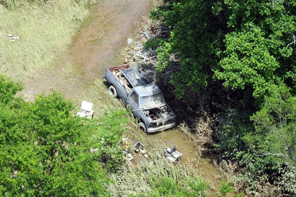
West Virginia’s history includes more extreme examples. In June 2016, repeated rounds of torrential thunderstorms caused major flooding across central and southern West Virginia. The geological survey recorded between 8 and 9.37 inches of rain in parts of Greenbrier County during the storms.
The resulting streamflows were the highest on record at seven survey measuring locations, while another 18 ranked among the five highest flows recorded at their respective gauges. USGS crews later documented 422 high-water marks across West Virginia to reconstruct the flood’s extent.
Forecasters saw the threat developing
Before this week’s flooding began, federal forecasters were watching several of the ingredients that can produce flash flooding in mountainous terrain.
The National Weather Service’s Weather Prediction Center warned ahead of the Aug. 16 storms that unusually moist air moving into West Virginia could support intense rainfall. Forecasters were particularly concerned about thunderstorms repeatedly developing or moving across the same locations, a process meteorologists describe as training or backbuilding.
The prediction center upgraded portions of West Virginia to a moderate risk of excessive rainfall and specifically cited strong moisture transport encountering the state’s complex terrain. Forecasters warned that repeated thunderstorms could produce numerous instances of flash flooding, with increasingly saturated soils adding to the risk.
Those forecasts put meteorological detail behind a hazard West Virginia emergency planners describe more simply: heavy rain falling on steep terrain can move into waterways rapidly.
Is August West Virginia’s worst month for flash flooding?
Although August has been identified as a peak month for flash flooding in parts of the southern Appalachians, research does not establish it as West Virginia’s worst month statewide. National Weather Service studies have found differing seasonal patterns across the Appalachian region.
National Weather Service research into the southern Appalachian Mountains found that flash-flood reports in the area studied peaked during summer, particularly in August. Researchers attributed much of that activity to thunderstorms and found that local terrain played an important role in focusing summer thunderstorm development.
But the study does not encompass all of West Virginia. In fact, separate weather service research covering the Blacksburg, Virginia, forecast area—which includes Mercer, Summers and Greenbrier counties in southern West Virginia—found fewer significant flash-flood events during July and August than might be expected during the height of thunderstorm season.
Service researchers attributed that partly to weaker upper-level winds, which can make intense summer storms less organized and more isolated.
The research underscores an important distinction—no single statewide West Virginia flood season behaves identically from the Ohio River to the Allegheny Mountains.
West Virginia’s own mitigation plan instead characterizes flooding as a year-round threat. Warm-weather thunderstorms can produce flash and river flooding, while tropical systems can bring severe rainfall later in the year. Other weather patterns can produce flooding during colder months.
A recurring West Virginia hazard
The latest flooding is part of a pattern that has already repeated several times in West Virginia this summer.
After the severe July floods, Morrisey extended a state of emergency through Sept. 19 in 12 counties where recovery was continuing. Four days later, following the Aug. 16-18 storms, he declared another emergency covering all 55 counties.
The individual storms differ, but the state’s underlying vulnerability is well documented.
The state resiliency office identifies mountainous topography and rapid runoff as reasons flash flooding is common in West Virginia. Its mitigation plan identifies steep terrain, valley development, heavy rainfall, and severe thunderstorms as factors contributing to flood risk. Geological survey measurements from major past floods show how repeated thunderstorms can translate into record streamflows.
Those factors remain present regardless of the month and help explain why periods of intense summer rainfall receive such close attention from West Virginia emergency officials and meteorologists.