CHARLESTON, W.Va. — West Virginia is haunted by the ghosts of rivers that no longer exist. They writhe like snakes through its mountains, nearly invisible to the unaware.

Geologist William G. Tight first theorized the existence of what’s now perhaps the best-known of these hidden rivers, the “Teays River,” in 1903. He suggested the Teays was one of two major river systems that drained much of West Virginia before the last Ice Age. (The other was the Monongahela River, which still drains part of the northern state.)
Since his discovery more than 100 years ago, an army of geologists has gathered samples in several eastern and midwestern states to piece together what happened to the Teays. The mighty river rose among the ancient Appalachian Mountains in North Carolina and wandered across southern West Virginia and Ohio before emptying into the Mississippi River in Illinois.
What happened to the Teays? A continent-sized glacier, the Laurentide Ice Sheet, buried it under millions of tons of sediment. Though it barely touched West Virginia, the ice sheet significantly reshaped the western and northern parts of the state.
West Virginia before the last Ice Age
MORE THAN TWO MILLION YEARS AGO, most rivers in West Virginia and western Pennsylvania ran northward into Canada. The Ohio River and the Great Lakes did not exist at that time, and many rivers have since disappeared.
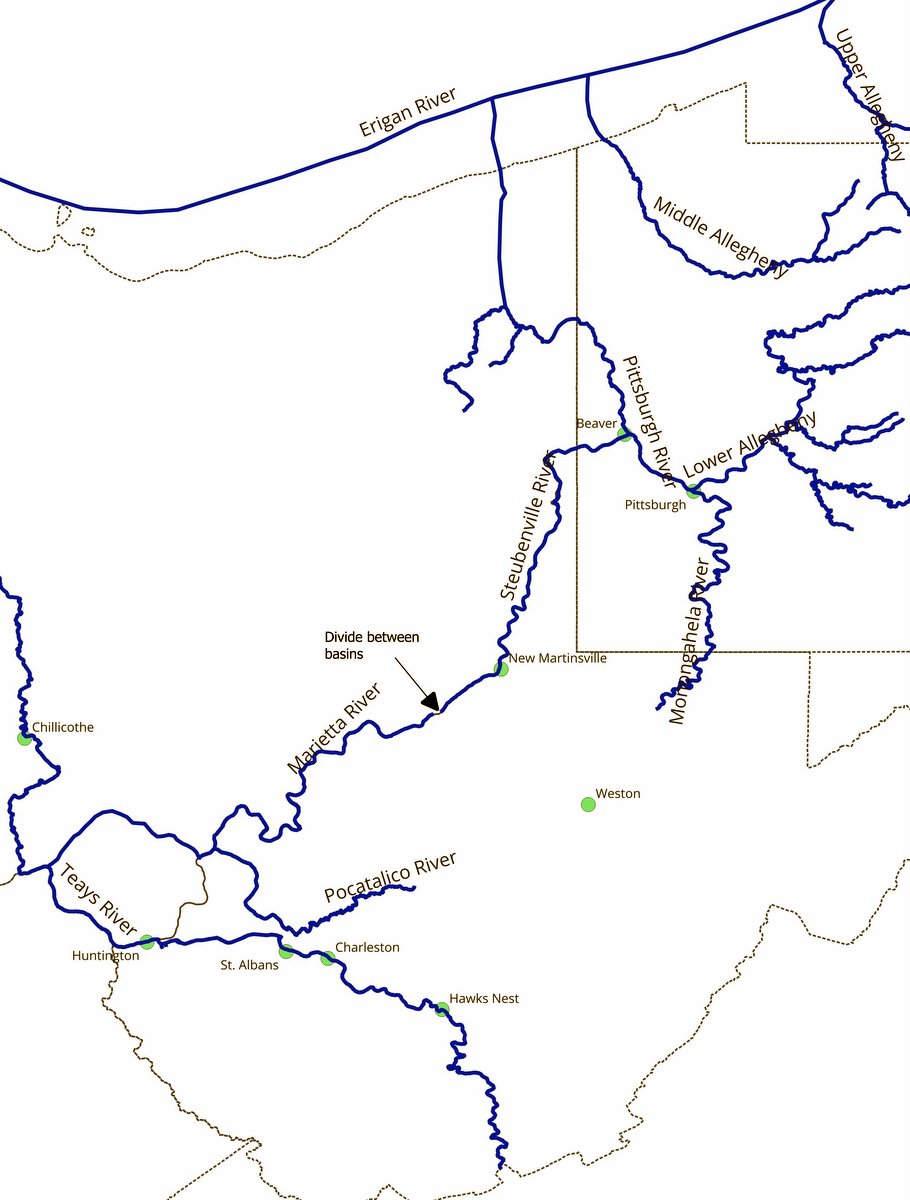
Today’s Monongahela River was a tributary of one such river, known by geologists as the Pittsburgh River. It ran northward through western Pennsylvania and was a tributary of the Erigan River, which no longer exists. The Erigan was a tributary of the St. Lawrence River, which emptied into the Atlantic Ocean.
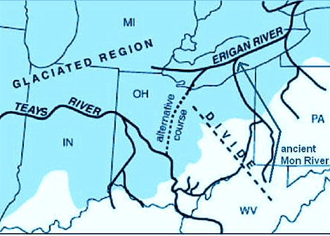
Its counterpart to the south, the Teays River, started in North Carolina and followed the routes of the New and Kanawha rivers northward until it reached an area near 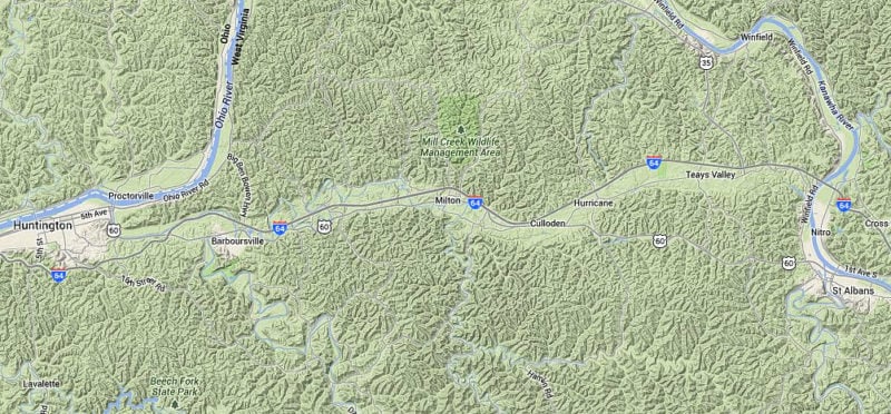 A Google terrain map shows the riverless Teays Valley (including the community of Teays Valley, West Virginia) stretching east-to-west between the valleys of the Ohio River, to the west, and that of the Kanawha, to the east.[/caption]
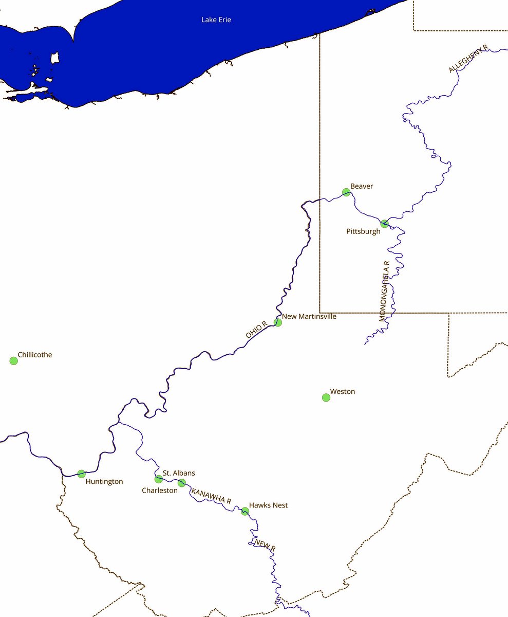
While most of these prehistoric rivers flowed north, the small Marietta River was one exception to the rule. It flowed south to join the Teays. A divide separated its basin from that of the Steubenville River, which flowed north from the same area to the Pittsburgh River. The divide is now located near what’s near New Martinsville, West Virginia.

Small though they were, the Marietta and Steubenville rivers played a key role in creating the Ohio River when the ice sheets retreated.
Glaciers: Nature’s Giant Belt Sander
WHILE SEVERAL POSSIBLE CAUSES of the Ice Age exist, there is a consensus that global temperatures dropped about two million years ago. This allowed ice to accumulate on land faster than it melted or evaporated, creating glaciers.
As it accumulated, the weight of the ice compressed the lower layers and caused them to flow or advance under their weight along the Earth’s surface in what geologists call a glaciation.
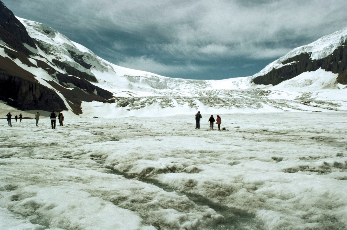
“The ‘moves-due-to-its-own-weight’ is important,” Kite said. “We normally think of ice as brittle, but if you build up 200 to 300 feet of ice, it begins to deform like 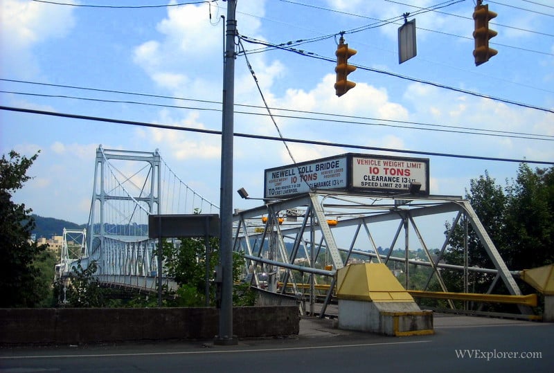 The Newell Toll Bridge over the Ohio River at Newell, West Virginia, in Hancock County, carries US-30 from the Northern Panhandle Region of West Virginia into East Liverpool, Ohio.[/caption]
To the west of the region, geologists believe glaciations reached as far south as Kentucky and parts of Illinois, extending further south than south-central West Virginia.
According to Brandon Graham, a geologist at the U.S. Geological Survey, ice sheets at their maximum covered about 25 percent of the Earth’s surface and locked up enough water to drop sea level an estimated 400 feet, exposing areas along the shore that were ordinarily underwater.
A Tale of Two Lakes: Teays and Monongahela
AS THE ICE SHEET ADVANCED, it dammed normal drainage channels, flooding the northern and western parts of West Virginia under two large lakes—Lake Tight and Lake Monongahela.
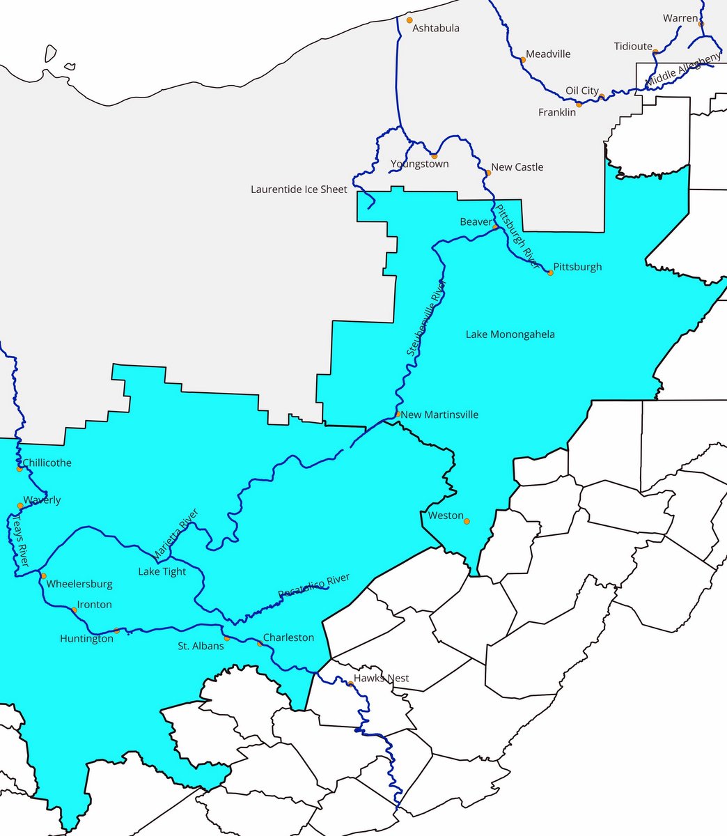
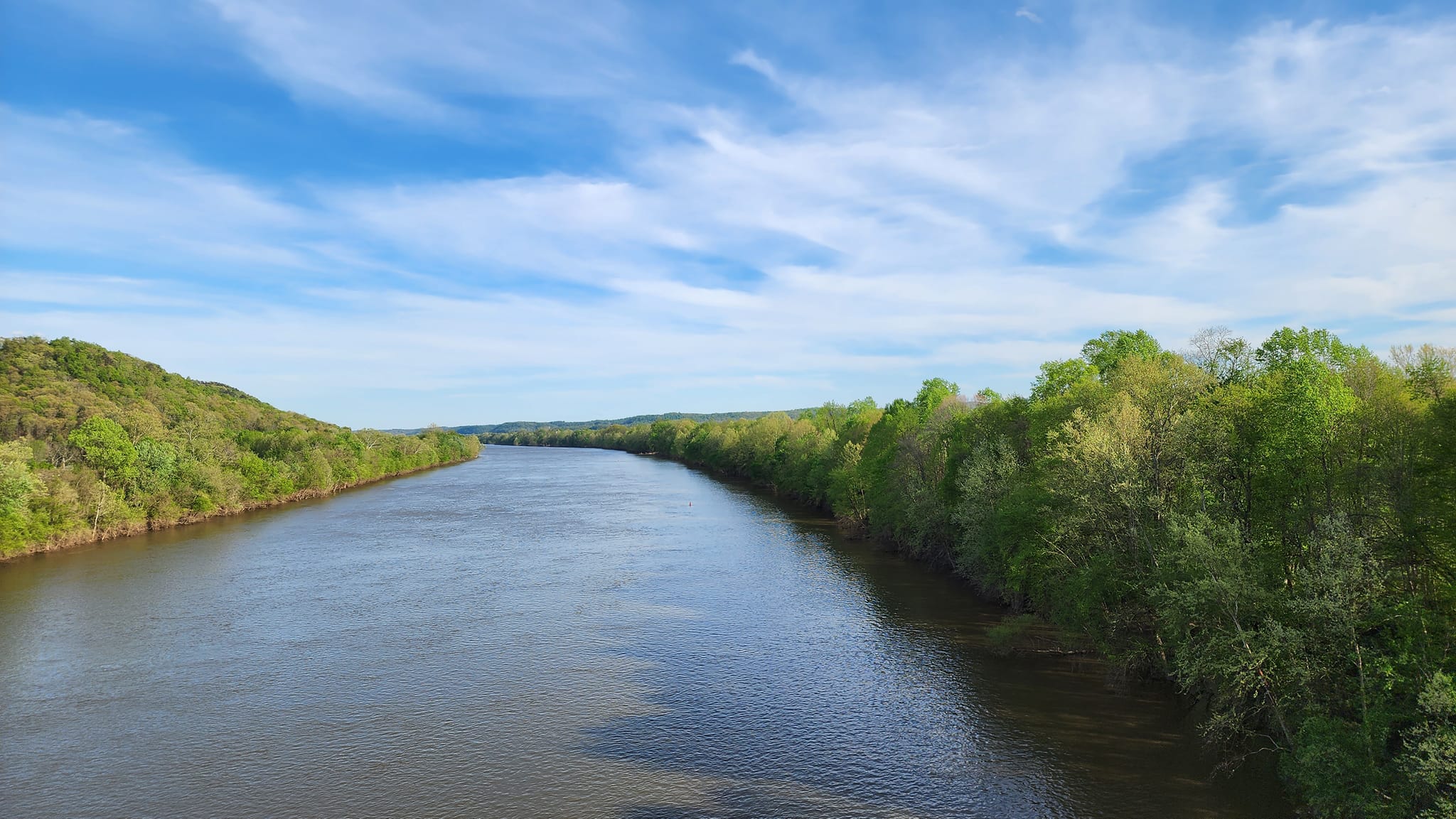
“Lake Tight” was created by damming the Teays River near Chillicothe, Ohio, and was named after geomorphologist William G. Tight. It covered parts of Ohio and Kentucky and reached into West Virginia as far east as the 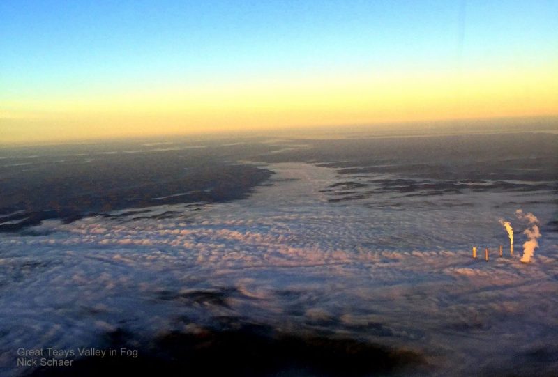 Filled with fog the valley of the ancient Teays River extends westward from the Kanawha Valley. (Photo courtesy Nick Schaer)[/caption]
The direction of the Earth’s magnetic field has reversed or “flipped” several times. Graham said before the last reversal, about 780,000 years ago, a compass would have pointed south rather than north.
Magnetic particles in the lower sediment levels of both lakes point south, indicating that those layers formed more than 780,000 years ago. Upper-level particles point north, showing they settled to the lakes’ bottoms more recently.
Geologists have also studied the degree of chemical weathering of the soils, plants, and pollen preserved in lake clays and have used geologic mapping and computer modeling to build a picture of what happened in the region.
Graham says that other geological evidence, including cosmogenic nuclide dating, indicates that Lake Monongahela also formed at least twice. Other evidence suggests that each lake formed more than twice over the past two million years.
If much of this seems vague, it’s because geologists have to contend with several obstacles when piecing together the region’s geologic history. One of the largest obstacles is that thousands of years of erosion have altered the landscape and washed away much of the evidence.

Even when estimating the size of the two lakes, Graham says they must contend with the fact that part of the terrain that determined their shape and depth no longer exists.
“When the northern drainage was blocked by the Laurentide Ice Sheet, the ice dam would force the water to form a lake until it spilled into another drainage divide,” he said.
Geologists estimate that the divide near New Martinsville, West Virginia, acted as the spillway between Lake Monongahela and Lake Tight, which was at a lower elevation.
“As water continued to flow over the spillway, erosion of the bedrock would lower the outlet and the level of (Lake Monongahela),” he said.
Geologists have found sediments from Lake Monongahela in high-elevation terraces in Ohio, West Virginia, and Pennsylvania. The highest sediments have been found at 1,100 feet, so geologists estimate that was the original height of the divide.
A further complication is that the glacier’s weight temporarily bent the Earth’s crust while all this was happening. In addition to scouring the land it crossed, the ice sheet added millions of tons of weight to the Earth’s surface. That weight pushed the land down—in some places by hundreds of meters.
Graham said that forcing the land down in one area also caused the land beyond the glacier to rise. The National Oceanic and Atmospheric Administration likens it to lying on a soft mattress: The weight of A body pushes down the mattress beneath it while raising the part of the mattress next to it. When you get up, the mattress slowly regains its original shape.
The Earth’s crust did the same thing—only in geologic time rather than in a few minutes. The Chestnut Ridge and Laurel Mountain section of northern West Virginia, for example, is still rising from when the last glacial advance pushed it down. Meanwhile, Virginia’s shoreline is still dropping from when the same glacier pushed it up.
All that water had to go somewhere!
AS MENTIONED EARLIER, A RIDGE of land near New Martinsville once divided the Monongahela River basin from the Teays River basin.
Each time the glacier dammed the Pittsburgh River and created Lake Monongahela, the lake rose until it reversed the flow in the Steubenville River and overflowed the divide into the Marietta River.
Eventually, the repeated overflows carved a permanent channel through the divide, permanently joining the two basins.
Further north in Pennsylvania, glaciation had a similar impact on the Allegheny River, which joins the Monongahela River at Pittsburgh to form the Ohio River.
Each glaciation blocked the normal drainage of the upper Allegheny while the glacier’s weight created a temporary lowland along its edge. With nowhere else to go, it flowed southward along the glacier’s edge rather than northward.
When it reached a point near the border of western New York, it joined what’s now the middle Allegheny, which was busy carving a new path south along the glacier’s edge until it reached the lower Allegheny in north of Pittsburgh.
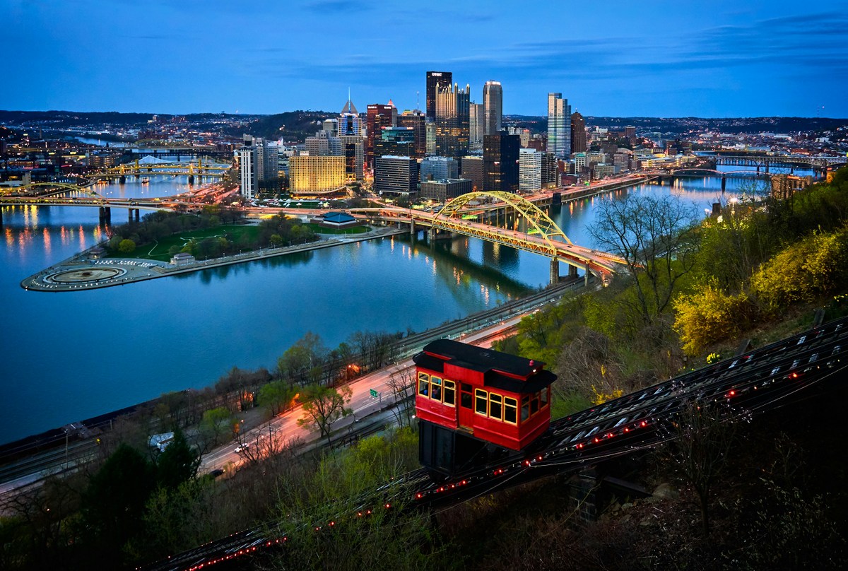
At the same time, the repeated glaciations buried the Pittsburgh River and, incidentally, left behind enough level land for the future home of the Steel City.
The birth of the mighty Ohio River
THE CONFLUENCE OF THE NEW Allegheny River and the Monongahela River created the Ohio River, which followed the Steubenville River’s path into the Marietta River and the Teays River basin.
Except the Teays River was gone. The repeated damming of the river and the creation of Lake Tight had covered its valley—now known as Teays Valley—beneath millions of tons of sediment.
Forced to find a new outlet, the Kanawha River carved a path north through the fresh sediment until it reached Point Pleasant and joined the Ohio River.
The same glaciations also buried sections of the old Teays River in Ohio, Indiana, and Illinois, forcing the Ohio River to carve a new path to the Mississippi.
The Aftermath
GEOLOGISTS ESTIMATE THAT MUCH OF West Virginia and western Pennsylvania were covered by gentle hills and meandering rivers before the Pleistocene ice age.
When the lakes covered those river valleys with sediment, the rivers were forced to dig new channels. With glacial meltwater adding to their flows, the temporarily stronger rivers cut deeper, straighter channels.
The result was deeper rivers running through relatively flat areas. In northern West Virginia, the sediment formed terraces along the Monongahela River, providing room for the homes, businesses, and steel mills of today.
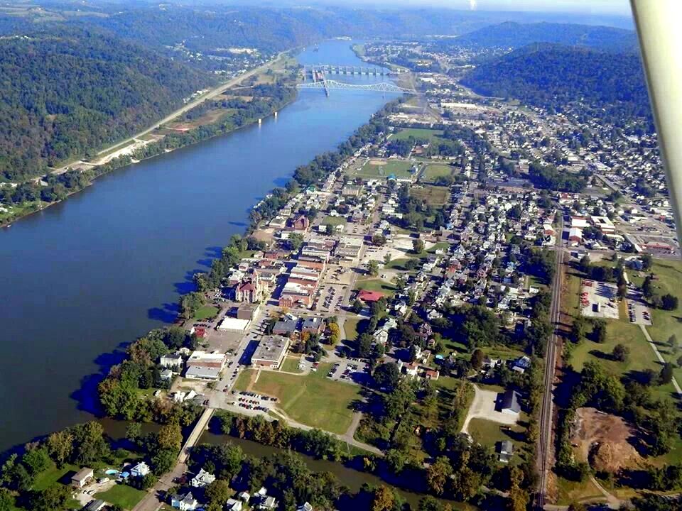
In western West Virginia, the new Teays Valley supported similar development and the growth of the suburban corridor in which the cities of Charleston, Huntington, and Barboursville thrive.
Elsewhere in the northeastern U.S., terminal moraines deposited by the glaciations created several notable island systems, including Martha’s Vineyard, Nantucket, and Long Island.
At the end of the ice age, warming global temperatures caused the ice sheets to retreat until most disappeared, though the Laurentide’s remnants include the Barnes Ice Cap on Baffin Island.
The only remaining ice sheets are in Greenland and Antarctica. The permanent ice pack at the North Pole is technically not a glacier because the Arctic Ocean separates it from the land beneath it.
Sign up to receive a FREE copy of West Virginia Explorer Magazine in your email twice weekly. Sign me up!
Nicely researched & written! From 1977-1991 I was writer-editor-pubs mgr for the WV Geological & Economic Survey on Cheat Lake near Morgantown. So I’m familiar with everything you wrote. You have done a really nice job of telling the story simply & clearly, with good maps. Thank you!
Fascinating! Having traveled back and forth between Northwestern Ohio and the New River Gorge, I’ve been able to observe the information in this article. It now makes sense why the Teays Valley is so relatively flat compared to the rest of WV.
As a side note, I live on the banks of the Maumee River which flows northeast and drains into Lake Erie. Glacial grooves can still be observed on the islands near Toledo Ohio. It’s believed that the Maumee River was part of this Teays River System.