


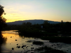
The 173-mile Greenbrier River is a tributary of the New River that drains parts of southeastern West Virginia, including the southern Allegheny Mountains. Its basin is about 1,580 square miles. The river rises in northern Pocahontas County and flows southwestward across eastern and southern Greenbrier County and eastern Summers County to join the New River near Hinton, WV.
Its basin of the Greenbrier River is singular in regard to West Virginia geography in that no mineable coal seams outcrop within its drainage. It is the longest free-slowing stream in West Virginia, and no part of the river or its branches is dammed.
Much of the upper watershed is protected as part of the Monongahela National Forest, and many areas along its course are protected as part of state parks and recreation systems. Beartown State Park, Watoga State Park, Droop Mountain Battlefield State Park, and Cass Scenic Railroad State Park are located on or near its course. Seneca State Forest and Calvin Price State Forest adjoin the river in its upper course. For more than 80 miles, the Greenbrier River Rail Trail follows the Greenbrier between Cass to Caldwell, near Lewisburg, WV.
History of the Greenbrier River
Despite bans against settling on lands claimed by Native American inhabitants, Europeans began to enter the area in the late 1600s and early 1700s. The limestone strata through which the river descends allowed for the formation of broad level areas of prime agricultural land. The upper watershed of the river was heavily timbered, and in the late 1800s and early 1900s was harvested.
Greenbrier River Communities
From source to mouth, the following select cities, towns, and villages are located on or near the Greenbrier River.
Glady, WV
Bartow, WV
Durbin, WV
Cass, WV
Marlinton, WV
Buckeye, WV
Seebert, WV
Falling Spring, WV
Anthony, WV
Caldwell, WV
Ronceverte, WV
Fort Spring, WV
Alderson, WV
Pence Springs, WV
Talcott, WV
Bargers Springs, WV
Hinton, WV
Name Origin
The origin of the name Greenbrier is widely believed to be an anglicization of "Riviere de la Ronceverte," the name given by early French explorers. “Ronce Verte,” which literally translates to “brier green,” possibly refers to the many green briers found growing along the river. Some sources claim the river was called “We-ot-o-we” by the Miamas and “We-ot-o-we” and “O-ne-pa-ke” by the Delaware.
Variant Names
Green Briar River, Green Brier River, Green Bryar River, Greenbriar River, O-ne-pa-ke, O-ne-pa-ke-cepe, Onepake, Riviere de la Ronceverte, We-o-to-we, We-o-to-we-cepe-we, Weotowe
Regional Information
Information on lodging, dining, and recreation on and near the lower Greenbrier River, downstream of Hillsboro, WV, may be found in our guide to travel in the Greenbrier Valley Region. Information for the upper segment of the Greenbrier may found in the Allegheny Highlands Region.


