


Devil’s Backbone continues to intrigue Pocahontas County visitors
Early settlers in Pocahontas County called it “The Devil’s Backbone” as most believed such an unnatural thing could only be the work of evil. While geologists now understand the forces that created this dramatic arch, the explanation may be even harder to believe than the superstition.
When Jacob Marlin and Stephen Sewell arrived in the valley of the Greenbrier River in the 1770s, the forces that created the sandstone arch were little understood, though they are perhaps even more unbelievable than a demonic cause.

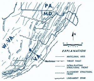
Anticlines follow the trend of the Appalachians. (W.Va. Geologic and Economic Survey)
Geologists say the layers of sandstone that vault upward at the backbone are, almost unimaginably, the remnants of a beach that had first been laid down some two billion years ago.
The grains of sand laid down on that beach were then buried, uplifted, eroded, and deposited again as a beach three different times before being warped and exposed here—near what’s now Marlinton, West Virginia.
The rock strata’s most recent incarnation as a beach may have been as a shore of the Iapetus Ocean, a predecessor of the Atlantic Ocean that underlies parts of the eastern U.S. and western Europe.
Read also: Did the Iapetus Ocean ever exist?
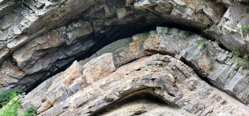
A close-up photograph shows the detail in the curving rock formation near Huntersville.
Much like the Atlantic coast today, the beach stretched a vast distance. The remnant of that beach is now known as the Tuscarora Sandstone, named for the Tuscarora people, who lived near where the rock was later identified on Tuscarora Mountain in Pennsylvania.
The Tuscarora may extend far to the northeast into New York and is now understood to extend far to the southwest into Tennessee where it is known as the Clinch Sandstone. It is also known as the Massanutten Sandstone.
Aside from the backbone, the sandstone outcrops remarkably in other areas in West Virginia as well, most spectacularly at Champe Rocks, Nelson Rocks, and Seneca Rocks, where it has been turned upward on edge by mountain-building forces that buckled the Earth’s crust. It also forms the Hanging Rocks on Peters Mountain in Monroe County.
Here at the backbone, the Tuscarora was folded by the same forces that created Seneca Rocks 200 million years ago, according to most reckonings. The fold is geologically known as the Brown’s Mountain Anticline, which extends some 80 miles across parts of Monroe, Greenbrier, and Pocahontas counties.
The West Virginia Geologic and Economic Survey described the fold technically in a 2013 survey:
Towering Seneca Rocks by Rick Burgess
“Intense folding in the eastern portion of the study area associated with the Brown’s Mountain Anticline was probably initiated by thrust faulting deeply “rooted” in Ordovician shale present in the subsurface. Deformation propagated readily through overlying units resulting in west-vergent compressional folding of strata in the area.
“The Silurian Tuscarora Sandstone is the dominant ridge former in the study area and is prominently exposed in Devils Backbone, an erosionally breached anticlinal feature on the east edge of the Quadrangle.”
While the average visitor may not be as concerned about its origin, the landmark is definitely among the region’s best known, says Cara Rose, executive director of the Pocahontas County Convention and Visitors Bureau.
“It seems that every time I drive by there are people taking photos,” Rose says.
The backbone may be especially well known to skiers visiting Snowshoe Mountain as it rises along WV-39, part of one of several preferred routes between the resort and I-64 to the south.
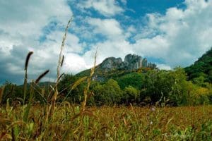
The Devil’s Backbone is located along Knapp’s Creek at WV-39 less than a mile southeast of Huntersville, West Virginia. It’s a drive of approximately seven miles southeast of Marlinton, 35 miles south of Snowshoe Mountain, 50 miles north of I-64 at Lewisburg, West Virginia.
Champe Rocks named for would-be captor of Benedict Arnold
Champe Rocks near Seneca Rocks
The towering blades of quartzite that form Champe Rocks, in Pendleton County, might seem a world away from the battlegrounds of the American Revolution, but by chance, they are tied to the history of Benedict Arnold, among the nation’s best-known traitors.
George Washington himself trusted Arnold with the command of fortifications at West Point in 1780, but Arnold secretly planned to surrender the fort to the British and, when discovered, fled to New York City and boarded a British vessel on the Hudson. Read the full story here.
Sign up to receive a FREE copy of West Virginia Explorer Magazine in your email twice weekly. Sign me up!

Inside Appalachian Escapes: Themed rentals, escape rooms, and a love letter to West Virginia
FAYETTEVILLE, W.Va. — What began as a search for an affordable retirement option has turned into one of southern West Virginia’s most imaginative...
West Virginia bottler wins silver award at international water competition
BERKELEY SPRINGS, W.Va. — Le Sage Natural Water, of Lesage, has been awarded a silver medal for its purified water at the 36th annual Berkeley...
West Virginia uniquely prepared to dominate 21st-century outdoor economy
CHARLESTON, W.Va. — West Virginia is uniquely prepared to dominate in the 21st-century outdoor economy of the U.S., thanks to its unmatched...
Flood risk outpaces warnings, advocates say, as W.Va. considers changes to resiliency fund
CHARLESTON, W.Va. — As the W.Va. House of Delegates considers changes to Senate Bill 390, the West Virginia Rivers Coalition warns that the state...
We asked AI how its own data centers could pollute West Virginia. Here’s what it had to say
(The following article was generated partly by ChatGPT in response to a prompt about how data centers pollute. As ChatGPT is powered by data...
Inaugural W.Va. Outdoor Economy Summit to unite leaders around $2.1 billion growth
CHARLESTON, W.Va. — West Virginia’s outdoors are more than a scenic backdrop. They’re a strategic economic asset. That message will take...
West Virginia State Parks Foundation launches online merchandise store
HURRICANE, W.Va. — The West Virginia State Parks Foundation has launched an official online merchandise store, offering supporters a new way to...
West Virginia Travel Safety: What it means for residents and visitors in 2026
CHARLESTON, W.Va. — Travel safety in West Virginia is shaped less by headline-grabbing crime and more by geography, weather, and the realities of...
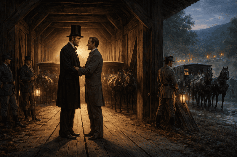
Did Abraham Lincoln and Jefferson Davis secretly meet in West Virginia?
PHILIPPI, W.Va. — Did Abraham Lincoln and Jefferson Davis secretly meet in what is now West Virginia just days after the first land battle of the...
Study finds WVU and its health system account for 17% of West Virginia’s economy
MORGANTOWN, W.Va. — West Virginia University and the WVU Health System together generate $14.3 billion in annual economic impact in West Virginia,...