MARLINTON, W.Va. — A new gravel and bikepacking network connecting 12 towns across the Monongahela National Forest region, colloquially called “the Mon,” has launched, offering more than 60 curated cycling routes across eight West Virginia counties.
The network, launched by the 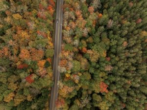 A lone motorist travels US-250 through the Monongahela National Forest. (Photo courtesy W.Va. Dept. of Tourism)[/caption]
The network connects the towns of Elkins, Parsons, Thomas, Davis, Durbin, Marlinton, Richwood, Cowen, Petersburg, Franklin, Seneca Rocks, and White Sulphur Springs. Routes are organized by both town and distance, allowing riders to begin trips from any participating community.
Among the featured routes is the Mon Circuit 600, a long-distance ride linking all 12 towns in a continuous route that includes more than 50,000 feet of climbing.
Pocahontas County contains some of the network’s largest and most varied offerings, with Durbin and Marlinton serving as major hubs. Routes in the area range from beginner loops along Forest Road 44 and the West Fork Rail Trail to more difficult rides reaching remote sections of the Mon Forest, including Laurel Fork Wilderness, Glady, and Smoke Camp Knob.
One of the most challenging Durbin-area routes, Gaudineer’s Watch, crosses both sides of the upper Greenbrier River valley and passes through red spruce forests near Gaudineer Knob and Camp Allegheny.
In the southern portion of the network, the Greenbrier River Trail serves as a central corridor for rides in the Marlinton area. Cyclists can choose shorter family outings or longer bikepacking trips extending between Caldwell and Cass Scenic Railroad State Park. Other routes climb toward the Highland Scenic Highway, the Falls of Hills Creek, the Droop Mountain Battlefield, and the Green Bank Observatory.
Josh Nease, executive director of the Mon Forest Towns Partnership, said the project represents a major milestone for the region and could help support recreation-based economic development and tourism in mountain communities.
The network was developed through support from the Appalachian Regional Commission, along with contributions from Village-to-Village Trails, Bikepacking Roots, and Mountain Rides.
David Landis of Village-to-Village Trails said the forest region offers a rare combination of remote public lands, mountain towns, and interconnected gravel roads.
Cyclists interested in exploring the new network will have an opportunity during the Bikepacking Roots Annual East Coast Summit, scheduled for May 29 through June 1, 2026, in Marlinton. The event will include guided rides and community activities throughout the southern Mon Forest region.
The complete route network is available through monforesttowns.org/gravel.

 A lone motorist travels US-250 through the Monongahela National Forest. (Photo courtesy W.Va. Dept. of Tourism)[/caption]