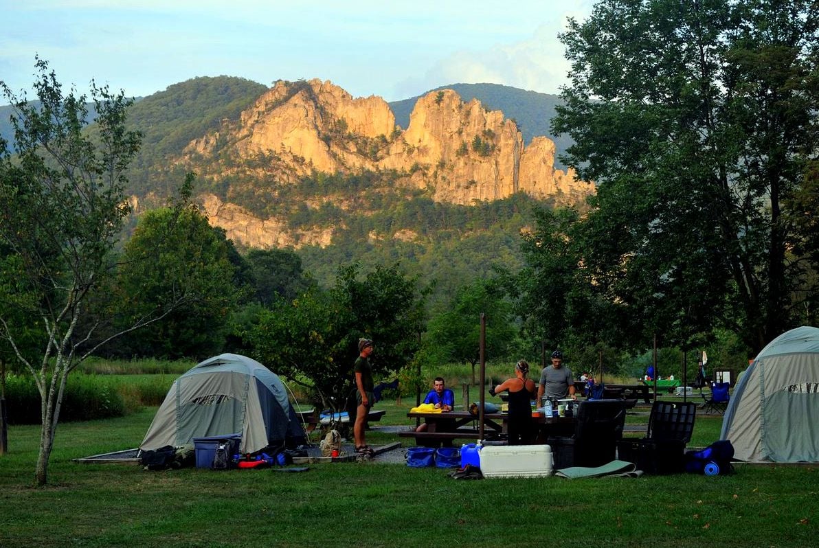
SENECA ROCKS, W.Va. — As summer approaches, residents of the historic village below Seneca Rocks brace for an influx of tourists that grows larger every year. At Harper’s Old Country Store, they field a steady stream of questions from travelers drawn to the otherworldly landscape. “How high are the rocks?” “How hard is the hike to the top?” “Did the Seneca tribe actually live here?”

Hikers, anglers, kayakers, and sightseers gather by the hundreds at the store, mingling with climbers geared up to scale the world-famous formation. Proprietor Matt Harper says the completion of a new expressway from the D.C. metro, route US 48, has boosted local tourism, as have the affluence of the Canaan Valley ski areas and the boutique towns of Davis and Thomas. “The new road changed everything,” he says.
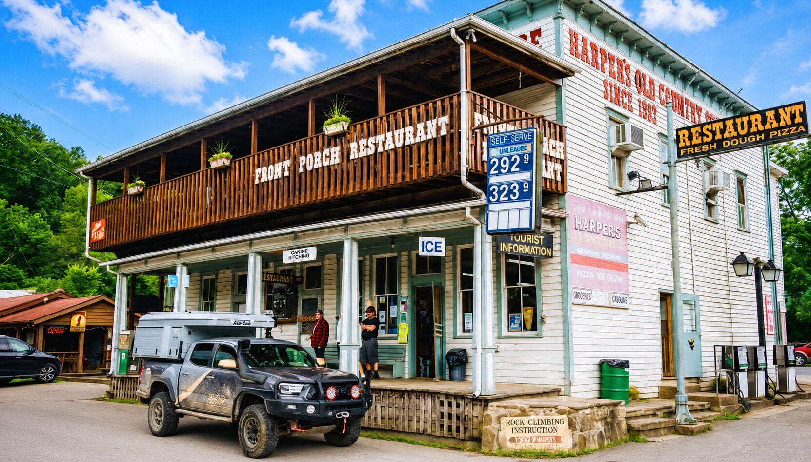
The tourists arrive from Richmond, Pittsburgh, and Washington—not actually that far away, though it seems a world away. “I can be at the White House in three hours,” he says, attesting to the drive time. To meet travelers’ needs, he recently began serving beer, and “as soon as we did, this guy came all the way from Virginia Beach saying he’d heard we had beer on tap.”
Seneca Rocks has always been a landmark. The Seneca peoples, traveling a warpath through the region in the 1600s, were in awe of the formation, the largest of many towering “fins” that followed their trail. Well into the 1700s, it was renowned as a boundary marker, designating the leading edge of the westward wilderness.
In 1965, the rocks and nearby Spruce Knob, the highest point in the state, came under federal protection as a national recreation area, and a visitor center was established, swiftly becoming one of the top attractions in the million-acre Monongahela National Forest, within which it lies.
At the discovery center, visitors can learn about geology, explore displays on local history, and investigate the development of rock climbing. Ranger programs and educational presentations are offered during the busy summer and fall seasons. Forest staff and rangers are available to discuss hiking and climbing conditions, local lore, and wildlife.
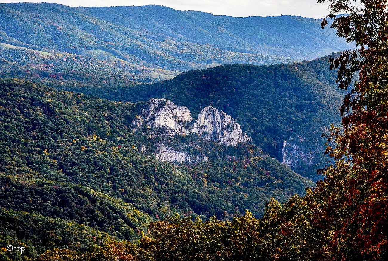
Beginning near the center, the Seneca Rocks Trail is a well-maintained route about 1.3 miles one way (roughly 2.6 miles round trip) that climbs steadily to an observation platform near the top of the rocks. The overlook provides sweeping views of the surrounding valley and the looming Allegheny Front to the west. The trail does not continue onto the exposed rock summits themselves, and technical climbing is required beyond the observation deck.
You’ll find more information about the visitor center and how to arrange a visit to the rocks at the end of this article.
Geology of Seneca Rocks
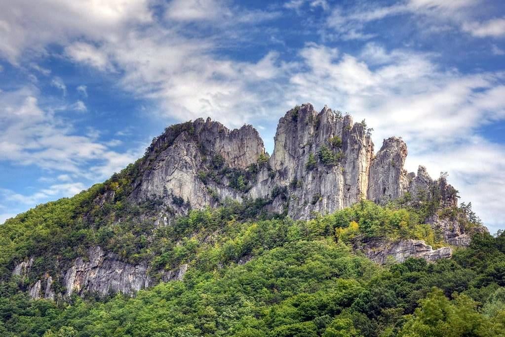
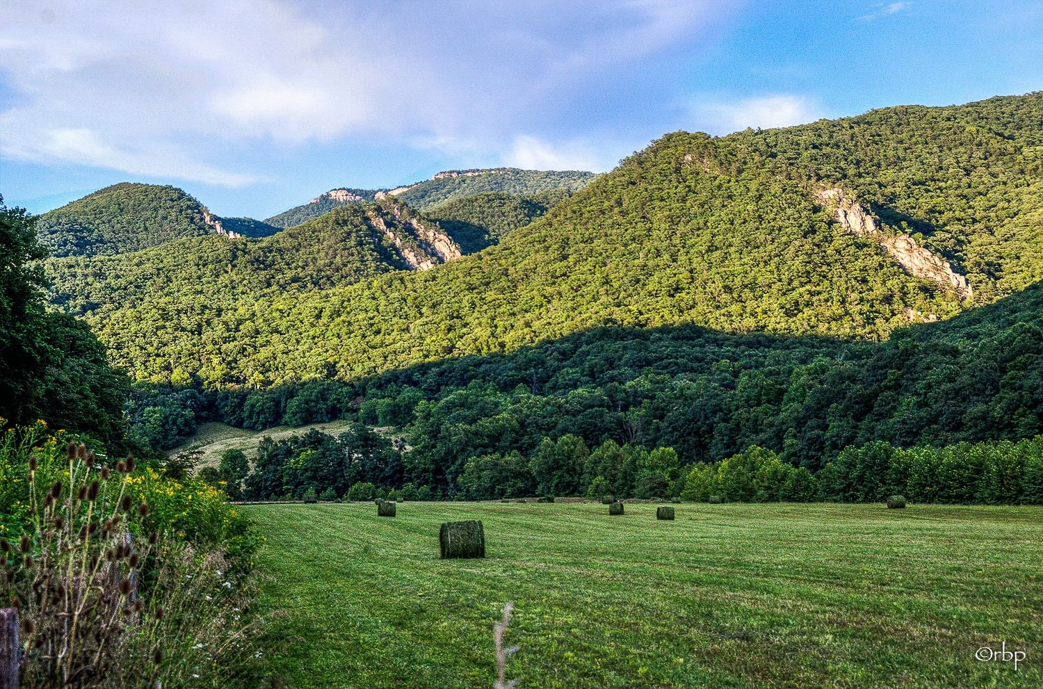
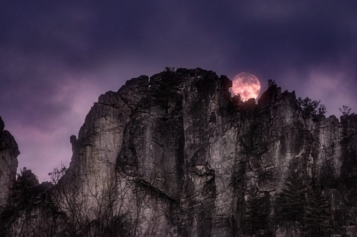
Seneca Rocks is one of the most distinctive geologic formations in the Appalachian Mountains and among West Virginia’s best-known natural landmarks. Rising nearly 900 feet above the valley of the North Fork of the Potomac River, its soaring fins are composed chiefly of hard, quartz-rich sandstone, now known as the Tuscarora formation.
Sand that accumulated along the shore of the ancient Iapetus Ocean, a precursor to the Atlantic Ocean, was deposited about 440 million years ago during the late Ordovician and early Silurian periods. At the time, the region lay within a broad coastal environment of shallow seas and sandy shoals. Over millions of years, the sand layers were buried, compacted, and cemented into stone. The Seneca Project, established by climbers to explore the culture of the rocks, describes the formation as the result of “hundreds of millions of years of active geology.”
Subsequent mountain-building events roughly 250 to 300 million years ago subjected the rock to immense pressure, producing the dense quartzite visible today. The dramatic shape of the rocks formed during a mountain-building period known as an “orogeny,” in this case the Alleghanian Orogeny, when continental collisions compressed and folded the Earth’s crust.
The rocks are part of the western limb of a massive folded structure, the Wills Mountain Anticline, that extends through parts of Pennsylvania, Maryland, Virginia, and West Virginia. Here at Seneca Rocks, geological forces tilted the horizontal rock layers nearly vertically, producing the towering, fin-like ridge visible today. Other nearby fins, such as Nelson Rocks and Champe Rocks, are part of the same formation.
The rocks are classified as an “erosional remnant.” Over vast spans of time, softer surrounding rocks weathered more rapidly than the Tuscarora quartzite. This differential erosion left behind the narrow, blade-like outcrop known as a “fin.” The West Virginia Geological and Economic Survey notes that the vertical rock beds at Seneca Rocks are a classic example of this erosional feature.
The Tuscarora quartzite itself is generally light gray to white and composed largely of tightly fused quartz grains. Geologist N.H. Darton described it in 1896 as “the very hard, white rock” responsible for the rugged crests of several Appalachian ridges.
“The line of ridges on the west side of North Fork Mountain is mainly due to the Tuscarora quartzite, which stands vertical and outcrops in jagged ledges along the center of the ridges,” Darton wrote.
“These ledges are often very prominent, notably at the famous ‘Rocks of Seneca’ at the Mouth of Seneca, where vertical walls of white quartzite over 200 feet high face westward. The crest line is quite jagged, and the white surface is beautifully mottled with streaks of yellowish, greenish, and brownish hues from lichens and iron stains.”
Because of its hardness, vertical fractures, and exposed bedding planes, Seneca Rocks has become one of the premier traditional rock-climbing destinations in eastern North America. The geologic processes that formed the cliffs also created the cracks and fissures now used as climbing routes. Today, the formation remains an outstanding example of Appalachian structural geology and long-term erosion in the Valley and Ridge Province.
The Lore of Seneca Rocks
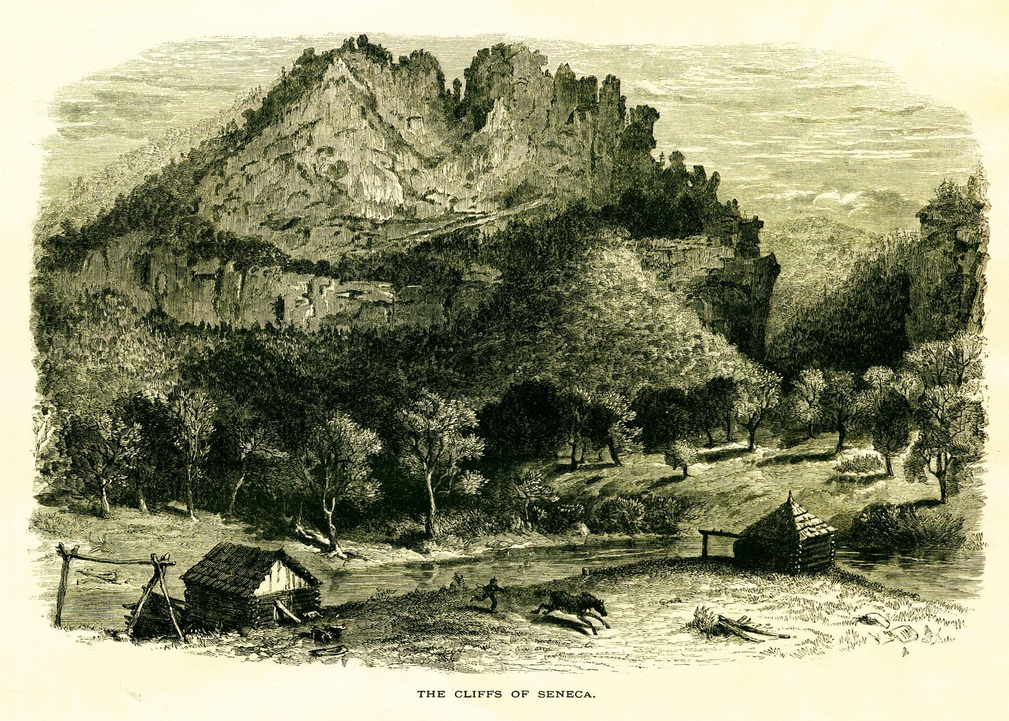
Seneca Rocks has long held a prominent place in the lore, oral traditions, and regional identity in the Potomac highlands. Its towering fins have inspired generations of frontier stories, romantic legends, and climbing lore.
The rocks derive their name from the Seneca people, members of the Haudenosaunee (Iroquois) Confederacy who traveled through and hunted in the region. Archaeological evidence indicates that indigenous peoples occupied the surrounding valleys centuries before European settlement. According to the Monongahela National Forest, excavations near the present visitor center uncovered evidence of prehistoric village sites dating back hundreds of years. The area also lay near the Great Indian Warpath, an important trade and travel route through the Appalachians.
Among the best-known legends associated with the rocks is the romantic tale of “The Betrothal of Snow Bird, Princess of the Seneca Indians,” published in 1932 by writer Harry Malcolm Wade. The story tells of Snow Bird, the daughter of a Seneca chief, who falls in love with an enemy warrior. Although literary rather than historical, the tale became deeply associated with the rocks and helped shape their popular mythology during the twentieth century. The U.S. Forest Service later preserved and shared the story as part of the area’s interpretive history.
Other frontier folklore linked to the rocks concerned conflict and survival along Virginia’s eighteenth-century western frontier. The imposing cliffs served as a landmark for settlers moving into the region and as a boundary between colonial settlements and native homelands.
By the twentieth century, new forms of lore emerged through mountaineering and outdoor recreation. Climbers developed stories surrounding dangerous ascents, unusual rock formations, and military training exercises conducted there during World War II. One of the most famous features was the “Gendarme,” a dramatic rock pinnacle that collapsed in 1987, becoming part of local climbing legend.

Climbing at Seneca Rocks
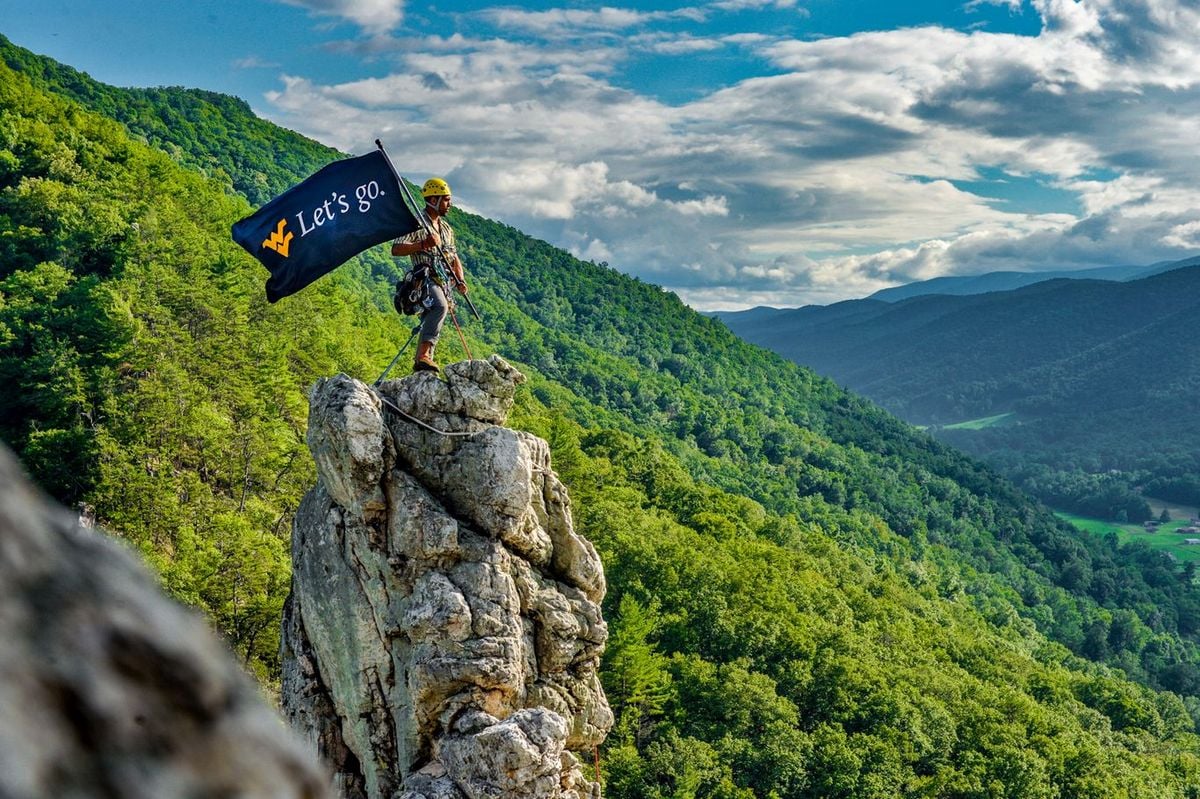
Seneca Rocks is also among the most important historic climbing destinations in the eastern U.S. Its steep faces, exposed summits, and extensive crack systems helped establish it as a center of traditional rock climbing in the twentieth century.
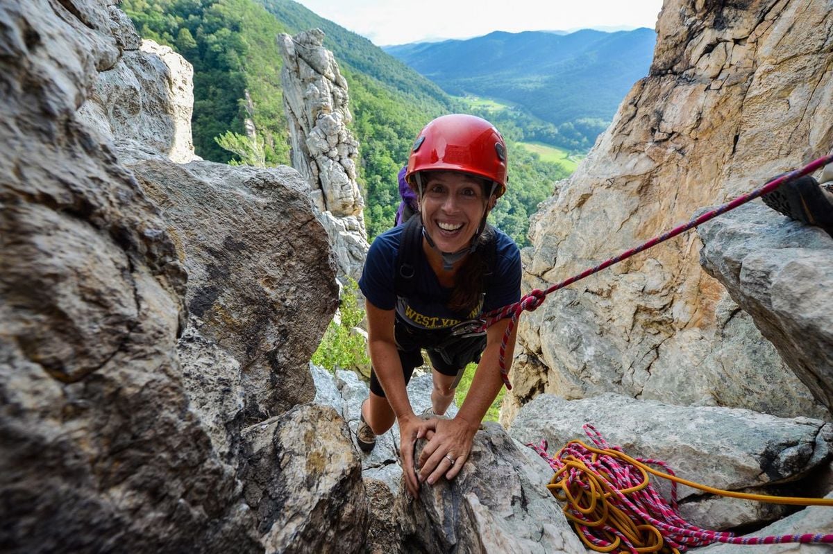
Although indigenous peoples likely climbed portions of the formation before European settlement, the first documented technical ascent did not occur until 1935. Called “the father of rock climbing” in the Washington, D.C., area, Paul Bradt and several companions then conducted one of the earliest recorded roped ascents and descents of the North Peak during an expedition organized by the Potomac Appalachian Trail Club.
After World War II, climbing expanded significantly in the U.S. Improved equipment and growing interest in mountaineering attracted more climbers. During the 1950s and 1960s, the rocks became known for difficult traditional “lead” climbing, in which climbers placed removable protection into cracks as they ascended. Many routes established during this era remain in use today. The rocks eventually gained national recognition for their sustained multi-pitch routes and exposed summit traverses. More than 375 mapped climbing routes now exist, ranging from beginner climbs to highly technical ascents rated 5.14b.
Military training also contributed to the area’s climbing history. During World War II, the U.S. Army used Seneca Rocks to train soldiers in mountain assault and rope techniques before deployment to Europe. This association later strengthened the area’s reputation as a premier vertical training site. (fs.usda.gov)
One of the most famous features in Seneca climbing lore was “The Gendarme,” a freestanding rock pinnacle located between the formations’ north and south peaks. The Chesapeake Bay Program described it as a “25-foot-tall, 20-ton slab” that collapsed dramatically on October 29, 1987. Its fall became a defining memory for generations of climbers and West Virginians familiar with the formation.
The rocks remain a nationally respected center for traditional climbing instruction and mountain guiding. Long-established local institutions such as Seneca Rocks Climbing School and Seneca Rocks Mountain Guides continue to train new climbers on the historic cliffs. Climbers can also obtain equipment and supplies from nearby shops, including The Gendarme, a climbing and outdoor gear store in the Town of Seneca Rocks.
Visiting Seneca Rocks
Seneca Rocks is in eastern West Virginia, within the Monongahela National Forest, near the junction of U.S. Route 33 and West Virginia Route 28. The formation lies about 35 miles east of Elkins and roughly three hours from Washington, D.C. The Seneca Rocks Discovery Center is at 13 Roy Gap Road, just south of the Route 33/28 intersection.

The rocks are accessible year-round for hiking and climbing, weather permitting. The popular Seneca Rocks Trail is open year-round and leads about 1.3 miles uphill to an observation platform beneath the cliffs. The nearby Discovery Center operates seasonally; the U.S. Forest Service lists current hours as daily from 9 a.m. to 5 p.m. from late May through early September, though hours can vary outside the main tourism season.
Parking is available near the Seneca Rocks Discovery Center and trailhead, though overnight parking is generally prohibited in day-use lots.
Oh that is just great. Now all the looney people will flood your beautiful parks, camp grounds, and etc. Now your locals will hate it and not be able to enjoy anything here on out without 1000s of outsider idiots enjoying what they used to. G good luck with that.