The 105-mile-long Gauley River rises in the highlands of eastern West Virginia (WV) and descends across the south-central state through an area of tablelands into its western valleys. It joins the New River at Gauley Bridge, West Virginia, to form the Kanawha River. It flows south-westward from its headsprings in the forests on Gauley Mountain at more than 4,000 feet above sea level.

Its basin is almost entirely forested, though farmlands and a few small towns are located along its mid-course. Along the way, the river descends out of Pocahontas County through Webster and Nicholas counties to its junction with the New in Fayette County at Gauley Bridge, West Virginia. The drainage of the Gauley is roughly 1,430 square miles. Many hunting and fishing camps are located along its banks.
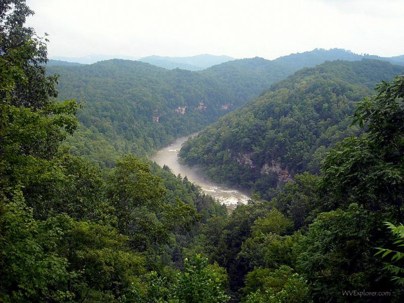
Gauley River National Recreational Area
The river rises in the Monongahela National Forest in the Allegheny Mountains region. Its lower course descends through the Gauley River National Recreational Area, a world-class destination for paddling and whitewater rafting. The National Park Service administers the recreation area as part of the New River Gorge National Park and Preserve. Above the recreation area, the river is impounded as Summersville Lake, the largest lake in West Virginia. The upper river and three of its primary tributaries, the Cherry River, Cranberry River, and Williams River, are popular fly-fishing streams. Its lower tributary river, the Meadow River, is a famous whitewater and bass-fishing stream.
History of the Gauley River
Aboriginal people lived within the watershed of the Gauley River, though it remained largely unoccupied as a result of its rugged terrain. The first European settlement in the region was at Peters Creek in Nicholas County in the 1700s. Coal and timber operations were established throughout the basin in the late 1800s, drawing more people to settle along the Gauley River and surrounding uplands.
During the Civil War, on September 10, 1861, a skirmish erupted between soldiers at Carnifex Ferry, which was a crossing on the Gauley River at the mouth of the Meadow River. It is now preserved as part of Carnifex Ferry Battlefield State Park.
Gauley River Communities
From source to mouth, the following select cities, towns, and villages are located on or near the Gauley River.
- Gauley Mills, WV
- Camden on Gauley, WV
- Cowen, WV
- Craigsville, WV
- Summersville, WV
- Swiss, WV
- Jodie, WV
- Belva, WV
- Gauley Bridge, WV
Name Origin
The name Gauley is said to be of French origin, a modification of the old French word, Gaud, which might in this application mean “ebulent” or “showy.
Variant Names
Chin-que-ta-na, Chinquetanacepewe, Falling Creek, Gaul River, Gawly River, Gualey River, River of Gauls, The Falling Creek, The Falls Creek, To-ke-be-lo-ke, To-ke-bel-le-ke, To-ke-bel-lo-ke, Tokobelloke. “To-ke-bel-lo-ke” is said to be a Native American phrase, from the Delaware tribe, meaning “falling creek”
Regional Information
Information on lodging, dining, and recreation on and near the upper Gauley River, upstream of Summersville Lake, may be found in our guide to travel in the Allegheny Highlands Region. Information on the river downstream of Summersville Lake may be found in the New River Gorge Region.
Read Also
- Five little-known facts about rafting the Gauley River