
BEAVER, W.Va. — West Virginia’s abundance of place names ending in Run and Fork is not simply a local impression. A nationwide study of stream names found that both terms occur in West Virginia at rates far above the national average.
Geographer Jon C. Campbell analyzed more than 221,000 stream names recorded in the federal Geographic Names Information System. His study found that run appeared in 45.1 percent of West Virginia stream names, compared with 6 percent nationally. Only Pennsylvania, at 65 percent, and Ohio, at 48 percent, recorded higher percentages.
West Virginia ranked first in Campbell’s analysis for using fork as the geographic term in a stream name. It accounted for 13.4 percent of West Virginia stream names, compared with 2 percent nationally. Kentucky ranked second at 12.3 percent.
The findings establish that West Virginia differs substantially from the national pattern in its use of at least two stream terms. They do not establish that West Virginia place names as a whole are more unusual than those in other states.
“West Virginia place names are wonderfully evocative,” said historian and West Virginia Explorer publisher David Sibray. “You can hear the landscape in them and often imagine the place before you ever see it.”
West Virginia linked by “run” to Ohio and Pennsylvania
Campbell’s 1991 study, “Stream Generic Terms as Indicators of Historical Settlement Patterns,” examined the words used to identify streams throughout the United States. He called those words generic terms. In Crooked Run, for example, Crooked distinguishes the waterway, and Run identifies the type of geographic feature.
Campbell found substantial differences among states. Pennsylvania had the highest percentage of streams using run, at 65 percent, followed by Ohio at 48 percent and West Virginia at 45.1 percent. Maryland had 24.1 percent, Virginia 15 percent, and Kentucky 3 percent.
Campbell noted that the Oxford English Dictionary traced the use of run as a stream term to Scotland by 1581. Earlier researchers had associated its American distribution with historical settlement patterns. Campbell found some correlation between stream terminology and settlement history but cautioned that place names alone cannot reliably determine who settled an area.
West Virginia ranks first in the use of Fork
Campbell found a different distribution for fork. West Virginia had 8,468 streams in the federal data Campbell examined. Of those, 1,135 used fork as the geographic term, or 13.4 percent. Kentucky followed at 12.3 percent, Utah at 7.5 percent, and Ohio at 5 percent. Virginia recorded 2.9 percent, Tennessee 2 percent, North Carolina 1.9 percent, and Pennsylvania 1 percent.
Campbell distinguished between fork used as the geographic term and its use as part of a longer name. Left Fork Rocky Creek, for example, uses fork directionally, while a name such as Harman Fork uses it to identify the stream itself.
The figures show a notable difference among neighboring states. Pennsylvania had the nation’s highest percentage of runs but recorded fork in only 1 percent of its stream names. Kentucky ranked second for fork but recorded run in only 3 percent. West Virginia recorded 45.1 percent for run and 13.4 percent for fork.
Gillenwater found another pattern in the New River Basin
West Virginia geographer Mack H. Gillenwater examined stream terminology at a regional scale nearly a decade before Campbell’s national study.
In 1982, Gillenwater studied 662 place names in approximately 1,100 square miles of the New River Basin. His paper, “Place Names as a Cultural Indicator in the New River Basin,” examined streams, settlements, and physical features using U.S. Geological Survey maps, West Virginia Geological Survey county maps, and historical manuscripts.
“Place names in any particular area are an accumulation from past history,” Gillenwater wrote.
Among the 273 stream names he examined, 125 were creeks, and 95 were branches. Together, creeks and branches accounted for 81 percent of the generic stream terminology in his study area.

The New River Basin results differed from Campbell’s later statewide figures, demonstrating that naming patterns also vary within West Virginia. Gillenwater considered the terminology possible evidence of settlers’ origins but called it only “moderate evidence” and said additional investigation was needed.
People were the largest source of New River stream names
Gillenwater also examined what distinguished one stream name from another. Personal names accounted for 110 of the 273 streams he studied, or 41 percent. Surnames included Adkins, Boone, Cook, Hale, and Smith, while given names appeared in Kates Branch, Hans Creek, Molly’s Creek, and Tommy Creek.
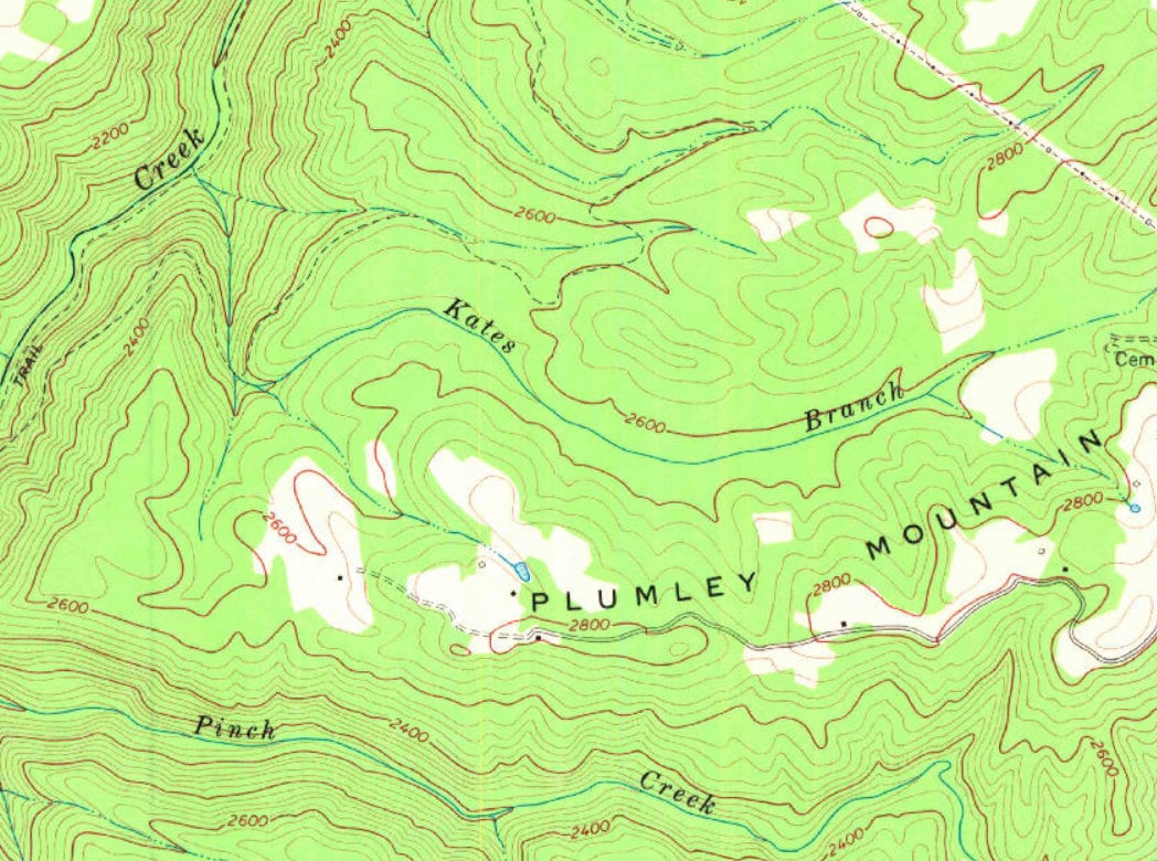
Gillenwater believed the prevalence of personal names reflected “the close relationship between early settlers and their land.”
Physical or descriptive characteristics accounted for 68 names, or 25 percent. Examples included Big Run, Broad Run, Long Branch, Short Creek, Contrary Creek, Crooked Run, and Loop Creek.
Vegetation accounted for another 40 names, or 15 percent. Gillenwater found Beech River, Maple Fork, Piney Branch, Cranberry Creek, Mulberry Branch, Fern Creek, and Laurel Fork, including 12 streams with laurel in their names.
Animals, birds, and insects accounted for another 25 names, including Bear Branch, Beaver Creek, Buffalo Creek, Bee Creek, and Turkey Branch. Gillenwater suggested that plant and animal names might contribute evidence about historical distributions, but he did not treat the names alone as proof that a particular species occupied a location at a particular time.
Some old terms remain in place names
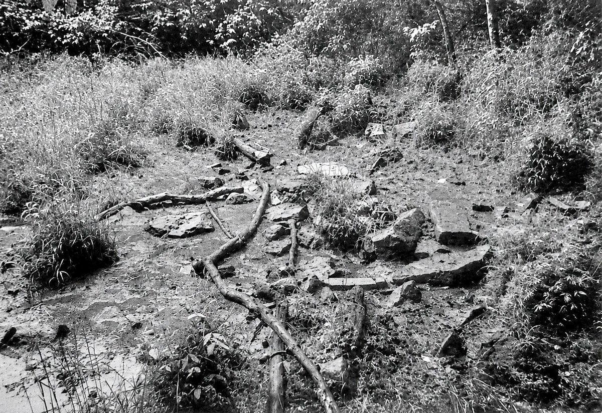
Gillenwater also examined lick, a term that appears in West Virginia names such as Stoney Lick Creek.
A lick referred to a place where animals came for salt or salt-bearing earth. He noted that the word could sometimes serve as the geographic term itself, as in Mud Lick.
Such terms can remain in place names even after their meanings fade from ordinary speech. Campbell noted that stream names can persist through maps and property descriptions even as everyday language changes.
Coal mining contributed another group of names
Gillenwater examined 272 settlement names in addition to streams. Seventy-six were mining towns, and 54 of those had personal names. Nine had feminine names, including Prudence, Sylvia, Variola and Tina. Other mining communities were named for companies or mining-related products.
Gillenwater’s interest in the subject extended beyond his New River study. A McDowell County native and Marshall University geography professor, he studied the cultural and historical geography of mining settlements in the Pocahontas coalfield and served as West Virginia director of a place-name survey conducted through the American Name Society.
His work followed an established tradition of place-name research in the state. In 1945, Hamill Kenny published the 768-page West Virginia Place Names: Their Origin and Meaning, Including the Nomenclature of the Streams and Mountains, documenting the origins of names across West Virginia.
Decades later, Campbell’s national data provided a way to put some of that West Virginia research into broader context.
For run, West Virginia’s 45.1 percent placed it behind Pennsylvania and Ohio but far above the national rate of 6 percent. For fork, West Virginia’s 13.4 percent was the highest percentage among the states, compared with 2 percent nationally.
The terms themselves are not unique to West Virginia. Their frequency and distribution are distinctive, and research by Campbell and Gillenwater indicates that their use may reflect historical patterns of settlement and language.
“Our place names do more than tell us where we are,” Sibray said. “They tell us what the land looks like, who lived there, and sometimes what happened there. In West Virginia, the map itself can read like a history.”