The Sinks of Gandy is one of the best-known cavern features in West Virginia and among the state’s most accessible cave systems. Located in the eastern highlands of the Monongahela National Forest near the community of Osceola in Randolph County, the sinks consists of a section of Gandy Creek that disappears beneath a limestone mountain before emerging approximately one-half mile downstream through a large cave entrance.

Unlike many caves in the state, the Sinks of Gandy can often be traversed without specialized equipment at normal water levels, making it one of the most popular “wild caves” in West Virginia. Its combination of geology, ecology, history, and recreation has made it an important destination for outdoor enthusiasts and a significant feature in Appalachian natural history.
Geography
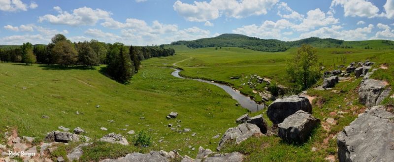
The Sinks of Gandy is located on the western flank of the Allegheny Mountains in eastern Randolph County, about 15 miles northeast of Spruce Knob. The feature lies within the upper watershed of Gandy Creek, a tributary of the Cheat River.
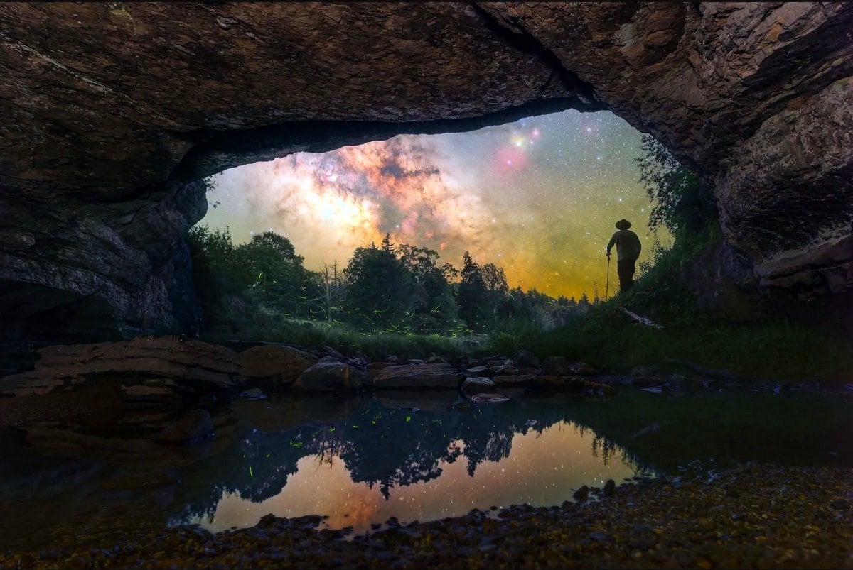
At the upstream “sink,” nearly the entire creek disappears into openings in the Greenbrier Limestone. Water then travels through an underground passage beneath a limestone ridge before reappearing at a broad cave mouth known as the “rise.”
The cave passage extends roughly 2,000-2,500 feet (600–760 m), depending on the route measured. Most visitors enter through one opening and exit through the other, effectively walking through the mountain along the underground stream.
Geology
The Sinks of Gandy formed within the Mississippian-age Greenbrier Limestone, which was deposited about 330 million years ago, when much of present-day West Virginia lay beneath a shallow tropical sea.
Over millions of years, slightly acidic groundwater dissolved fractures in the limestone, enlarging them into passages. As surface drainage developed, Gandy Creek captured one of these underground conduits, creating today’s disappearing stream.
The cave exhibits several classic karst features, including:

- Sinkholes
- Underground streams
- Solution passages
- Breakdown rooms
- Speleothems in isolated sections
- Seasonal flooding
Because the active stream still occupies much of the cave, the interior continues to evolve through erosion and dissolution.
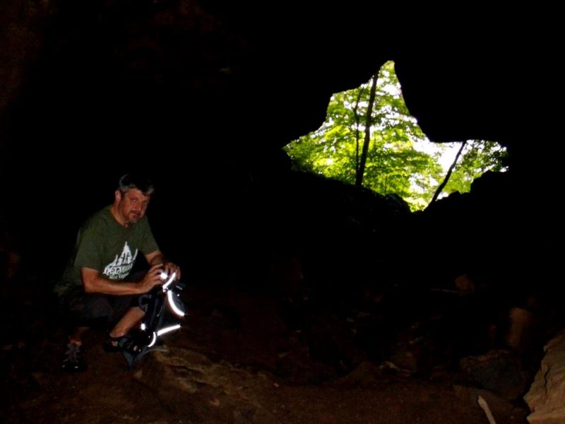
Cave characteristics
Unlike decorative commercial caves, the Sinks of Gandy is primarily a stream passage. Visitors encounter:
- Flowing water throughout much of the route
- Gravel bars
- Limestone ledges
- Boulder breakdown
- High-ceilinged chambers
- Narrow passages requiring brief stooping
- Complete darkness beyond the entrances
Water depths vary from ankle-deep to waist-deep, depending on rainfall.
The cave normally takes two to three hours to traverse comfortably, though experienced visitors may complete the trip more quickly.
Hydrology
The underground section is one of the most dramatic examples of stream piracy in West Virginia.
During periods of normal flow, nearly all of Gandy Creek disappears underground. During heavy rain or spring snowmelt, however, the cave’s capacity may be exceeded, causing portions of the creek to continue flowing across the surface while the cave passage fills rapidly.
Water levels can rise with little warning, making flooding the greatest natural hazard within the cave.
Biology
The Sinks of Gandy supports several specialized cave-dwelling organisms adapted to permanent darkness.
Species documented in the cave include:
- Cave crickets
- Salamanders
- Various aquatic invertebrates
- Bats that periodically roost in parts of the cave
Because caves provide sensitive habitat, visitors are encouraged to avoid disturbing wildlife, especially hibernating bats.
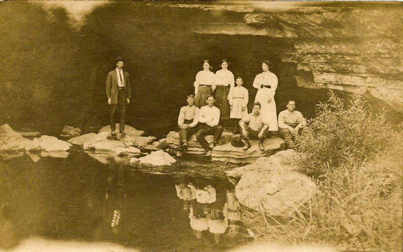
Human history
Indigenous peoples almost certainly knew of the sinks long before European settlement, though little archaeological evidence has been documented in the active stream passage because of periodic flooding.
European-American settlers recorded the feature in the nineteenth century, and it gradually became known among hunters, loggers, and local residents. By the twentieth century, it had become one of West Virginia’s most famous wild caves, attracting generations of explorers.
Unlike many caves that required technical climbing, the Sinks offered adventurous visitors an opportunity to experience underground travel with relatively modest equipment.
Recreation
The Sinks of Gandy remains a popular destination for hikers, cavers, photographers, and naturalists.
Visitors should prepare for:
- Cold water year-round (typically 50–55°F)
- Complete darkness, requiring multiple reliable light sources
- Wet, slippery footing
- Variable water depths
- Remote conditions with no cell service
The cave should never be entered during or immediately after heavy rainfall, as rapidly rising water can trap visitors inside.
Although ropes are typically not required, helmets, sturdy footwear, waterproof lighting, and warm clothing are strongly recommended.
Conservation
The sinks lie within the Monongahela National Forest and are managed to balance recreation with the protection of sensitive cave resources.
Conservation concerns include:
- Disturbance of bats
- Litter and graffiti
- Damage to fragile cave formations
- Spread of White-nose Syndrome among bat populations
Visitors are encouraged to follow Leave No Trace principles, avoid touching cave formations, and thoroughly clean clothing and equipment before visiting other caves to reduce the spread of disease.
Significance
The Sinks of Gandy is widely regarded as one of West Virginia’s premier examples of active karst geology. It offers scientists opportunities to study groundwater movement, cave ecology, and limestone landscape evolution, while providing the public with a rare chance to experience a naturally flowing underground river.
Because of its accessibility, educational value, and scenic character, the Sinks continues to rank among the state’s most recognized natural landmarks and remains a favorite destination for those seeking to explore the hidden landscapes beneath the Allegheny Mountains.