RICHWOOD, W.Va. — Visitors planning trips to the Cranberry and Williams River regions of the Monongahela National Forest this summer should prepare for detours and temporary road closures as the U.S. Forest Service begins repairs to flood-damaged forest roads serving some of the area’s most popular recreation destinations.
Construction is expected to begin in late June or early July on Forest Road 76 in the Cranberry area and Forest Road 86 in the Williams River area, according to forest service spokesman Josh Poling.
The projects are intended to repair flood damage, improve public safety, and restore reliable access for visitors and nearby communities, Poling said.
Forest Road 76 provides access to portions of the Cranberry region, including campgrounds, recreation sites, and backcountry areas. Work there will focus on stabilizing embankments damaged by flooding near the Baranshee drainage and Upper Cranberry areas.
On Forest Road 86, crews will repair the road base and resurface sections serving the Williams River corridor, a popular destination for camping, fishing, hiking, and hunting.
U.S. Forest Service officials said construction will occur in phases, with some sections of road closed while crews are actively working. Travel may not be possible in certain areas during construction, and visitors may need to use alternate routes that are longer than normal.
Access to private property will be maintained throughout the project, according to the agency.
Campgrounds and trailheads to remain accessible
Although travel patterns may change, forest service officials expect visitors will continue to reach key recreation destinations through alternate routes.


Sites expected to remain accessible include Cranberry Campground, Big Rock Campground, Woodbine Recreation Area, Tea Creek Campground, and the Three Forks Trailhead.
Alternative access routes will include Forest Road 101 and County Route 46/2 near Dyer. Officials said route recommendations may change as construction progresses and project segments are completed.
Visitors are encouraged to check conditions before traveling and allow extra time to reach recreation sites. The communities of Cowen, Richwood, and Marlinton are located in the Cranberry and Williams River areas.
Popular recreation destinations draw visitors across the region
The affected roads serve recreation areas that attract visitors from across West Virginia and neighboring states.
The Cranberry region includes access to the Cranberry Wilderness, one of the largest federally designated wilderness areas in the eastern United States. The area is known for its remote hiking opportunities, mountain streams, scenic drives, and camping facilities.
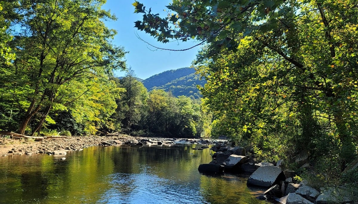
The Williams River area is widely known among anglers, campers, and outdoor enthusiasts for its trout fishing waters, forest roads, campgrounds, and trail systems. Nearby Tea Creek also serves as a gateway to backcountry recreation in the central Monongahela National Forest.
Summer is typically one of the busiest travel seasons for both regions.
Visitors asked to follow closures
Forest officials said vehicles, bicycles, and pedestrians will not be permitted to pass through active construction zones while work is underway.
Drivers should expect construction traffic, flaggers, changing traffic patterns, and temporary delays in affected areas. Construction schedules may change because of weather, field conditions, contractor availability, or other operational factors.
The Forest Service said additional information regarding closure dates, detours, and access routes will be released as project schedules are finalized.
Updates will be available through Monongahela National Forest alerts, district offices, social media channels, and future Forest Service announcements.
Visitors are asked to observe all posted closures and avoid entering active work areas for their safety and the safety of construction crews.
Recreation destinations affected by road closures
Sites expected to remain accessible include Cranberry Campground, Big Rock Campground, Woodbine Recreation Area, Tea Creek Campground, and the Three Forks Trailhead.
Cranberry Campground
Located along the upper Cranberry River in Monongahela National Forest, Cranberry Campground serves as a base for visitors exploring the Cranberry Wilderness and surrounding backcountry.

The campground provides access to hiking trails, fishing streams, and scenic drives, including nearby segments of the Highland Scenic Highway. Its location near one of West Virginia’s largest wilderness areas makes it a popular destination for campers seeking access to remote mountain landscapes.
Big Rock Campground
Big Rock Campground is situated along the Cranberry River and is known for its proximity to trout fishing waters and forest recreation opportunities. The campground provides a more secluded setting than some larger public campgrounds and serves visitors exploring the Cranberry Backcountry and surrounding national forest lands. The area is especially popular during the spring and summer fishing seasons.
Woodbine Recreation Area
Woodbine Recreation Area occupies the site of a former Civilian Conservation Corps camp and serves as a gateway to outdoor recreation in the Cranberry region. The area offers picnic facilities, access to hiking trails, fishing opportunities, and interpretive features highlighting the region’s natural and cultural history. The recreation area is a common stop for travelers exploring the Highland Scenic Highway corridor.
Tea Creek Campground
Tea Creek Campground lies along the upper Williams River watershed and is widely known among anglers, campers, and hikers. The campground provides access to Tea Creek, a nationally recognized trout stream, as well as numerous trails leading into the backcountry of Monongahela National Forest. Its central location makes it a popular base camp for visitors exploring the Williams River and Tea Creek areas.
Three Forks Trailhead
The Three Forks Trailhead serves as an important access point to the extensive trail system surrounding the Williams River headwaters. The area is known for hiking, backpacking, mountain biking, hunting, and fishing opportunities. Several trails converge near the trailhead, allowing visitors to reach remote sections of the forest, high-elevation streams, and backcountry campsites. Three Forks is considered one of the principal recreation gateways to the southern portion of the forest’s backcountry trail network.
About the Monongahela National Forest
The Monongahela National Forest is a federally managed public forest spanning nearly one million acres across the Allegheny Highlands of eastern West Virginia. Established in 1920, following extensive timber harvesting in the late nineteenth and early twentieth centuries, the forest today encompasses some of the state’s highest elevations and largest expanses of public land.
It extends across portions of ten counties and includes diverse landscapes, from hardwood forests and red spruce stands to mountain rivers, wetlands, and high-elevation plateaus.
The forest contains many of West Virginia’s best-known natural attractions, including Spruce Knob, the state’s highest point; Dolly Sods Wilderness; Seneca Rocks; the Highland Scenic Highway; and the Cranberry Wilderness.
than 900 miles of trails, hundreds of miles of streams, numerous campgrounds, and extensive backcountry areas support hiking, camping, fishing, hunting, mountain biking, and wildlife viewing. The forest also protects critical habitat for a variety of rare plant and animal species and serves as an important source of drinking water for communities throughout the region.
Cranberry Area
The Cranberry region spans a large portion of the central Monongahela National Forest and is centered on the Cranberry River watershed. The area is best known for the Cranberry Wilderness, a federally designated wilderness encompassing nearly 48,000 acres.
Established by Congress in 1983, it is among the largest wilderness areas in the eastern United States and contains extensive tracts of second-growth forest that regenerated after widespread logging in the early twentieth century.
The Cranberry area includes a network of campgrounds, trailheads, fishing streams, and scenic drives. Portions of the Highland Scenic Highway pass through the region, providing access to overlooks and recreation sites. The Cranberry River itself is renowned for its trout fishing, while numerous trails provide access to remote sections of the wilderness.
Recreation facilities such as Cranberry Campground, Big Rock Campground, and Woodbine Recreation Area serve as gateways to the region’s natural and historical resources.
Williams River Area
The Williams River area occupies the southern portion of the Cranberry backcountry and centers on the upper Williams River watershed, a major tributary of the Gauley River system. Flowing through rugged mountain terrain, the river is known for its cold, clear waters and has long been regarded as one of West Virginia’s premier trout streams. The surrounding forests offer extensive recreational opportunities and support diverse wildlife populations.
The Williams River corridor includes numerous campgrounds, trailheads, and forest roads that provide access to remote sections of the national forest. Tea Creek Campground and the Three Forks Trailhead are among the best-known recreation sites in the area.
The region serves as a starting point for hikers, backpackers, anglers, hunters, and mountain bikers exploring the backcountry. Several trails connect the Williams River watershed with neighboring portions of the Cranberry Wilderness and the broader Monongahela National Forest trail system.
Together, the Cranberry and Williams River regions form one of the largest and most heavily visited recreation complexes within Monongahela National Forest. Their combination of wilderness lands, mountain streams, campgrounds, and trail networks has made the area a centerpiece of outdoor recreation in West Virginia for decades.
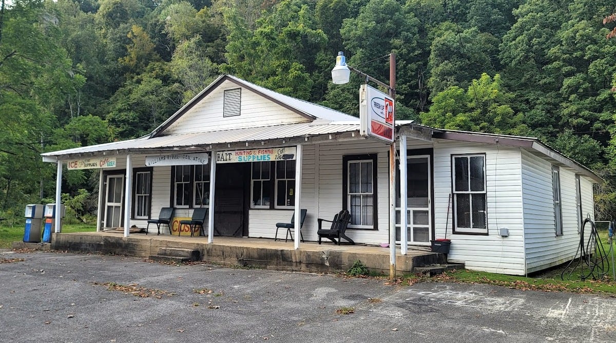
The General Store on Williams River Road has not been open for years. Not sure where picture came from but it is an oldie.