
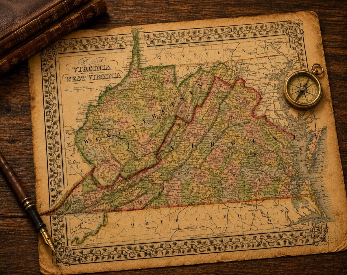
CHARLESTON, W.Va. — Most Americans know there is a Virginia and a West Virginia, but far fewer know why. The answer is not simply that the Civil War divided the nation. It also divided Virginia, producing the only permanent change to the map of the United States during the conflict.

Before the war began in 1861, West Virginia did not exist. Two years later, 50 western counties had become the nation’s 35th state, while five more joined soon afterward.
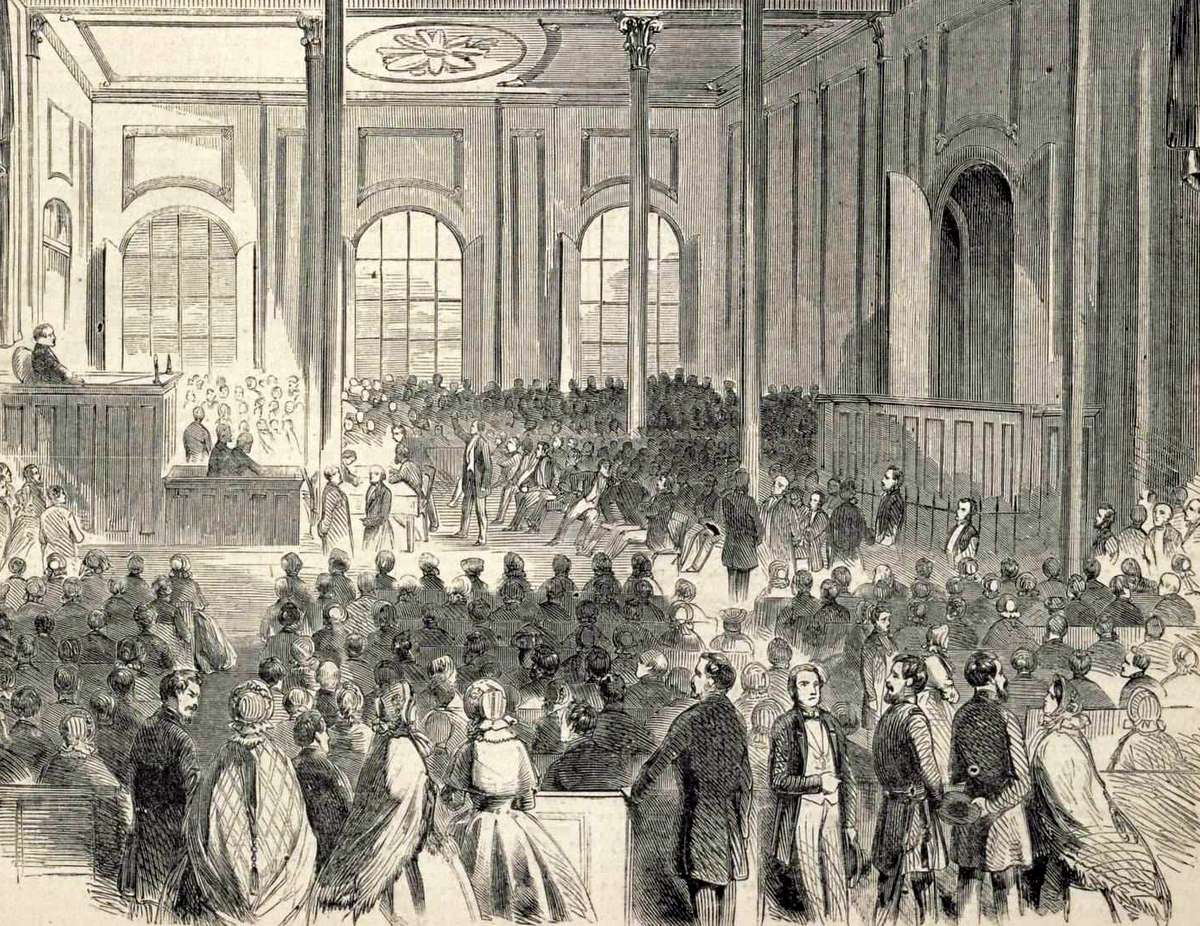
That transformation did not occur because residents of western Virginia simply decided to go their own way. It resulted from a political struggle in Wheeling, a series of Union military victories across the Appalachian Mountains, and a contest for railroads, rivers, and natural resources that both the Union and Confederacy considered essential to winning the war.
The story explains not only why West Virginia exists, but why one of the nation’s least understood Civil War campaigns carried consequences that extended far beyond the mountains where it was fought.
Virginia was already divided before the first shots were fired
The divide between eastern and western Virginia had been widening for decades before the Civil War. Although they shared a government in Richmond, the two regions often clashed over representation, taxation, transportation improvements, and economic priorities.

Large plantations and enslaved labor dominated much of eastern Virginia, while western counties relied more heavily on small farms, timber, livestock, salt production and emerging industries.
When Virginia’s convention voted to secede from the Union in April 1861, those divisions became impossible to ignore. Many western Virginians opposed leaving the Union, while others supported secession and joined Confederate forces. Communities split over the issue, and families often discovered that sons, brothers and cousins had enlisted on opposite sides.
Historians Philip Conley and Dr. William Thomas Doherty wrote that western Virginia experienced one of the Civil War’s most personal conflicts. They cited the family of Confederate General Thomas J. “Stonewall” Jackson, whose sister, Laura Jackson Arnold, of Buckhannon, remained loyal to the Union, and Martinsburg attorney John Rogers Cooke, whose relatives fought for opposing governments.

Similar stories unfolded throughout the region, where loyalty often became known only after a soldier failed to return home.
Why the Appalachian Mountains mattered
If western Virginia had been little more than isolated mountain country, neither government would have committed so many troops to controlling it. Instead, the region occupied one of the most important strategic positions in the eastern United States.

The Baltimore & Ohio Railroad connected Washington with the Midwest, enabling troops, supplies, and communications to move quickly between the capital and the growing industrial states to the west. Major turnpikes crossed the Allegheny Mountains, and the Kanawha Valley produced much of the salt needed to preserve meat for armies before refrigeration.
Read more: Historic maps showing these transportation routes and the military geography of the conflict are available through the Library of Congress Civil War Maps Collection.
President Abraham Lincoln understood that losing western Virginia would threaten the Union’s transportation network and weaken support among the border states. Confederate leaders recognized the same geography from the opposite perspective. Whoever controlled western Virginia controlled some of the most important routes through the Appalachians.
The war for western Virginia therefore became much more than a contest over mountain counties. It became a struggle over whether the Union could maintain one of its most important military lifelines.
The campaigns that changed the map
Union forces moved quickly in the war’s opening months. In June 1861, they defeated Confederate troops at Philippi, securing an important foothold in northwestern Virginia. A month later, victories at Rich Mountain and Corrick’s Ford forced Confederate forces to abandon much of the region while preserving the transportation routes connecting Washington with the Midwest.
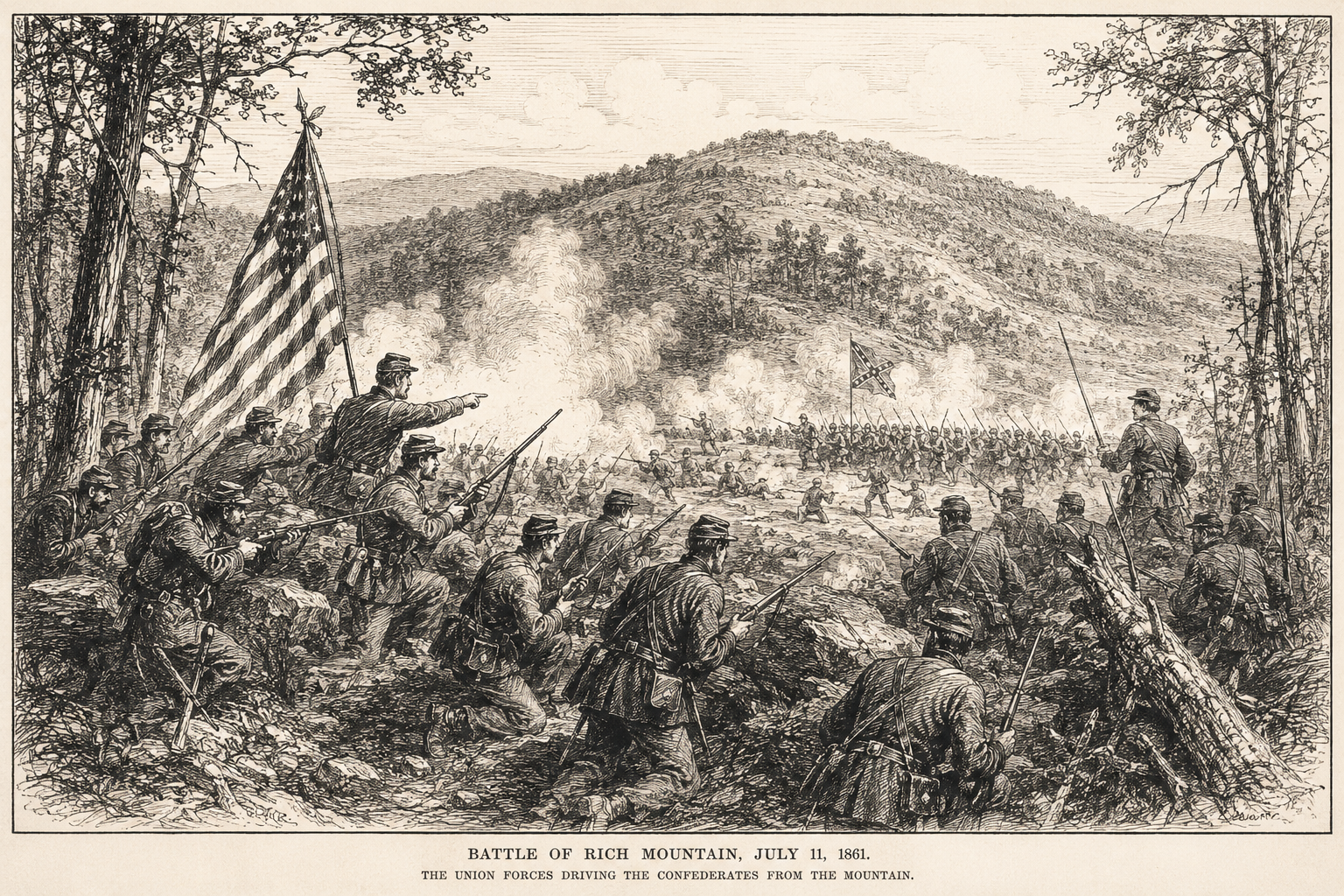
Military operations soon shifted south into the Kanawha Valley, where Confederate commanders Henry A. Wise and John B. Floyd hoped to recover valuable saltworks and reopen the route toward the Ohio River. Union victories culminating in the Battle of Carnifex Ferry secured the valley and confirmed Federal control over most of western Virginia.
The campaigns accomplished far more than winning battles. They established military control over the territory where Unionist leaders were attempting to organize a government loyal to the United States. Without those victories, historians generally agree, the political movement for statehood would have faced a far more uncertain future.
Read more: Readers interested in the battles at Philippi, Rich Mountain, Corrick’s Ford and Carnifex Ferry can explore additional history and preservation efforts through the American Battlefield Trust’s Guide to West Virginia Civil War Battles.
Robert E. Lee’s forgotten defeat
One of the least familiar chapters in the career of Confederate Gen. Robert E. Lee unfolded in what’s now West Virginia. Months before he became the Confederacy’s most celebrated commander, Lee was sent to recover territory that had fallen under Union control.
He faced steep mountains, primitive roads, heavy rains, and persistent supply problems that frustrated Confederate operations. Planned offensives failed to dislodge Union forces, and by the end of 1861, Confederate leaders had largely abandoned hopes of reclaiming most of western Virginia.
Lee would later achieve fame in Virginia’s eastern campaigns, but his experience in the mountains showed how geography could shape the Civil War as decisively as battlefield tactics.
Politics followed the armies
As Union forces secured western Virginia, political leaders met in Wheeling to establish the Reorganized Government of Virginia, which rejected secession and claimed to be the lawful government of the Commonwealth.

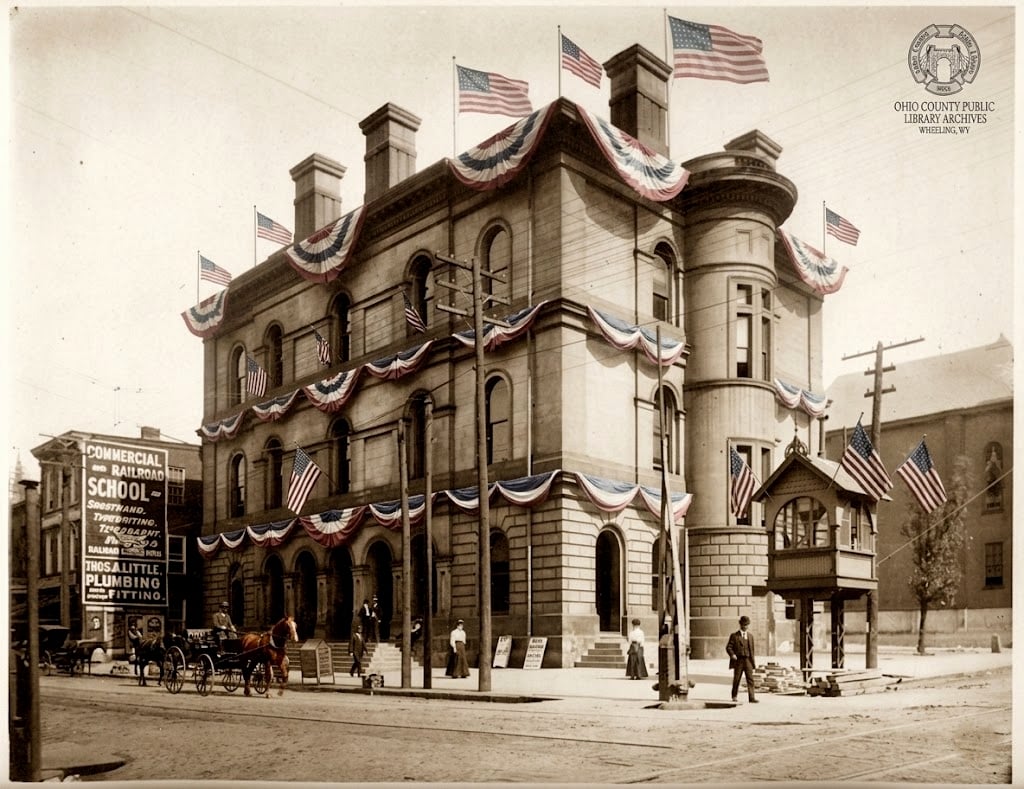
That government approved the creation of a new state from Virginia’s western counties, allowing Congress to consider the proposal during the war. President Lincoln signed the statehood bill on Dec. 31, 1862, and West Virginia entered the Union on June 20, 1863.
Read more: Readers interested in the constitutional process that led to statehood can explore original documents and historical background through the West Virginia State Archives’ West Virginia Statehood collection.
Military victories alone did not create the new state, but they made statehood possible. Union control protected the delegates meeting in Wheeling, secured the territory claimed by the proposed state, and prevented Confederate armies from overturning the new government by force.
The fighting did not end
Statehood did not bring peace to the mountains. Confederate commanders continued launching cavalry raids intended to destroy railroads, bridges, telegraph lines, and industrial facilities while gathering recruits and supplies.

The largest came in 1863, when Generals William E. Jones and John D. Imboden swept through western Virginia, damaging the Baltimore & Ohio Railroad and destroying vast quantities of oil at Burning Springs in present-day Wirt County.
Although these expeditions disrupted Union operations and caused extensive property damage, they never restored Confederate control over the region. After the Union victory at Gettysburg later that summer, the prospect of reversing West Virginia’s statehood became increasingly remote.
A question with an enduring answer
More than 160 years after the Civil War, visitors still ask why there are two Virginias. The answer lies not in a single vote or a single battle, but in the convergence of politics, geography and war.
Union victories across western Virginia protected one of the nation’s most important transportation corridors, allowed a loyal government to take root in Wheeling and created the conditions under which Congress admitted a new state to the Union.
The Civil War redrew the American map only once. The result was West Virginia, whose existence remains one of the conflict’s most enduring and least understood legacies.
Learn more: The West Virginia Encyclopedia’s Civil War entry provides additional background on the military campaigns, political events, and people that shaped the creation of West Virginia.
Great article!
Anyone that knows factual history knows that the only reason WV joined the Union is because of representation & economics. Had the Confederacy recognized WV as it’s own state, WV would have remained in the Confederacy. WV joining the Union is a perfect example of how the Civil War was not about abolishing slavery. If the Civil War was about abolishing slavery, WV would not have continued being a slave state even after joining the Union. The entire point of the Civil War was not to abolish slavery, it was to remove blacks from US soil. It didn’t become about abolishing slavery until after the Civil War was well underway. How do we know it was about removing blacks? Lincoln himself said it, & his actions prove it. Lincoln rounded up hundreds/thousands of blacks, put them on ships & sent them to islands where the majority of them died. The survivors only survived because they became cannibals. We all know to the victor goes the spoils. What most fail to realize is, the victor also gets to rewrite history. The majority of US citizens do not know factual history, they only know fictional history fabricated by the victor. The type of BS propaganda history they teach school children.
So, these two sources are professionals with years of study. What are your qualifications?
Most racist people get their information from ignorance and passed on via family values sadly.
I’m a West Virginian born in Charles Town, Jefferson County, a State born of fire during the Civil War, as were many of my ancestors. My Ancestors were in Various (Union & Confederate) Civil War Regiments:
Confederate:
1st Virginia Cavalry (Stuart’s)
Missouri Infantry, 1st Bn., Co. A,
2nd Virginia Infantry (“Stonewall Brigade”)
7th Virginia Cavalry (Ashby’s)
12th Virginia Cavalry (“Laurel Brigade”)
18th Virginia Cavalry (“Imboden’s Brigade”)
41st Battalion Virginia Cavalry was organized in September 1863, with four companies, later increased to seven. This unit skirmished in western Virginia and the Shenandoah Valley, then in April 1864, merged into the 23rd Regiment Virginia Cavalry, (“Imboden’s Brigade”)
43rd Battalion Virginia Cavalry (“Mosby’s Rangers”)
Quantrill’s Raiders
McNeill’s Rangers
39th Battalion Virginia Cavalry (“Lee’s Bodyguards”), Company A
Union:
2nd Regiment Maryland Cavalry, Company F, Potomac Home Brigade
11th Ohio Cavalry a “Galvanized Yankee”
Company H, 107th Regiment, Pennsylvania Infantry
Brigadier General George A. Custer is my 4th cousin, 4 times removed. In June 1863 he was appointed Brig. Gen. of Volunteers in command of 2nd Brigade (1st, 5th, 6th, and 7th Michigan Regiments) / 3rd Division / Cavalry Corps. LXMN-391
I’m distantly related to George Armstrong Custer through my great-great Grandmother (4th cousin 4 times removed). She married my Great-Great Grandfather Charles Prather, Company D, 12th Virginia Cavalry on 18 Dec 1866 in Berkeley County, West Virginia, Joanna Page Custer, also known as Josie, b. 7 Oct 1847 in Berkeley County, West Virginia, (daughter of Peter Custer and Matilda Lewis).
Daddy needs to learn the freed slaves volunteered to go to Haiti for colonization to live a life free of the evils of the racist man. Lincoln sent them and the experiment was a hard fail moslty due to disease, specifically smallpox. Many did die off but due to illness and starvation. Lincoln then returned the free men and women back to America. No people eaten here, by slaves on the way there or back. Long known lies to slur the black man. Apparently not everybody knows, hugh?
Most racist people get their information from ignorance and passed on via family values sadly. I’m not calling anyone a racist, just passing on ignorant behavior that never occurred is at its core dumb and WV doesn’t need to be known as more racist than it is or more ignorant than it is. I was born in Charleston and lived here my whole life. It is both for the most part and it needs to change or we will get left behind further. T hank you for your query…Wonder if he ever replies because he is not a historian, if he is, he’s trying to teach propaganda. Thanks WV Explorer!
Thank you , David, for always providing us with the best history of West Virginia on WV Explorer. I appreciate your articles so much and always learn something knew. I graduated in 1964 so what we learned regarding any History at that time was limited as to what we are able to find out now.
Thanks again and I look forward to your next article!