
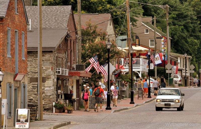
Harpers Ferry, West Virginia (WV), is a historic town at the confluence of the Potomac and Shenandoah rivers in Jefferson County, in the state’s Eastern Panhandle. Surrounded by steep, forested mountains, the community is best known for John Brown’s 1859 raid, its role in the Civil War, and the remarkably preserved historic district, now protected as part of Harpers Ferry National Historical Park.

The town also sits within one of West Virginia’s most dramatic landscapes. Here, the Potomac cuts eastward through the Blue Ridge at the natural passage known as the Potomac Water Gap, with Maryland Heights rising across the river and Loudoun Heights overlooking the Shenandoah.
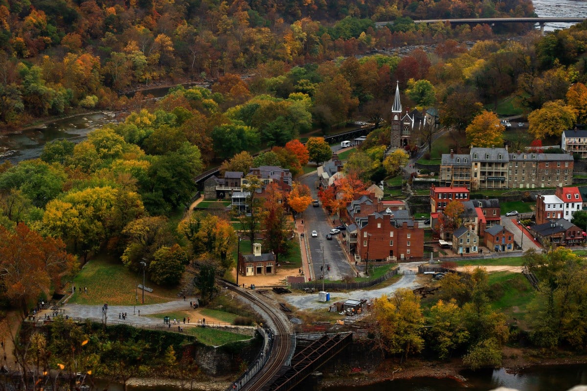
Today, Harpers Ferry is among West Virginia’s most popular historic and outdoor destinations. Visitors explore museums and restored buildings in Lower Town, hike the Appalachian Trail, climb to overlooks above the rivers, cross the Potomac on foot, and use the community as a base for exploring the surrounding Eastern Panhandle.
Things to do in Harpers Ferry
The visitor experience centers on Harpers Ferry National Historical Park, which preserves historic buildings, archaeological sites, museums, trails, and landscapes spanning more than two centuries of American history.
Lower Town contains many of the community’s best-known landmarks. Narrow streets climb between historic buildings toward Jefferson Rock and the upper portions of town, while trails and pedestrian routes lead to the rivers and surrounding mountains.
Visitors can explore exhibits on John Brown, the federal armory, the Civil War, African American history, industry, transportation, and the town’s development. Hiking, sightseeing, photography, cycling, paddling, and fishing are also popular in and around the community.
John Brown’s Fort
John Brown’s Fort is the building most closely associated with the abolitionist’s October 1859 raid on the federal armory at Harpers Ferry.
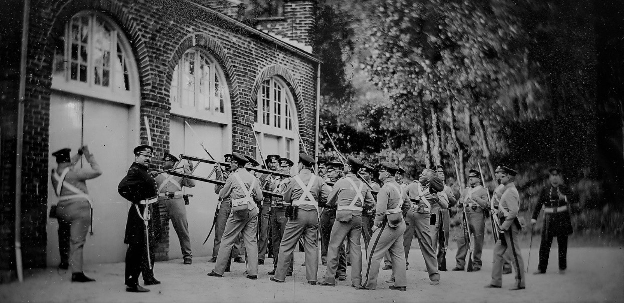
Brown and his followers seized the armory to obtain weapons and to inspire an uprising against slavery. After taking hostages, Brown and several surviving raiders barricaded themselves inside the armory’s fire-engine house.
U.S. Marines, commanded on the scene by Col. Robert E. Lee, stormed the building on October 18. Brown was captured, tried in nearby Charles Town, and executed that December.
The raid failed militarily but became one of the defining events preceding the Civil War, intensifying the national conflict over slavery and making Harpers Ferry internationally known.
The small brick building later became known as John Brown’s Fort. It was moved several times before being returned to Harpers Ferry, though not to its exact original location.
Harpers Ferry National Historical Park
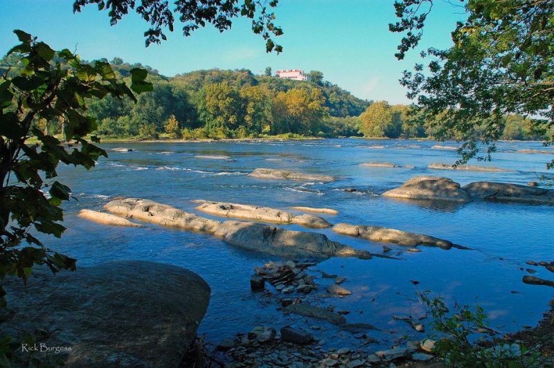
Harpers Ferry National Historical Park encompasses historic and natural areas across West Virginia, Maryland, and Virginia. Rather than preserving a single battlefield or building, the park interprets an entire landscape shaped by industry, transportation, slavery and abolition, war, education, and conservation.
Visitors to Lower Town can walk among restored 19th-century buildings and exhibits near the rivers’ confluence. Park lands also extend to the surrounding heights, preserving trails, Civil War sites, scenic overlooks, and portions of the Appalachian Trail.
Because parking is limited in historic Lower Town, many visitors use the National Park Service visitor center and shuttle system to reach the historic district.
Appalachian Trail
The Appalachian National Scenic Trail passes directly through Harpers Ferry, making the town one of the best-known communities along the approximately 2,190-mile footpath from Georgia to Maine.

Harpers Ferry is often described as the psychological midpoint of the Appalachian Trail, though the trail’s exact geographic halfway point lies farther north in Pennsylvania.
The Appalachian Trail Conservancy has long maintained a presence in Harpers Ferry, and generations of long-distance hikers have stopped here while traveling north or south along the trail.
Within the town, the Appalachian Trail passes through the historic district, crosses the Potomac River into Maryland, and continues along the Chesapeake and Ohio Canal towpath.
Jefferson Rock
Jefferson Rock is a prominent rock formation above Lower Town, overlooking the confluence of the Potomac and Shenandoah rivers.
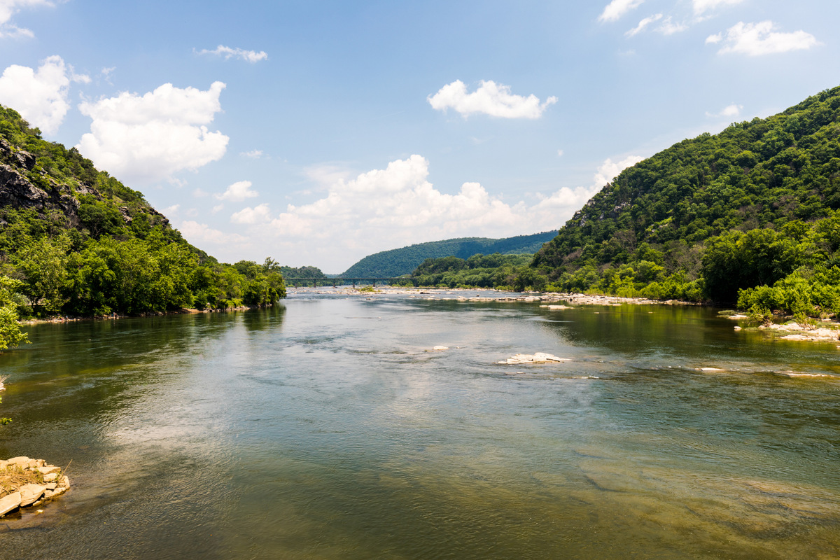
Thomas Jefferson visited the site in 1783 and later described the view in Notes on the State of Virginia, famously declaring that the scene was “worth a voyage across the Atlantic.”
The overlook remains one of the town’s best-known historic viewpoints and is accessible by climbing steps from Lower Town toward Harpers Ferry’s higher residential areas.
Maryland Heights
Across the Potomac River, Maryland Heights rises dramatically above Harpers Ferry, offering one of the most celebrated views of the town and the river confluence.
The Maryland Heights Trail climbs through the forest to an overlook high above the Potomac. Along the way, hikers encounter remains of Civil War fortifications built when control of the surrounding heights was essential to defending Harpers Ferry.
The hike is strenuous in places, but the overlook has become a signature viewpoint in the Harpers Ferry area.
Outdoor recreation
The mountains and rivers surrounding Harpers Ferry make the community an important destination for outdoor recreation and history.

The Potomac and Shenandoah rivers support paddling, tubing, rafting, fishing, and other water-based recreation. Trails climb into the Blue Ridge and follow the river corridors, linking Harpers Ferry to extensive public lands in West Virginia, Maryland, and Virginia.
The Chesapeake and Ohio Canal National Historical Park begins just across the Potomac in Maryland. Its towpath offers a nearly level route popular with walkers and cyclists and connects with the Appalachian Trail near Harpers Ferry.
Rock climbing is also popular on cliffs within the surrounding water gap.
History of Harpers Ferry
Early settlement and the federal armory
The community developed around a key crossing of the Potomac River. In the 18th century, Robert Harper established a ferry here, and the settlement that grew around the crossing eventually took his name.
The town’s location changed dramatically after President George Washington selected Harpers Ferry as the site of a federal armory and arsenal in the 1790s.
Waterpower from the Potomac and Shenandoah supported manufacturing, and the federal works transformed the small settlement into an important industrial community.
The armory became significant in the development of American manufacturing. Firearm production spurred advances in machinery, standardization, and interchangeable parts, while associated industries developed along the riverbanks.
Transportation and industry
Harpers Ferry occupied a strategic position where river, canal, railroad, and road routes converged.
The Baltimore and Ohio Railroad reached the area in the 1830s, linking the town more closely to Baltimore and eastern markets. The Chesapeake and Ohio Canal developed along the opposite bank of the Potomac.
Railroad bridges and industrial facilities became defining features of the landscape, while the surrounding mountains confined development to narrow terraces and steep hillsides.
John Brown’s raid
On October 16, 1859, abolitionist John Brown and a small group of followers attacked the federal armory at Harpers Ferry.
Brown hoped to seize federal weapons to support a broader revolt against slavery. His party initially captured the armory and several hostages, but local militia and federal forces soon surrounded the raiders.
The raid ended with Brown’s capture two days later. His subsequent trial and execution in Charles Town became national events.
Although unsuccessful in its immediate objective, the raid deepened sectional divisions over slavery and helped propel Harpers Ferry to the center of the national crisis that preceded the Civil War.
Civil War
Harpers Ferry’s strategic location made it extremely difficult to defend during the Civil War. The town sat below commanding heights on three sides while occupying an important transportation corridor between North and South.
Control changed repeatedly during the war, and military activity devastated much of the community’s industrial infrastructure.
The largest military action was the Battle of Harpers Ferry in September 1862. Confederate forces under Gen. Thomas J. “Stonewall” Jackson surrounded the Union garrison and captured more than 12,000 federal troops—the largest surrender of United States forces until the 20th century.
The battle was part of Gen. Robert E. Lee’s Maryland Campaign and occurred immediately before the Battle of Antietam.
Storer College
After the Civil War, Harpers Ferry became a key site in another chapter of American history.
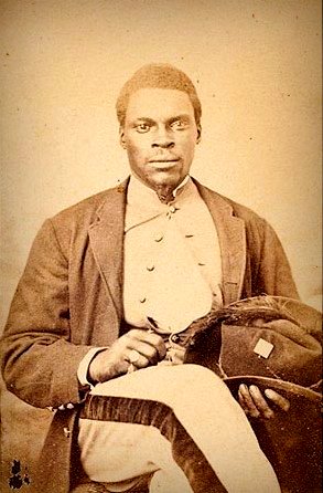
Storer College, established in 1867 to educate formerly enslaved people, became one of the nation’s early institutions of higher education for African Americans. The school operated for nearly 90 years.
In 1906, Storer College hosted the second meeting of the Niagara Movement, a civil-rights organization led in part by W.E.B. Du Bois that helped lay the groundwork for the NAACP.
The college closed in 1955, but several of its buildings still stand within Harpers Ferry National Historical Park.
Lower Town and historic architecture
Lower Town occupies the narrow strip of land where the Potomac and Shenandoah rivers meet. Its dense collection of historic buildings, steep streets, stone walls, railroad structures, and surrounding cliffs creates one of West Virginia’s most distinctive townscapes.
The National Park Service maintains many buildings, which house museums, exhibits, shops, or interpretive spaces. Above Lower Town, residential streets climb the hillside toward Bolivar, preserving additional examples of 19th- and early-20th-century architecture.
The dramatic terrain is integral to the community’s character. Buildings appear to rise in tiers above the rivers, while stairways and footpaths connect streets at different elevations.
Geography
Harpers Ferry is in eastern Jefferson County, where the Shenandoah River enters the Potomac.
The rivers cut through the Blue Ridge here, forming the Potomac Water Gap. Maryland lies immediately across the Potomac, while Virginia begins across the Shenandoah.
This three-state setting places Harpers Ferry within easy reach of Washington, D.C., Baltimore, and communities throughout northern Virginia and central Maryland.
The surrounding terrain is rugged. Maryland Heights rises north of the Potomac, Loudoun Heights rises south of the Shenandoah, and the historic town sits on steep ground between the rivers.
Harpers Ferry and Bolivar
Harpers Ferry adjoins the incorporated town of Bolivar, which sits on higher ground immediately west of the historic community.
To visitors, the two towns can appear almost continuous, but they are separate municipalities. Bolivar has residential neighborhoods, businesses, lodging, and services many visitors to Harpers Ferry use.
Nearby attractions
Harpers Ferry’s location makes it a convenient base for exploring the Eastern Panhandle and the surrounding Potomac and Shenandoah valleys.
Charles Town, the Jefferson County seat, lies a short drive southwest and features historic sites linked to the Washington family and John Brown’s trial.
Shepherdstown, one of West Virginia’s oldest communities, lies north along the Potomac and is known for its historic district, Shepherd University, restaurants, shops, and proximity to the Antietam battlefield in Maryland.
Other nearby destinations include the Chesapeake and Ohio Canal, Antietam National Battlefield, wineries and farm markets in Jefferson County, and hiking areas throughout the Blue Ridge.
Lodging
Lodging in and around Harpers Ferry includes historic inns, bed-and-breakfasts, vacation rentals, hostels, cabins, and conventional hotels.
Additional accommodations are available in nearby Bolivar, Charles Town, Shepherdstown, and elsewhere in Jefferson County. Because Harpers Ferry is a popular weekend destination for visitors from the Washington and Baltimore metropolitan areas, lodging can fill quickly during fall foliage season and other busy weekends.
Explore: Harpers Ferry (WV) Hotels
Dining and shopping
Restaurants, cafés, and small shops cluster in and around the historic district and neighboring Bolivar.
Lower Town hosts businesses serving visitors exploring the national historical park, while additional dining options line Washington Street and appear in nearby communities.
Independent shops reflect the town’s strong tourism economy and historic character, offering gifts, books, outdoor gear, art, and locally produced goods.

Getting to Harpers Ferry
Harpers Ferry is accessible by highway and passenger rail. U.S. Route 340 is the main highway approach, connecting the community to Charles Town, Frederick, Maryland, and northern Virginia.
The town also retains passenger-rail service, an unusual advantage among West Virginia tourism destinations. MARC commuter trains and Amtrak’s Capitol Limited serve the historic Harpers Ferry station, providing rail connections to Washington, D.C., and other destinations.
Visitors arriving by automobile should be aware that parking in Lower Town is limited. The National Park Service operates a visitor center and parking area outside the historic district, with shuttle transportation into Lower Town.
Frequently asked questions about Harpers Ferry
What is Harpers Ferry, West Virginia, famous for?
Harpers Ferry is best known for abolitionist John Brown’s 1859 raid on the federal armory, its importance during the Civil War, Harpers Ferry National Historical Park, and its location at the confluence of the Potomac and Shenandoah rivers.
Is Harpers Ferry worth visiting?
Harpers Ferry combines nationally significant history with one of West Virginia’s most dramatic natural settings. Visitors can explore museums and historic buildings, hike the Appalachian Trail and Maryland Heights, visit John Brown’s Fort and Jefferson Rock, and walk along the Potomac and Shenandoah rivers.
Is Harpers Ferry on the Appalachian Trail?
Yes. The Appalachian Trail passes directly through Harpers Ferry and crosses the Potomac River into Maryland. The town is traditionally regarded as the trail’s psychological midpoint.
Where do the Potomac and Shenandoah rivers meet?
The Shenandoah River flows into the Potomac at Harpers Ferry. Their confluence lies below the historic Lower Town at the opening of the Potomac Water Gap through the Blue Ridge.
How far is Harpers Ferry from Washington, D.C.?
Harpers Ferry is approximately 60 miles northwest of Washington, D.C., making it a popular day-trip and weekend destination from the capital region.
What county is Harpers Ferry in?
Harpers Ferry is located in Jefferson County in the Eastern Panhandle of West Virginia.
Where should visitors park at Harpers Ferry?
Parking in historic Lower Town is limited. For most visitors to Harpers Ferry National Historical Park, the main National Park Service visitor center and parking area provides the most convenient option, with shuttle transportation connecting the parking area with Lower Town.
Why is it called Harpers Ferry?
The community was named for Robert Harper, who established and operated a ferry across the Potomac River here during the 18th century. The settlement that developed around the crossing became known as Harpers Ferry.
Map of Harpers Ferry, West Virginia
Regional Information
Harpers Ferry is located in the Eastern Panhandle Region in eastern West Virginia.