
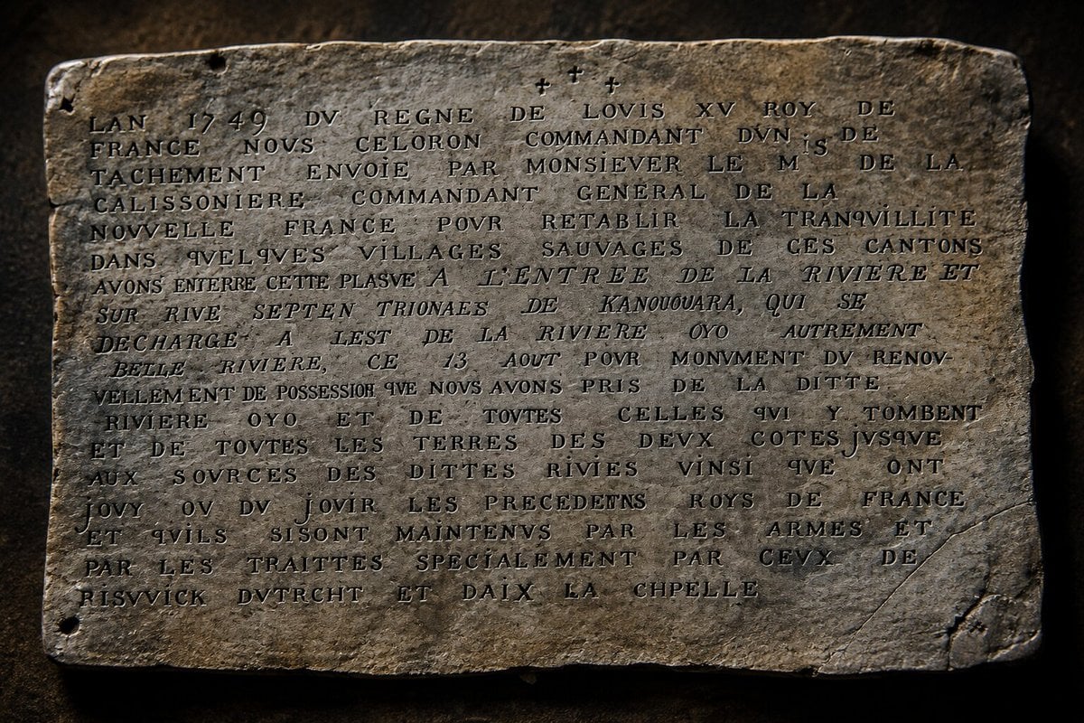
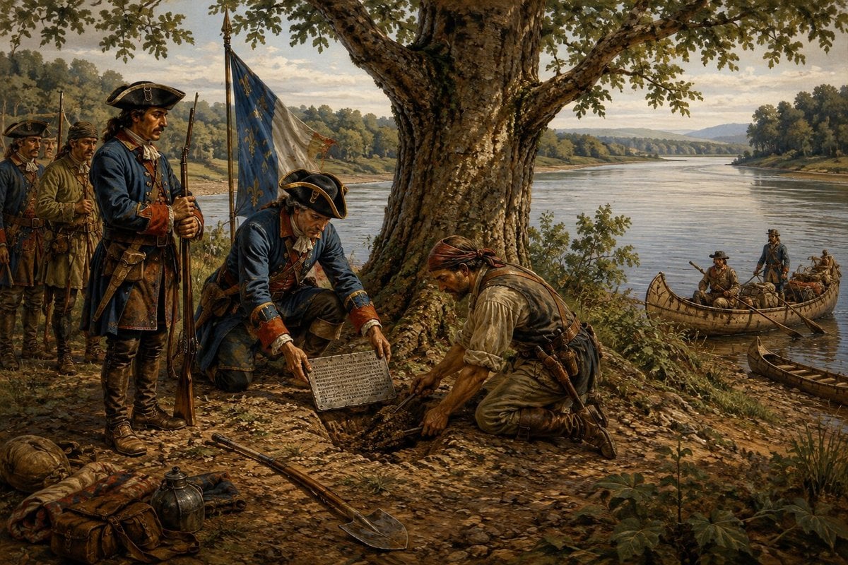
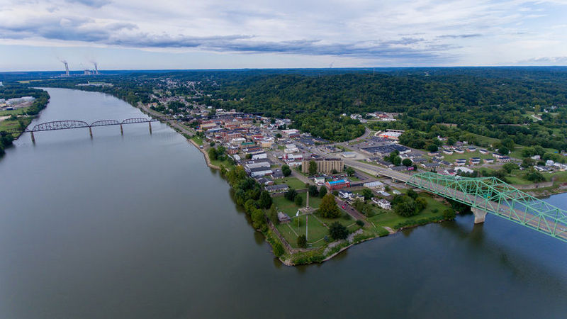
POINT PLEASANT, W.Va. — On Aug. 18, 1749, French soldiers stopped at the mouth of the Kanawha River in present-day Point Pleasant and buried a lead plate beneath an elm tree—a declaration of ownership in a territorial struggle that, within five years, would draw a young George Washington into combat and help ignite a war fought around the world.
The plate bore an extraordinary claim. In the name of King Louis XV, France asserted possession of the Ohio River, the rivers flowing into it, and the lands extending toward their headwaters—an enormous territory that included much of what would eventually become West Virginia.
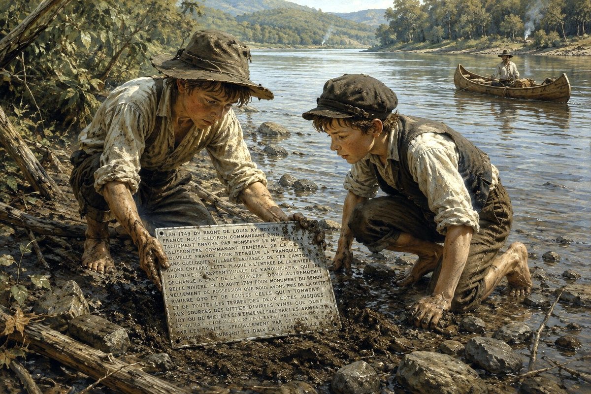
Nearly a century later, the plate reappeared. According to a West Virginia historian who later contacted its discoverers, boys searching the Point Pleasant riverbank for stones to use as fishing sinkers spotted it protruding among the exposed roots of an old elm.
The artifact eventually made its way to Richmond, where it remains today in the collection of the Virginia Museum of History & Culture. The museum regards the Céloron plate as an important surviving artifact of the struggle for the Ohio Country and has featured it alongside a 1754 letter from Washington concerning the escalating confrontation with France.
The story connects present-day West Virginia to the struggle among France, Great Britain, and Native nations for control of the Ohio Valley, to the beginning of Washington’s military career, and ultimately to a war that altered the balance of power around the world.
It also leaves an unresolved West Virginia mystery: Another plate was buried five days earlier at Wheeling, and its fate remains unknown.
France stakes its claim to the Ohio Valley
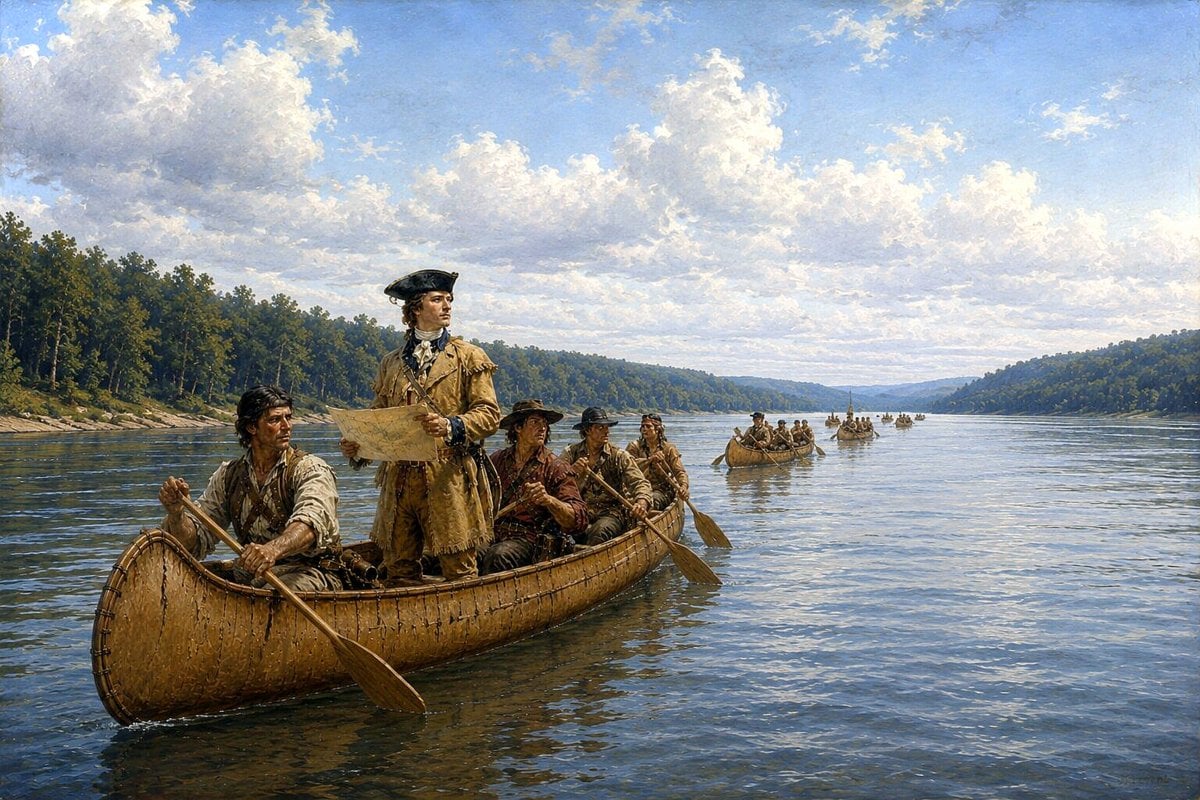
Céloron was not simply exploring the Ohio. The governor general of New France sent Capt. Pierre-Joseph Céloron de Blainville into the Ohio Country in 1749 at the head of a substantial expedition intended to reinforce France’s claim to the region and counter growing British trade and influence.
France regarded the Ohio River and its watershed as part of New France. Virginia, relying in part on the expansive language of its colonial charter, claimed much of the same territory. British traders were moving west across the Appalachian Mountains and establishing increasingly important commercial relationships with Native communities.

The French response was both diplomatic and unmistakably imperial. Céloron carried lead plates bearing declarations of French sovereignty, and at significant tributaries of the Ohio, his men buried the plates and attached the royal arms of France to nearby trees. Six plates were deposited during the expedition.
The surviving Point Pleasant plate declared that France had taken possession of the Ohio, the rivers flowing into it, and lands on both sides extending as far as their sources. Read literally, the claim encompassed an enormous territory.
The plates, however, should not be mistaken for evidence that France actually controlled all that land. The Ohio Country was not an empty wilderness waiting for France and Britain to divide it.
Shawnee, Seneca, and other Native peoples exercised political and economic power throughout the region, and their alliances and trading relationships were critical to both European powers. Virginia Museum educational material likewise describes the western lands into which British colonists were expanding as contested not only by France and Britain but also by Native nations.
Celoron’s expedition itself demonstrated the weakness beneath France’s sweeping declaration. British traders were already operating in the region, and France was trying to counter their influence. The lead plates therefore represented something more complicated than possession: They were declarations of sovereignty planted in a country where sovereignty itself was bitterly disputed.
A French claim is buried at Wheeling
Céloron entered what is now West Virginia before reaching Point Pleasant. On Aug. 13, his expedition stopped at the mouth of Wheeling Creek, where the third of the six plates was buried. Historical accounts of the expedition place the plate near the mouth of the creek, an area now within the city of Wheeling.

From there, Céloron continued downstream, depositing another plate near the mouth of the Muskingum River before the expedition reached the Great Kanawha. On Aug. 18, Céloron stopped at the confluence of the Kanawha and Ohio.

The inscription on the plate buried there identifies the Kanawha by a French rendering of its Native name and describes the Ohio as the “Beautiful River.” It records the date—Aug. 18, 1749—and declares the burial a monument to France’s renewed possession of the Ohio watershed.
The ceremony was simple but symbolically immense. A lead declaration went into the earth, while the arms of the French king were attached to a nearby tree. France had proclaimed its ownership, but the proclamation did not make the dispute go away.
The struggle that brought George Washington west
Over the next several years, competition for the Ohio Country became increasingly dangerous. In 1748, prominent Virginians had organized the Ohio Company, hoping both to strengthen Virginia’s western claims and profit from western land. Meanwhile, France moved to reinforce its own position in the region.

In December 1753, Virginia Lt. Gov. Robert Dinwiddie sent 21-year-old George Washington into the Ohio Country to tell the French to leave. The French refused. The following year, Dinwiddie sent Washington west again, this time as a lieutenant colonel authorized to use force.
In May 1754, Washington’s force encountered a small French detachment in what is now southwestern Pennsylvania. French officer Joseph Coulon de Jumonville was killed, and the confrontation escalated rapidly. The fighting became the North American conflict known as the French and Indian War and widened into the Seven Years’ War, drawing major powers into fighting across several parts of the world.
The Point Pleasant plate did not, by itself, cause that war. The causes were far larger—competing imperial claims, Native diplomacy and alliances, international rivalry, commerce and the growing struggle over western lands. But the sheet of lead buried at Point Pleasant was a physical expression of the territorial dispute at the heart of the coming conflict.
Washington would return to the Ohio Valley in 1770, traveling down the Ohio and up the Great Kanawha while examining western lands and recording the country in his journal.

Only five years separated Céloron’s assertion of French sovereignty at the Great Kanawha from Washington’s first combat against French forces, and France would ultimately lose most of its mainland North American empire.
Boys looking for fishing sinkers find a piece of an empire
For nearly a century, the Point Pleasant plate disappeared from recorded history. Then the river apparently revealed it.
One of the most detailed accounts of its rediscovery was written by Delta A. McCulloch of Point Pleasant, whose history of the plate was published in the Pocahontas Times in 1924. McCulloch had become interested in the artifact while serving as historian of the Col. Charles Lewis Chapter beginning in 1905.
After efforts to locate it through inquiries elsewhere, she did something particularly valuable to later historians: She tracked down the men who had found the plate as boys and asked them what happened.
Their story could hardly have begun more ordinarily. The boys told McCulloch they had gone looking for two small stones to use as sinkers on their fishing lines. Along the riverbank, they noticed something protruding from the tangled roots of an old elm where the current had swept away the surrounding soil. It was the plate.
The detail is remarkable because the surviving accounts of Céloron’s expedition describe the French depositing their territorial markers at trees along the river. The boys carried the object to James Beale, according to McCulloch, and accompanied him to a small brick schoolhouse on the Kanawha riverfront.
There, she wrote, a teacher was able to read enough of the inscription to recognize its historical significance. A piece of France’s vanished North American empire had returned to daylight.
McCulloch traced the artifact eventually to James M. Laidley and the Virginia Historical Society in Richmond, predecessor of today’s Virginia Museum of History & Culture.
Was the plate found in 1846 or 1849?
Historical accounts have sometimes disagreed over when the Point Pleasant plate was discovered, with both 1846 and 1849 associated with its early history. The available evidence strongly supports 1846 as the discovery date.
McCulloch wrote that notice of the plate appeared in a Parkersburg newspaper in April 1846 and then in the May issue of The Olden Time, published in Pittsburgh. That contemporary publication history makes an 1849 discovery impossible.
The later date appears to be associated instead with the artifact’s movement into the Virginia Historical Society collection. The Virginia Museum of History & Culture catalogs the plate as 1849.1, while McCulloch’s later reconstruction identifies Laidley as the person through whom the artifact reached Richmond.
The available evidence therefore supports 1846 as the year the plate emerged at Point Pleasant, while 1849 appears to mark its arrival in the Virginia Historical Society’s collection.
At the time, there was nothing geographically unusual about sending it to Richmond. Point Pleasant was in Virginia; West Virginia would not exist as a separate state until 1863.
West Virginians wanted their plate back
After West Virginia achieved statehood, however, the location of the artifact took on a different meaning. By the early 20th century, McCulloch was openly arguing that the plate belonged in West Virginia.
She regarded the object not simply as an artifact of Virginia’s colonial past but as a relic found at Point Pleasant that had been sent to Richmond when present-day West Virginia was still part of Virginia and had no separate state historical institution to receive it. “If Virginia thus values it, how should West Virginia regard it?” she asked.
McCulloch emphasized that the plate had been found not at Jamestown or Williamsburg or along the James River, but at the mouth of West Virginia’s Great Kanawha. She expressed appreciation for the care Virginia had given the artifact but hoped the neighboring state would someday return it for what she called its “long delayed homecoming” to West Virginia.
More than a century after she wrote those words, the plate remains in Richmond. Evidence has not emerged showing that the West Virginia government formally demanded its return, so McCulloch’s appeal should not be confused with an official interstate dispute. But her account establishes that the question of where the plate belonged was being raised in West Virginia by the early 20th century.
The artifact, meanwhile, has been treated as an important possession in Richmond. A Virginia Historical Society annual report from 2013 even listed a dedicated fundraising effort for “Protecting the Endangered Celeron Plate,” reflecting the conservation attention given to the centuries-old lead object.
Somewhere, perhaps, is another West Virginia plate
The Point Pleasant plate survived, but the fate of the plate buried at Wheeling is far less certain. McCulloch wrote in 1924 that the Wheeling plate had never been found. She placed its burial on the north bank of Wheeling Creek at its mouth and repeated speculation that changes to the riverfront or the Ohio itself might have carried it away or concealed it.
Other histories likewise record Céloron’s Aug. 13, 1749, burial of a plate at Wheeling Creek. Mike Mangus of Ohio State University’s Department of History told Cincinnati public radio station WVXU in 2024 that he was not aware of any organized academic effort to locate the remaining plates. Mangus said the changing courses and flood histories of the rivers make their modern locations difficult to predict.
Whether the Wheeling plate remains buried somewhere beneath the modern riverfront, was uncovered without being recognized, was swept into the Ohio, or disappeared through some other means is unknown. That leaves West Virginia with an unusual pair of artifacts from the same expedition: One disappeared for almost a century, emerged from the riverbank at Point Pleasant and now survives in Richmond; the other vanished at Wheeling and has never returned.
A claim that outlived the empire that made it
There is an irony in the survival of the Point Pleasant plate. Céloron buried it to proclaim French authority over the Ohio Valley, but within 14 years, the empire whose king was named on its face had lost its claim to the region.
France’s defeat in the Seven Years’ War transformed the political map of North America, although Britain’s victory did not settle Native sovereignty or end conflict over western expansion. The plate remained.
Long after Louis XV’s claim to the Ohio Valley had failed, long after New France disappeared and long after Virginia itself was divided to create West Virginia, the declaration Céloron buried at Point Pleasant survived.
On Aug. 18, 1749, France buried a claim to an empire beneath an elm at the mouth of the Great Kanawha. The empire disappeared. The plate did not.
I wish someone in Richmond might help to get the plate returned to where it belongs.That is history about Wv.and needs to come home.Love these articles!
Well what the heck did the plate say please Word for word
Great article I have never read anything about these plates before .
I grew up in the Ohio Valley and have always been interested in the Celeron plates. I now live in Virginia about 2 hours from Richmond. I made a trip to the museum there hoping to actually see the plate. There is a wonderful print of it on display and a message it was under restoration. This would have been about 2015. Has anyone inquired about the restoration process or when it is to be completed?
New Information for me!! Really enjoy finding out about West Virginia.
Thanks.
To further clarify, the Col. Charles Lewis Chapter referenced in the article is a chapter of the National Society of the Daughters of the American Revolution.