


Lost West Virginia saltworks are known to only a few adventurers
MERCER SALT WORKS, W.Va. — The legend of the lost Mercer Saltworks near the New River in West Virginia may be remembered now by only a few locals and adventurers, and its ruins may be known to even fewer.
Accessible by a rough trail, it was once among the most important landmarks in the valley upstream of the New River Gorge. First, no more than a salt lick on what’s now known as Lick Creek, the site was much visited by Native Americans, who passed their knowledge on to settlers.
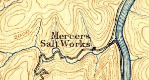
An 1890 topographic map shows Mercer’s Saltworks near the New River, then in Mercer County.
It was developed commercially in the 1840s but was destroyed by the U.S. Army during the Civil War. Though rebuilt, it fell out of use soon after when the supply of timber needed to heat and evaporate the brine was exhausted.
Its present isolation, though, came later—in the 1930s, when the New River was dammed to create Bluestone Lake. Until then, the valley had been a busy place, home to wilderness plantations known for their corn and roads traveling either side of the river.
After the river was dammed, however, and the valley upstream came under the control of the Army Corps of Engineers, plantations and landmarks such as the salt works were abandoned and forgotten.
Eric Jones, project director for Bluestone Lake, says that, as far as he knows, few people even know about the ruins, which now include the remnants of a chimney and scattered foundation stones.
“I rarely hear anyone ask about the saltworks, and I haven’t been back in there for years,” Jones said.
Perhaps one of the most concise descriptions of the operation was recorded in the West Virginia Heritage Encyclopedia under the heading “SALT MANUFACTURING (Mercer County)” and follows here:
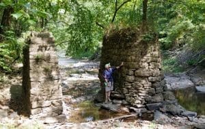
Justyn Marchese studies two stone piers at the mouth of Lick Creek near the New River.
“Shawnee Indians, who hunted in what is now Mercer County, West Virginia, knew from time immemorial that there was a salt spring about 15 miles north of the present Virginia-West Virginia state line—about a quarter of a mile north of Lick Creek where it empties into New River.
“Later, the deposits of salt were discovered by white men, and in 1849 a Staunton, Virginia, company began to investigate the possibility of commercially exploiting them. Charles Clark, a native of Kanawha County, was hired as a prospector by Kinney Eskridge and Co., of Staunton, that year.
“After concluding his investigations in Mercer County, he returned to Staunton, where he reported favorably on the possibility of establishing a salt works. He was provided with funds and sent to Cincinnati to purchase equipment for boring the well.
“In September 1849, the well was completed, and saltwater was found in sufficient quantity at 600 feet to produce 50 bushels of salt a day. The well was extended to 800 feet, and a plant for making the salt was erected.
“The first salt was made in the spring of 1850 and was continuously in operation until 1861 when the operation was destroyed by Union partisans.
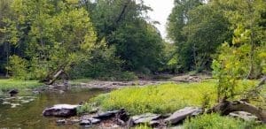
Lick Creek empties into the New River in a shoal area, an ideal picnic spot for hikers who have made the trek. Beware of river currents on the New.
“In 1862, Clark and William Crump rebuilt the plant, and it operated until 1866 when it was closed down because fuel was no longer available. By this time, richer brine sources had been found in Michigan, Ohio, and New York, as well as in the Kanawha Valley, where gas was available for fuel. The stands of timber in the vicinity of the Mercer works had all been burned to evaporate the brine and the cost of transporting firewood made it impossible to compete with the Kanawha operations.
“The salt produced in Mercer County was of a fine texture, slightly blueish in color. It took about 45 gallons of brine from one of the wells to make a bushel of salt weighing 56 pounds. The brine was brought to the surface by the use of steam, which was piped through a casing into the well. The steam pressure forced the brine up, where it was diverted to the salt vats. The saltwater was evaporated in pans four feet wide, eight feet long, and 18 inches deep placed side-by-side over a stone furnace, in which a wood fire burned continuously. A 35-foot stack carried off the smoke.”
Though the ruins are located on public property—owned by the Army Corps and leased by the state as part of the Bluestone Wildlife Management Area—access is not easy without a four-wheel drive. Saltwells Road is muddy and rutted and fords Lick Creek in three places, so the drive may best be delayed until dry weather, and even then can be practically impassable.
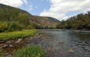
New River (Photo: Justyn Marchese)
However, the mile-long road to the ruins makes for a great hike, and there are plenty of water features along the way, including waterfalls and fords, which are ideal for wading around in during low water, so be prepared to get wet. And if you’re willing to walk that far, you might as well walk a mile farther to the New River, where there’s a delightful picnic spot.
The head entrance to Saltwell Road is a drive of about 30 minutes from W.Va. Route 20 near the main entrance to Pipestem Resort State Park. From W.Va. 20 at Indian Ridge Road, follow Indian Ridge Road (CR 25) approximately five miles to a right turn at Butler Scales and onto Lick Creek Road (CR 26/2) for 2.5 miles to Lick Creek and the junction of Dry Fork Run. Proceed straight approximately .8 miles to a left turn onto a gravel road in a pasture (Saltwells Road, currently unmarked). You’ll be able to park in the field before the first ford less than 100 feet ahead.
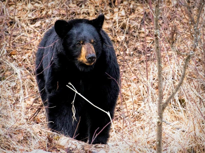
As the road wanders through a wildlife management area, use caution during hunting season. As well as the deer that frequent the area around the lick, bear also browse in the area, so familiarize yourself with bear precautions.
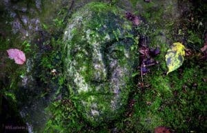
An enigmatic stone face carved into mossy sandstone is attracting visitors to the New River Gorge.
Mysterious stone face attracts curious in New River Gorge
An enigmatic stone face carved into mossy sandstone along the rim of the New River Gorge is attracting increased attention as hiking, biking, and climbing in the region grows. Though its origins are popularly regarded as a mystery, the bas-relief countenance was likely carved in the 1950s. Read the story here.
For more stories like this, sign up to receive a FREE copy of West Virginia Explorer Magazine in your email twice weekly. Sign me up!
Nightfall’s Value: Light pollution can diminish real estate worth in W.Va.
WINFIELD, W.Va. — An increasing number of new West Virginia residents are being drawn to its rolling hills and quiet valleys to escape brightly lit...
Inside Appalachian Escapes: Themed rentals, escape rooms, and a love letter to West Virginia
FAYETTEVILLE, W.Va. — What began as a search for an affordable retirement option has turned into one of southern West Virginia’s most imaginative...
West Virginia bottler wins silver award at international water competition
BERKELEY SPRINGS, W.Va. — Le Sage Natural Water, of Lesage, has been awarded a silver medal for its purified water at the 36th annual Berkeley...
West Virginia uniquely prepared to dominate 21st-century outdoor economy
CHARLESTON, W.Va. — West Virginia is uniquely prepared to dominate in the 21st-century outdoor economy of the U.S., thanks to its unmatched...
Flood risk outpaces warnings, advocates say, as W.Va. considers changes to resiliency fund
CHARLESTON, W.Va. — As the W.Va. House of Delegates considers changes to Senate Bill 390, the West Virginia Rivers Coalition warns that the state...
We asked AI how its own data centers could pollute West Virginia. Here’s what it had to say
(The following article was generated partly by ChatGPT in response to a prompt about how data centers pollute. As ChatGPT is powered by data...
Inaugural W.Va. Outdoor Economy Summit to unite leaders around $2.1 billion growth
CHARLESTON, W.Va. — West Virginia’s outdoors are more than a scenic backdrop. They’re a strategic economic asset. That message will take...
West Virginia State Parks Foundation launches online merchandise store
HURRICANE, W.Va. — The West Virginia State Parks Foundation has launched an official online merchandise store, offering supporters a new way to...
West Virginia Travel Safety: What it means for residents and visitors in 2026
CHARLESTON, W.Va. — Travel safety in West Virginia is shaped less by headline-grabbing crime and more by geography, weather, and the realities of...
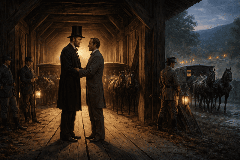
Did Abraham Lincoln and Jefferson Davis secretly meet in West Virginia?
PHILIPPI, W.Va. — Did Abraham Lincoln and Jefferson Davis secretly meet in what is now West Virginia just days after the first land battle of the...