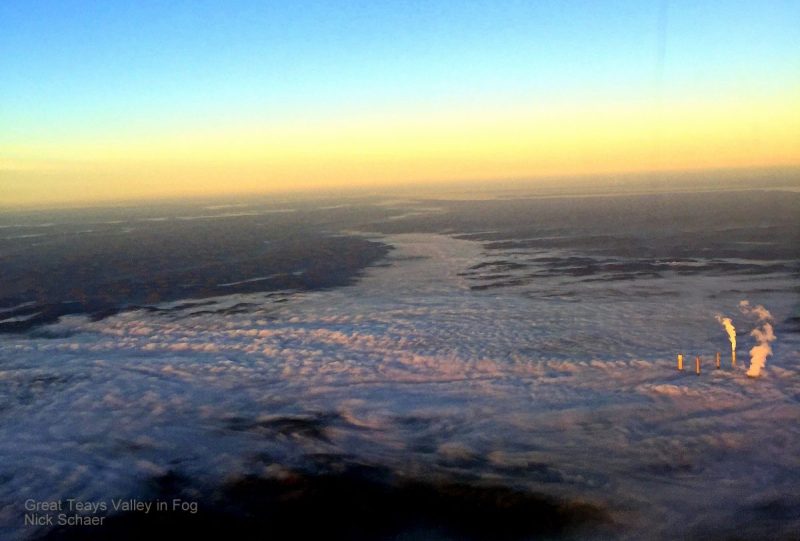
Though outwardly unremarkable, the Teays Valley of western West Virginia, for which the community of Teays Valley, West Virginia is named, is one of the most curious landforms in the eastern U.S. — a riverless valley, a remnant of the ancient Teays River, one of the oldest river systems in the world. The New River and upper Kanawha River are also a part of this ancient system.
The valley had long been a part of the east-west passage across the central Appalachian Mountains between the Atlantic seaboard and the valley of the Ohio River. Bison routes and native American trails made use of its relatively gentle character. The Old State Road, established by the Commonwealth of Virginia in 1800, and the James River & Kanawha Turnpike, established by the commonwealth in the 1830s, also followed its course. The Chesapeake & Ohio Railway was completed through in the 1870s. In the early 1900s, highway US-60, also known as the Midland Trail, opened through the valley, accommodating cross-country automotive traffic. In the 1960s, Interstate 64 was built along the same route as its predecessors.
Geologic history of the Teays Valley
Geologist William G. Tight established the geologic history of the valley, the origins of which were long undiscovered. Though it had been part of one of the most important passages across central Appalachia, few had thoroughly investigated its origin. Tight discovered that the valley had been created by an ancient river that coursed northwestward across Appalachia, much as the New and Kanawha rivers today.
Two million years ago, however, during a period of glaciation, ice dammed the Teays into a vast lake that filled much of the present Kanawha Valley and its tributaries. When the glaciers receded, the Teays changed its course. Rather than emptying into the Ohio River in the west near present-day Huntington, it emptied to the northwest near present-day Point Pleasant. Tight named the valley for the community of Teays, now known as Teays Valley.
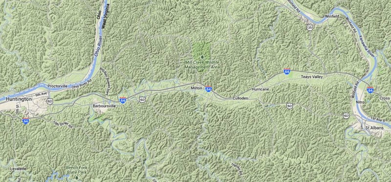
Though the ancient river no longer courses through the length of the valley, several smaller rivers and streams wander its bed. Scary Creek drains its easternmost reach, draining into the Kanawha River. Mill Creek, Popular Creek, and Hurricane Creek wander through parts of the eastern sections before draining northward through hills to the Kanawha. The Mud River and lower Guyandotte River course through the westernmost valley before emptying their mingled waters in the Ohio River.
Communities in the Teays Valley
The Teays Valley today is part of the Charleston and Huntington metropolitan areas. The two cities ostensibly anchor the valley at either end. Its relatively level character has accommodated residential and commercial development, and today the valley is part of one of the largest growing population areas in West Virginia, the Metro Valley Region. From west to east, the valley is part of eastern Cabell County, southern Putnam County, and western Kanawha County. From west to east, the following communities are located within the valley —
- Pea Ridge, West Virginia
- Barboursville, West Virginia
- Ona, West Virginia
- Milton, West Virginia
- Culloden, West Virginia
- Hurricane, West Virginia
- Teays, West Virginia
- Teays Valley, West Virginia
- Scott Depot, West Virginia
Map showing the Teays Valley
More information on the Teays Valley
- Geologic History of the Teays Valley in West Virginia