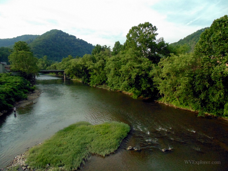
The 166-mile Guyandotte River is a tributary of the Ohio River that drains part of the Allegheny and Cumberland regions of southwestern West Virginia. The river forms in Raleigh County, southwest of Beckley, West Virginia, at the junction of Winding Gulf Creek and Devils Fork. From the Raleigh County boundary, it flows westward across Wyoming County before turning north and descending slowly across Mingo County, Logan County, Lincoln County, and Cabell County. It enters the Ohio River at Guyandotte, near Huntington, West Virginia.

The river is impounded as R.D. Bailey Lake, the centerpiece of the R.D. Bailey Lake Wildlife Management Area, near the midpoint in its course. The Elk Creek Wildlife Management Area, Horse Creek Lake Wildlife Management Area, and Chief Logan State Park also protect land along the river and its tributaries. The Mud River, which joins the Guyandotte at Barboursville, WV, is its most significant tributary.
History of the Guyandotte River
Though an important waterway, the Guyandotte was never practically navigable. In 1848, the Guyandotte Navigation Company was established to construct locks and dams on the stream, facilitating the harvesting of the region’s abundant timber and coal resources. However, the dams were poorly crafted, and a flood routed the project in 1861. In 1980, the U.S. Army Corps of Engineers established a flood control dam upstream of Gilbert, creating R.D. Bailey Lake. (Read: Guyandotte: Little-known river with a lesser-known past)
Guyandotte River Communities
From source to mouth, the following select cities, towns, and villages are located on or near the Guyandotte River.
- Amigo, WV
- Mullens, WV
- Itmann, WV
- Pineville, WV
- Wyoming, WV
- Justice, WV
- Gilbert, WV
- Man, WV
- Logan, WV
- West Logan, WV
- Mitchell Heights, WV
- Chapmanville, WV
- Big Creek, WV
- Harts, WV
- Ranger, WV
- Midkiff, WV
- Branchland, WV
- West Hamlin, WV
- Salt Rock, WV
- Barboursville, WV
- Pea Ridge, WV
- Guyandotte, WV
Name Origin
Some sources claim that an unidentified native tribe called the Guyandotte River the “Se-co-nee,” which meant “the narrow-bottom river.” The origin of the present name is likely related to the Native American culture group known as the Huron or Wyandot, who referred to themselves as the “Wendat,” meaning “island people” or “dwellers on a peninsula.” European settlers often spelled the name “Guyandot.”
Fishing the Guyandotte River
Fishing on the Guyandotte River offers anglers a rich and rewarding experience, thanks to its impressive variety of species and well-maintained access points. Smallmouth bass are a popular catch, with many fish between 8 and 15 inches providing plenty of action without requiring extreme rapids.
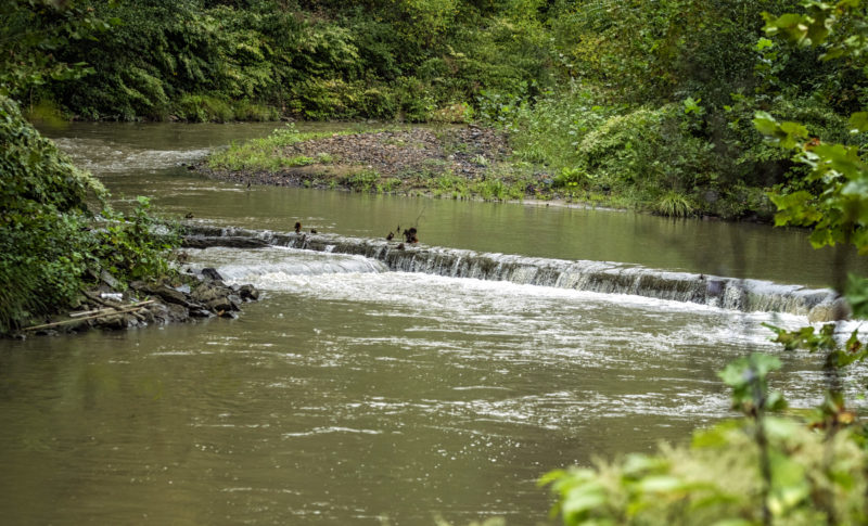
Anglers targeting spotted bass will find excellent opportunities, especially in the stretch from Pineville to R.D. Bailey Dam, where specimens exceeding five pounds have been reeled in, and plenty of 10–15 inch holes keep anglers consistently busy.
For those after larger game, channel catfish and hybrid striped bass also frequent the river, particularly in the lower, more navigable sections. Local fishing reports emphasize that simple baits—live worms for spotted bass, tube jigs or drop‑shot rigs for smallmouth—often work best.
The upper river has also developed into a thriving trout fishery, thanks to hatchery-supported stocking efforts in its upper reaches. Since 2021, rainbow trout have been regularly introduced into the stretch between Mullens and Pineville, adding a cold‑water dimension to the river’s warm‑water appeal.
State stocking ceremonies in late 2021 marked the beginning of this program, where officials released some 250 pounds of trout into the river and signaled plans for annual spring and fall stockings under a new trout management initiative Anglers here now enjoy opportunities to catch both stocked rainbows and wild brown or brook trout in the upper river—making the Guyandotte a year‑round destination for diverse fishing pursuits.
Variant Names
Arbuckles River, Big Laurel Fork, Guiandotte River, Guyan Dot River, Guyan Dott River, Guyan River, Guyandates Creek, Guyandot Creek, Guyandot River, Guyandott River, La-ke-we-ke-ton, Little Guiandot, Se-co-ne, Se-co-nee, Secone, Seconec
Regional Information
Information on lodging, dining, and recreation in and around the lower Guyandotte, downstream of West Hamlin, can be found in our guide to travel in the Metro Valley Region, located in western West Virginia. Information for the middle and upper river, upstream of West Hamlin, may be found in the Hatfields & McCoys Region, in southwestern West Virginia.