
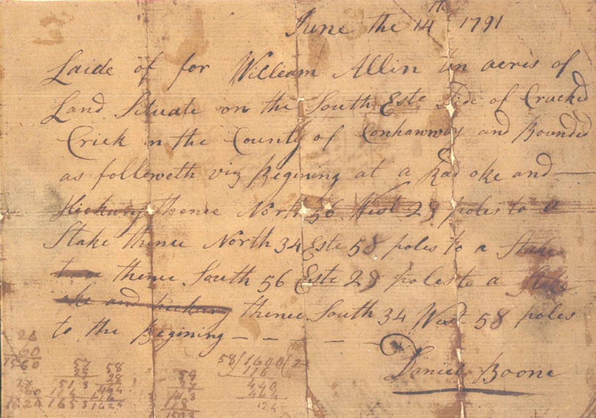
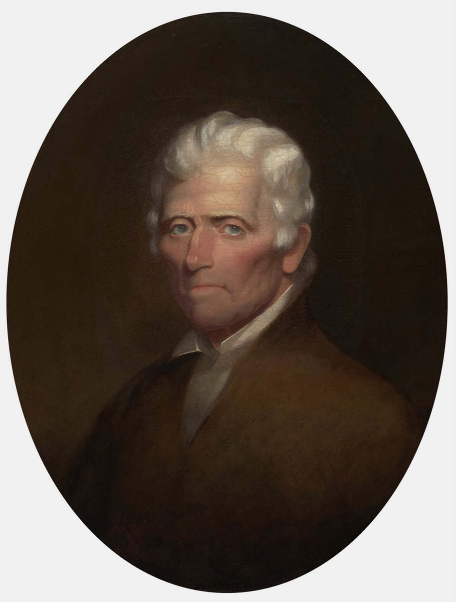
CHARLESTON, W.Va. — Daniel Boone is remembered as a great figure of the Kentucky frontier, but a surviving document in his own hand illuminates a lesser-known chapter of his life. The famed frontiersman spent years in what’s now West Virginia, where he surveyed land, served in the militia, and represented Kanawha County in the Virginia legislature.

In 1791, Boone surveyed ten acres for William Allin on Crooked Creek in what was then Kanawha County. On the faded sheet, he described a tract beginning at a red oak and hickory. He measured its boundaries in poles, and signed his name. He wrote that he had “Laide of for Willeam Allin ten acres of Land” on the southeast side of “Crucked Crick.”
Charleston physician and historian John P. Hale (1806–1873), who examined the original, noted that the spelling and capitalization were Boone’s own. The document places Boone at work in the Kanawha Valley during a period Hale said his early biographers had almost entirely overlooked.
Boone came to the Kanawha after Kentucky
The Kentucky adventures that made Boone famous occurred primarily in the 1760s, 1770s, and early 1780s. Hale places Boone in the region that became West Virginia by the middle of that decade.
According to Hale, a deed conveying Kentucky land was signed and acknowledged by Boone and his wife, Rebecca, at Point Pleasant on April 28, 1786. Another surviving letter places Boone elsewhere in Virginia in January 1788, while family records document a visit by Boone, Rebecca, and their son Nathan to relatives in Pennsylvania beginning the following month.
The evidence makes it difficult to pinpoint the exact start date of Boone’s West Virginia residency. Hale believed the family may have been living in the Kanawha region as early as 1786, while later histories generally place their move there closer to 1788.
By 1789, however, his connection to Kanawha County is clear. When the newly created county organized its first court and military establishment on Oct. 6, he was appointed lieutenant colonel of the county militia. In 1791, voters elected Boone and George Clendenin, the founder of Charleston, to represent Kanawha County in the Virginia General Assembly.
Hale wrote that Boone traveled from the Kanawha Valley to Richmond on foot, carrying his rifle and butcher knife over mountain paths that then connected the western settlements with eastern Virginia.
His home stood near present-day Charleston
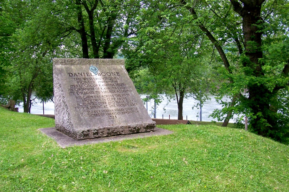
The Boones established a home on the south side of the Kanawha River above present-day Charleston near Kanawha City. Hale placed it about four miles from the Charleston of his day, approximately half a mile from an early salt spring. He described it as a double log house with two rooms separated by a passage and a front porch.
His ties to the valley extended beyond his residence. His son Jesse remained after his father departed, married Cloe Van Bibber, and, according to Hale, became the first salt inspector in Kanawha. Jesse’s son, Albert Gallatin Boone, was born at the Kanawha homestead and later became a western trapper, trader, and explorer.
Hale also consulted early assessment books to determine what Boone owned while living in Kanawha County. He reported that Boone was assessed for two horses, 500 acres of land, and one enslaved person, with the land remaining on the tax books in his name until 1803.
Boone continued hunting and trapping
Public service and surveying did not end Boone’s pursuits for which he was already famous. Hale arrived in the Kanawha Valley in 1840 and later collected recollections from people who had known the explorer or whose parents had known him, preserving stories still circulating among local families.
Among them was the Huddleston family’s account of Boone arriving one evening at their home carrying a rifle and pack. According to Jared Huddleston’s recollection of a story his father repeatedly told, Boone rose before the family the next morning to look for signs of game. He returned for breakfast after finding evidence of beaver nearby and asked whether the family owned a trap.
They had a steel trap intended for foxes, and Boone invited the younger Huddleston to accompany him and offered to show him how to catch beaver. Hale’s account says they caught five the first day and eventually took about a dozen from the colony.
Another account collected by Hale places Boone on Mill Creek in what is now Jackson County during a winter 1793-94 hunting and trapping expedition. John Warth reportedly remembered his father saying Boone was suffering badly from rheumatism, and Warth carried him across creeks to keep his feet dry while Boone tended the beaver traps.
Hale also recalled Paddy Huddleston telling him that he and Boone had trapped together and found more beaver on the Gauley River than on any other stream in the region. Although such stories were recorded decades after the events they describe, they preserve a local memory of Boone that extends well beyond the immediate Charleston area.
Read also: Five things you probably didn’t know about West Virginia’s famous Gauley River
Boone surveyed an enormous stretch of country
His intimate knowledge of the region also made him a valuable surveyor. Hale wrote that much of Boone’s time in the Kanawha Valley was devoted to locating and surveying property, and survey books frequently listed him as the “marker” on a party. In that role, he helped locate tracts, guided surveyors through the country, and marked lines through the forest.
The ten-acre Crooked Creek survey, preserved from 1791, was a small example of that work. In 1795, Boone participated in two adjoining surveys totaling more than 200,000 acres. Hale said they began near the site of present-day Madison and extended west across the waters of the Guyandotte, Twelvepole, and Big Sandy toward the Kentucky line.
Members of the surveying party carved their names and dates into beech trees along the route. A surveyor who later retraced the lines told Hale that some remained legible, including places where Boone had marked either his name or simply the initials “D.B.” The last local survey in which Hale found Boone’s participation was dated Sept. 8, 1798.
The surveying work captures a transition in Boone’s life and the region’s history. A man celebrated for exploring country beyond established settlements was now helping define property lines as settlement advanced westward.
His name became part of West Virginia
The explorer’s connection to the region remained important long after he left. When Virginia lawmakers created a new county from portions of Kanawha, Cabell, and Logan in 1847, Logan County delegate St. Clair Ballard proposed naming it Boone County and offered a personal reason.

According to an account of the legislative proceedings published in the Richmond Enquirer and later reproduced by Hale, Ballard said his mother had been captured during an attack in which her parents were killed. He told lawmakers that Boone pursued her captors, rescued her, and subsequently raised and educated her. Ballard asked that the new county bear his name, and the House unanimously agreed.
Hale identified the woman as Cloe Flinn and provided a much fuller account of the rescue. Because that expanded narrative was recorded long after the event, some of its details are difficult to verify. The 1847 legislative account is nevertheless significant because it shows that Ballard himself invoked his mother’s rescue when proposing Boone as the name of the new county.
Boone left the Kanawha for another frontier
No surviving record cited by Hale establishes the exact day Boone left the Kanawha Valley, but he was still surveying there on Sept. 8, 1798. Hale believed he probably remained through the following winter before leaving for Missouri in 1799.
The story of his departure survives as local tradition rather than contemporary documentation, yet it is among the most evocative accounts Hale preserved. He wrote that Boone’s friends and neighbors gathered from across the region to bid him farewell, arriving by land and water. He loaded his family and belongings into canoes and embarked at the junction of the Elk and Kanawha rivers—in what is now downtown Charleston.
The family went west again and spent the final decades in what is now Missouri, where he died Sept. 26, 1820, at the home of his youngest son, Nathan. His years in the Kanawha Valley fall between the two places most Americans associate with his later life—Kentucky and Missouri—but surviving records show they were far more than an interlude.
Boone lived here, represented Kanawha County, surveyed its land, and hunted its rivers. His family put down roots, and a West Virginia county ultimately took his name. More than two centuries later, one of the simplest pieces of evidence remains the faded survey dated June 14, 1791—ten acres beside Crooked Creek, beginning at a red oak and hickory, with Daniel Boone signed beneath it.
Thanks to David and your team for delivering positive stories about the Mountain State. I get so frustrated with state politicians and all the negative news coming from within the state, it’s nice to be reminded that good things are going on, and locals are making a meaningful difference in their communities.
There was a cave with Boone’s name carved into the rock. The state made an attempt to move the cave by cutting it out of the rock, when the interstate went through, but it didn’t work. I was very young at the time.
Thank you, Mr Toler, for a piece of Boone’s history!
What a wonderful story! I appreciate the history lesson, and the details that make it easy to read, rather than simply cold, hard facts. I love West Virginia history.
Great story, I have read about Boone at Point Pleasant but was unaware of his travels and home in the Charleston area.
I’ve known the name Daniel Boone since I was small. I am now 72 yrs old and am thrilled to read his name again. Back in my school days we were taught about the frontier men who explored and helped define the country.
I don’t believe our children are taught about these men anymore. I’m going to ask my 16 y.o. granddaughter if she knows of Boone. Then I will give her access to this article.
Ed Toler, thank you for a bit of history lost to time but saved by your memory!