


In 2014, without much fanfare, the National Park Service opened a new access point for two of the most remote trails within the New River Gorge National Park and Preserve. So far, only the most die-hard hikers seem to have noticed.
The Kates Plateau Trail and Polls Plateau Trail were once practically rumors. They appeared on park maps, but few people hiked them. I still haven't spoken with many park rangers who have hiked the Polls Plateau Trail, the more remote of the two. Why? Access!
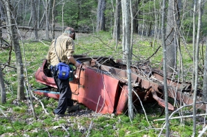
Until the access opened, most hikers would have been required to trek six miles over the park's Glade Creek Trail to reach the Kates Plateau Trail and then another five miles on that trail to reach the Polls Plateau Trail. Most of those miles are uphill, too, and some of them are steep. Whatever then awaited discovery on the trails, it was too distant for most people to attempt to reach. Hunters, in particular, knew the trails, but few others had ever seen them.
All that changed when the park service quietly completed an agreement with property owners and opened a tidy little access area with a gravel parking lot. The access had been opened before, but an agreement that accommodated the parking area had not been reached, as I understand it, and, so, the park service simply did not promote the access.
But what of the trails themselves? I had the opportunity to hike four miles of the Kates Branch Trail in preparation for this article, and I have much to report.
These trails are unlike any others in the park. In the first place, they haven't seen any of the foot traffic that other park trails have witnessed, and so staying on track could be difficult. I wouldn't recommend either of these trails to the newbie. Drifts of leaves and fallen trees sometimes obscure the trail, and though markers appear at trail junctions, the trails aren't blazed. I highly recommend using a good park service map or geologic survey map or employing a smartphone. I found it absolutely necessary to use the maps there to keep myself oriented.
The two trails are also unique in that they wander upland areas far from the steep terrain and cliff-walls for which park trails in the New River region are better known. The trails are long (both are 5.1 miles) but are not otherwise strenuous. In some cases, you'll be required to leap across puddles, but most of the trails are quite level and follow old logging roads with shallow grades. Historians may be particularly interested in the cuts and grades that remain as evidence of the logging industry that cleared the plateaus in the 1920s.
Here and there the remains of timbers used to support rails are in evidence, though if nothing else these trails embody solitude, and the memory of any industry here is difficult to sustain. The second-growth forest here is quite dense, though the Polls Plateau Trail crosses old farm fields and the remnants of long-forgotten homesteads.
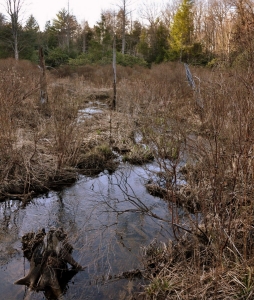
If I might recommend any must-see aspect of the trail network, it would be the wetland along the upper reach of Kates Branch, accessible along the southern section of the loop on the Kates Branch Trail. Though not a large wetland, it's notably the home of a rare species of orchid identified by botanist Osbra Eye. The orchid caused the route of Interstate 64 to be shifted south of the wetlands while it was being built in the 1980s.
Now that the trails are more accessible, I think they're likely to see more foot traffic, though I don't expect either to enjoy the popularity of other nearby trails such as those at Grandview and Sandstone Falls or at Little Beaver State Park.
I think the plateau trails are ideally suited for overnight hikes, and this spring, I intend to hike both trails and the Glade Creek trail as part of a single 16-mile trek.
Directions: The new trailhead is easy to find and only a mile-and-a-half from the Bragg exit (133) on I-64. From the exit, follow Plumley Mountain Road (CR-27) approximately one mile to a left turn onto Polls Branch Road. Follow the latter approximately one-half mile to the trailhead. The trailhead is a drive of approximately 40 minutes west of Lewisburg and 20 minutes east of Beckley.


