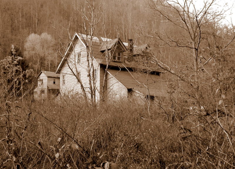
Bacontown, Battleship, Black Oak Bottom — though they no longer exist, these vanished communities are among nearly 300 towns that historian Carl Wolfe has cataloged in Raleigh County. And he’s asking past and present county residents to help find more.

Having witnessed the boom-and-bust economy of coal mining, Raleigh County, in southern West Virginia, is an ideal lab for such a study, Wolfe says.
“We can learn a lot about history by charting when and where people lived, and names of communities can reveal plenty about the intent of their founders and the needs of residents,” Wolfe said.
Many community names, such as Beckley or Bradley, are derived from surnames, established to honor a family or a person, in these cases John Beckley, father of the founder of Beckley, and General Omar Bradley, a hero who members of that community admired.
Others, such as Fireco and Besoco, were named by the mining companies that created them — in these cases, the Leckie Fire Creek Coal Co. and Beckley Smokeless Coal Co.
Others, such as Clifftop, Dry Hill, or Crab Orchard, describe their settings.
Wolfe’s work is being supported by the Raleigh County Historical Society, which annually aids, sponsors, and advocates for many historical initiatives being pursued across the county, including the recent relocation of Ferguson’s Rock and development of the Alfred Beckley Mill.
Wolfe has cataloged community names, the county districts in which they’re located, and their approximate locations and periods of existence, and he hopes to build on that registry with the help of the historical society.

Can you find a name that’s not listed here? Please let Wolfe know by emailing him at squawkbox@suddenlink.net.
1. Abney (1896-1953) – Town – 37°N 41’ 18 81°W 12’15, north of Coal City
2. Abraham (1907-1982) – Richmond – 37°N 47’25 80°W 57’17
3. Abronia (1903)
4. Admiralty – Trap Hill – 37°N 47’04 81°W 16’00, former name of Eccles
5. Affinity (1909-1957) – Town – 37°N 42’42 81°W 13’53
6. Allentown (1912) -Town – part of Eccles
7. Ameagle (1920-2004) – Clear Creek – 37°N 56’59 81°W 25’07
8. Amigo (1915-1945) – Slab Fork – 37°N 35’50 81°W 19’13
9. Arnett (1904-1956) – Marsh Fork – 37°N 50’00 81°W 25’48, formerly known as Vista
10. Artie (1903-1997) – Clear Creek – 37°N 55’57 81°W 21’35
11. Atkinsville (1900-1907) –Town – 37°N 46’14 81°N 10’00, name later changed to Sylvia
then East Beckley, now part of Beckley
12. Bacontown (Jonben) (1853) – Town – 37°N 39’20 81°W 11’33, 12 miles south on Piney
Creek
13. Battleship – Town – 37N 39’49 81W 11’29, west of Whitby
14. Baylor (1917-1935)
15. Beaver (1926+) – Shady Spring – 37°N 44’58 81°W 08’21, formerly known as Oxley then Glen Hedrick
16. Beckley (1839-1853, 1896+) – Town – 37°N 46’49 81°W 11’22, first called Beckley,
Fayette County, formerly Raleigh Court House
17. Beckley Junction – Town – 37°N 45’52 81°W 11’53
18. Beckley Slope – Town – 37°N 46’27 81°W 12’25, formerly Bickel and Wickham, now
part of Beckley
19. Bickel – Town – 37°N 46’27 81°W 12’25, formerly Beckley Slope and Wickham, now
part of Beckley
20. Besoco (1929-1964) – 37°N 37'44 81°W 14’17
21. Big Stick (1929) – Town – 37°N 41’33 81°W 16’04, Between McAlpin and Hotcoal
22. Birchton (1918-1958) – Marsh Fork – 37°N 55’58 81°W 32’28
23. Black Oak Bottom (on New River) (1853) – 22 miles southeast of Beckley
24. Blockston (1881-1906) – Town – 37°N 50’55 81°W 05’52, on New River, former name of McCreery
25. Blue Jay (1906+) – Shady Spring – 37°N 44’18 81°W 08’08, south of Beaver
26. Blue Jay 6 – Shady Spring – 37°N 30’54 81°W 06’36 – west of Cherry Creek
27. Bob (1902)
28. Bolt (1890+) – Trap Hill – 37W 45’44 84°°W 42’24, formerly named Drawbar and
Harvey.
29. Bone Lick (1933)
30. Bradley (1948+) – Town – 37°N 52’00 81°W 11’36, just south of the Fayette County line
31. Bragg – Richmond – 37°N 46’42 80°W 59’17
32. Breckenridge (1884-1889) – Trap Hill – 37°N 47’06 81°W 24’38, between Bolt and
Saxon
33. Briery Bottom (1853) – on New River, 26 miles east of Beckley
34. Brooklin (Brooklyn) (1889-1907) – Richmond – 37°N 40’29 81°W 53’46, near Hinton on New River
35. Bryson (1902-1923) –Trap Hill – 37°N 44’32 81°W 20’44, west of Lester, later known as Maple Meadow
36. Cabell (Cabell Bottom) – Town – 37°N 47’07 81°W 13’57, just west of Beckley near
Briarpatch Golf Club
37. Calloway Heights (1929) – Town – 37°N 47’41 81°W 10’46, just north of Beckley
38. Camp Floyd (near Sophia) (1853) – eight miles south of Beckley
39. Cedar (1900-1916) – Town – 37°N 44’15 81°W 12’42, southwest of Fitzpatrick on Piney Creek
40. Cherry Creek (1943-1945) – Shady Spring – 37°N 40’44 81°W 06’00, between Cool
Ridge and Shady Spring
41. Cinco (1919)
42. Circle View – Town – 27°N 47’42 81°W 15’04, southwest of Harper Heights
43. Cirtsville (1886-1927) – Town – 37°N 52’45 81°W 06’05
44. Citie (1904-1912) – Marsh Fork – 37°N 50’48 81°W 28’37, on Peachtree Creek, former
name of Pineknob
45. Clear Creek (1867+) – Clear Creek – 37°N 54’58 81°W 20’39
46. Clear Fork (1929)
47. Clifftop – Shady Spring – 37°N 45’16 81°W 07’18, north of Beaver
48. Coal City (1920+) – Town – 37°N 40’44 81°W 12’37, east of Sophia
49. Coal River Marshes (1856-1891) – Trap Hill – also known as Marshes and Marshes of
Coal
50. Coalgate (1891) – Shady Spring – 37°N 50’55 81°W 05’52 – On New River, Former name of McCreery
51. Coketon – Clear Creek – 37°N 56’41 81°W 26’16, Also Honaker?, Former name of
Colcord?
52. Colcord (1908-2002) – Clear Creek – 37°N 56’41 81°W 26’16
53. Cole (1892)
54. Cool Ridge (1922-1963) – Shady Spring – 37°N 39’29 81°W 05’45, Formerly Sink?
55. Cove Creek – Trap Hill – Near Saxon
56. Covey (1902-1907)
57. Crab Orchard (1911-1965) – Town – 37°N 44’30 81°W 13’45, Formerly Sutphin
58. Cranberry (1906-1997) – Town – 37°N 49’17 81°W 11’43
59. Crimson (1916)
60. Crow (1889-1929) – Shady Spring – 37°N 45’33 81°W 04’37
61. Dameron (1899-1903) – Trap Hill – 37°N 49’34 81°W 22’21
62. Daniels (1881+) – Shady Spring – 37°N 44’36 81°W 07’23, East of Beaver
63. Darlow (1910)
64. Delbert (1916) – Trap Hill – 37°N 49’24 81°W 29’21, Former name of Munition
65. Dillon (1913) – Richmond – 37°N 46’13 80°W 57’02, East of Bragg
66. Dorothy (1907+) – Clear Creek – 37°N 57’19 81°W 26’58
67. Drawbar – Trap Hill –– 37W 45’44 84°°W 42’24, former name of Bolt
68. Dry Creek (1884-1944) – Marsh Fork – 37°N 51’36 81°W 27’49
69. Dry Hill – Town -37°N 49’07 81°W 13’02, North of Tamarack, also known as James Crest Farms
70. Dugout (1901-1910)
71. East Beckley (1920-1940) – Town– 37N 46’14 81°°N 10’00, formerly Atkinsville and
Sylvia, now a part of Beckley
72. East Gulf (1915-1944) Town – 37°N 37’47 81°W 37’17’40
73. Eccles (1907+) – Trap Hill – 37°N 47’04 81°W 16’00, Formerly called Wittenburg and
Admiralty
74. Edwight (1920-1959) – Marsh Fork – 37°N 53’01 81°W 32’02, Mouth of Hazy Creek
75. Egeria (1897-1961) – Slab Fork – 37°N 32’32 81°W 12’00, SE of Amigo, 4 miles SE of
Malco on Raleigh/Mercer County line
76. Ekla (1915)
77. Ellison (1911) – Shady Spring – 37°N 04’26 81°W 04’26, Next to Crow
78. Embury (1905-1920)
79. Emerson (1912-1948) – Marsh Fork – 37°N 56’26 81°W 30’00 – East of Marfork
80. Epperly (1916-1948) – Town – 37°N 40’10 81°W 14’40, SW of Winding Gulf
81. Esau (1916)
82. Eunice (1920-1965) – Marsh Fork – 37N° 56’47 81°W 32’36, South of Pettus
83. Fairdale (1939+) – Trap Hill – 37°N 46’47 81°W 21’48 – just west of Glen Daniel
84. Fiddler’s Green (Maple Meadow) (1853) – 12 miles west of Beckley
85. Fireco (1916-1950) – Town – 37°N 38’34 81°W 11’52, South of Jonben
86. Fitzpatrick (1905-1934) – Town – 37°N 44’37 81°N 11’38, Fitzpatrick Park
87. Flat Top (1929) – 27N 35’21 81W 06’28, Just over the Raleigh County line in Mercer
County
88. Flats (1948) – Marsh Fork – 37°N 51’42 81°W 28’55, Between Naoma and Dry Creek
89. Fleesburg (1853) – near Marshes of Coal, 12 miles west of Beckley
90. Flower (1922)
91. Friendly View (1976) – Marsh Fork – 37°N 51’45 81°W 27’48, Between Dry Creek and
Rock Creek
92. Georgetown (near Marshes of Coal) (1853) – 12 miles west of Beckley
93. Ghent (1903+) – Shady Spring – 37°N 37’00 81°W 06’53
94. Glade Springs – Shady Spring – 37°N 43’06 81°W 04’20
95. Glen Daniel (1914+) – Trap Hill – 37°N 46’45 81°W 20’29 – used to be called Marshes of Coal and Trap Hill
96. Glen Hedrick (1926) – Shady Spring – 37°N 44’58 81°W 08’21, Formerly called Oxley,
Former name of Beaver
97. Glen Morgan (1901-2005) – Shady Spring – 37°N 45’22 81°N 09’29
98. Glen White (1909-2011) – Town – 37°N 43’51 81°W 16’53, East of Lester
99. Glenview – Town – 37°N 44’31 81°W 15’27 – NE of Glen White
100. Glomera (1884-1897)
101. Grandview (1889-1934) – Shady Spring – 37°N 49’31 81°W 04’08
102. Gulf (1909-1912) – Slab Fork – 37°N 39’58 81°W 18’23, Former name of Tams
103. Hamlet (1914-1935) – Town – 37°N 49’45 81°W 53’00, Mouth of Glade Creek,
formerly called Paw Paw and Krise
104. Hampton (1891-1906) Pumpkintown?
105. Harper (1903-1959) – Town – 37°N 47’54 81°W 15’40
106. Harper Heights (1929) – Town – 37°N 48’12 81°W 14’41, NW of Beckley
107. Harvey (1890-1893) – Trap Hill – – 37W 45’44 84°°W 42’24, former name of Bolt
108. Hazy (1924-1955) – Marsh Fork – 37°N 52’44 81°W 32’44, near Edwight on Hazy
Creek
109. Hecla (1907- 1910?) – Marsh Fork – 37°N 54’38 81°W 32’40, Between Stickney
and Montcoal
110. Helen (1899+) – Slab Fork – 37°N 38’10 81°W 18’50
111. Hollywood (1929-1942) – Town – 37°N 45’19 81°W 12’58, Former name of
MacArthur
112. Honaker (1894-1907) – Clear Creek – 37°N 56’41 81°W 26’16, Former name of
Colcord, also Coketon?
113. Hoohoo – Trap Hill – 37°N 44’33 81°W 18’ – Just north of Lester
114. Hot Coal (1909-1927) – Town – 37N 41’58 81°°W 14’10, East of Big Stick
115. Hotchkiss (1894-1958) – Slab Fork – 37°N 48’28 81°W 22’00 – on Raleigh-
Wyoming County line
116. James Crest Farms – Town -37°N 49’07 81°W 13’02, North of Tamarack, Also
known as Dry Hill
117. Jap (1906, 1911-1920?) – Marsh Fork
118. Jarrett’s Valley (1857)
119. Jarrolds Valley (1857-1921) – Clear Fork
120. Jenny Gap – 37°N 42’56 81°W 19’46, 5 miles north of Slab Fork
121. Johnstown – Town – 37°N 47’00 81°W 10’11, Corner of N. Vance Drive and
Marshall St. in Beckley
122. Jonben (1921-1960) – Town – 37°N 39’20 81°W 11’33, formerly known as
Bacontown, 12 miles south on Piney Creek
123. Josephine (1946-1963) – Slab Fork – 37°N 37’12 81°W 13’21, 1 mile east of
Besoco
124. Jupiter (1884)
125. Killarney (1917-1956) – Slab Fork – 37°N 37’54 81°W 17’33
126. Klemeth (1924-1926)
127. Krise – Town – 37°N 49’45 81°W 53’00 former name of Hamlet on Glade Creek
128. Lanark (1901-2005) – Town – 37°N 49’39 81°W 08’47
129. Lanark Station – Town – 37°N 49’18 81°W 08’14, on Piney Creek east of Lanark
130. Launa (1884-1909) – Marsh Fork – near Edwight 28 miles NW of Beckley,
postmaster
131. Lawson (1886-1907, 1920?)
132. Leevale (1921-1948) – Clear Fork – 37°N 58’08 81°W 51’31, South of Whitesville
133. Lego (1917-1955) – 37°N 38’07 81°W 14’18
134. Lester (1889+) – Trap Hill – 37°N 44’05 81°N 17’59
135. Lick (1882) – Clear Creek – 37°N 52’18 81°W 19’18, Between Cirtsville and
Colcord
136. Lillybrook (1927-1961) – Town – 37°N 38’43 81°W 13’06, South of Princewick
137. Link (1882)
138. Locust Flat (1853) – (Beaver and Glade waters), Eight miles east of Beckley
139. Long Bottom (1924-1933) – close to Lillybrook
140. Lyman (1904)
141. Lynwinn (1916) – Town, 37°N 40’54 81°N 14’34, West of Coal City and north of
Winding Gulf
142. Mabscott (1904+) – Town – 37°N 46’15 81°W 12’32, Adjacent to Beckley on the
SW side
143. MacArthur (1942+) – Town – 37°N 45’19 81°W 12’58, Formerly called
Hollywood
144. Madeleine (1907-1933) – Slab Fork – 37°N 34’43 81°W 81’11, SE of Amigo 2
miles, same as Malco
145. Malco – Slab Fork – 37°N 34’43 81°W 81’11, SE of Amigo 2 miles, same as
Madeleine
146. Malcolm (1930)
147. Manatus (1918-1920)
148. Maple Fork – Town – 37°N 15’16 81°W 13’50, Between Cirtsville and Bradley
149. Maple Meadow – Trap Hill – 37°N 44’32 81°W 20’44, West of Lester, Formerly
called Bryson
150. Marfork (1915-1951) – Marsh Fork – 37°N 56’40, 81°W 31’29
151. Marshes of Coal (1892-1907) – Trap Hill – 37°N 46’57 81°W 20’50 – Also known
as Marshes, Name later changed to Trap Hill and then Glen Daniel
152. Masseyville (1906-1912) – Marsh Fork – 37°N 51’02 81°W 27’04, Former name
of Rock Creek
153. Mattville (1867-1909) – Trap Hill – 37°N 49’40 81°W 19’48, East of Dameron
154. Maynor (1910-1951) – Town – 37°N 52’03 81°W 15’50
155. McAlpin (1909-1963) – Town – 37°N 41’30 81°N 16’41
156. McCreery (1905-1929) – Town – 37°N 50’55 81°W 05’52 – Formerly Coalgate, On
New River
157. McVey (1916-1948) – 37°N 42’44 81°W 12’35 – SE of Pemberton
158. Mead (Vanwood Station) (1929-1989) – Shady Spring – 37°N 37’30 81°W 15’35,
Between Killarny and Besoso
159. Metalton (1917-1946) – Town – 37°N 46’00 81°W 17’21, Southwest of Eccles,
Also known as Semoco
160. Midway (1946-1954) – Town – 37°N 43’10 81°W 14’13
161. Miller’s Camp (Harper) (1853) – Five miles west of Beckley
162. Miller’s Camp Branch (1871-1879)
163. Montcoal (1917-1997) – Marsh Fork – 37°N 54’52 81°W 32’07
164. Morgan Hills
165. Mountview (1901-1903) – Shady Spring – 37°N 38’41 81°W 04’04, SE of Cool
Ridge
166. Mt. Tabor (1929) – Town – 37° N 47’55 81°W 13’57, NW of Beckley
167. Munition (1918-1937) – Trap Hill, – 37°N 49’24 81°W 29’21, formerly named
Delbert
168. Naoma (1926+) – Marsh Fork – 37° 52’02 81°°W 29’14
169. Nauie (1912)
170. Ned (1905-1920)
171. Nesco (1902-1967)
172. New (1891-1950) – 37°N 46’59 80°W 58’59, 1 mile NW of Bragg
173. Noble (1902-1920)
174. Norvell (1925-1943) – Town – 37°N 50’16 81°W 05’50, on Piney Creek south of
McCreery
175. Odd (1886-1967) – Slab Fork – 37°N 35’36 81°W 11’38
176. Old Mill Village (MacArthur) – Town – 37°N 45’19 81°W 12’58
177. Oley (1889-1907)
178. Oswald (1906-1950) – Town – 37°N 52’13 81°W 10’44, South of Price Hill
179. Otis (1908)
180. Owlesburg (near Marshes of Coal) (1853) – 13 miles west of Beckley
181. Oxley (1915-1926) – Shady Spring – 37°N 44’58 81°W 08’21, Later as Glen
Hedrick and now Beaver
182. Packs Hill (near Cooper’s Creek (1853) – 13 miles southeast of Beckley
183. Packsville (1919-1948) – Clear Creek – 37°N 57’04 81°W 31’40
184. Paw Paw – Town – 37°N 49’45 81°W 53’00, a former name of Hamlet on Glade
Creek
185. Peachtree (1890-1907) – Marsh Fork – 37°N 48’35 81°W 27’56, On Peachtree
Creek
186. Pear (1899-1940) – Richmond – 37°N 48’01 81°W 58’23, NW of Abraham
187. Pemberton (1886-1963) – Town – 37°N 43’11 81°N 13’13
188. Penman (1929-1942) – Shady Spring – 37°N 48’53 81°W 08’00
189. Pettry Bottom – Marsh Fork – 37°N 52’27 81°W 30’13 – Between Sundial and
Naoma
190. Pettus (1927-1967) – Marsh Fork – 37°N 57’15 81°W 32’15
191. Peytonia Bottom (Breckenridge Fork) (1853) – 18 miles west of Beckley
192. Phipps (1882)
193. Pickshin (1917-1929) – Town – 37°N 38’30 81°W 13’42, Between Lego and
Lillybrook
194. Pine Grove (1853) – near Marshes of Coal, 13 miles west of Beckley
195. Pine Hills – on road between the Char and Prosperity
196. Pine Knob (1916-1928) – Marsh Fork – 37°N 50’48 81°W 28’37, On Peachtree
Creek, formerly Citie, south of Flats
197. Pinepoca – Shady Spring – 37°N 47’17 81°W 08’15, on Piney Creek north of
Rodes
198. Piney View (1929-1942) – Town – 37°N 50’11 81°W 08’06
199. Pluto (1901-1944) – Richmond – 37°N 42’40 80°W 59’41, near Summers County
line
200. Posey (1903-1947) – Marsh Fork – 37°N 48’14 81°W 26’00
201. Pretty Glade (1853) – on Glade Creek, 17 miles southeast of Beckley
202. Price Hill (1907-1946) – Town – 37°N 52’46 81°W 11’06, South of Mt. Hope
203. Princewick (1918-1953) – Town – 37°N 39’38 81°W 13’20
204. Prosperity (1878-1971) – Town – 37°N 50’07 81°W 12’07
205. Pumpkintown (1890) – Marsh Fork – Near Posey-Saxon
206. Purity Hill – Part of Eccles
207. Raleigh (1882-1949) – Town – 37°N 45’26 81°W 10’07, On Piney creek
208. Raleigh Court House (1855-1889) – Town – 37°N 46’49 81°W 11’22 – First name
of Beckley
209. Redbird (1890-1907) = Marsh Fork – 37°N 47’31 81°W 26’10 – SW of Saxon
210. Rhodell (1917-1957) – Slab Fork – 37°N 36’29 81°W 18’18
211. Richman Falls (1856-1867)
212. Riley (1905-1929) – Town – 37°N 48’58 81°W 09’24, SW of Stanaford
213. Rock Creek (1948-1968) – Marsh Fork – 37°N 51’02 81°W 27’04, Formerly
Masseyville
214. Roda
215. Rodes – Shady Spring – 37°N 47’20 81°W 08’14, On Piney north of Worley
216. Root (1906)
217. Round Glades (1858-1874)
218. Rowan (1903-1907)
219. Roxie (1881-1901) – Four miles west of Beckley
220. Royal (1915-1936) – Shady Spring – 37°N 51’13 81°W 03’58, on New River, East
of McCreery
221. Saxon (1898-1932) – Marsh Fork – 37°N 47’57 81°W 25’15,
222. Semoco (1928) – Town – – 37°N 46’00 81°W 17’21, Southwest of Eccles, Also
known as Metalton
223. Shady Spring (1853+) – Shady Spring – 37°N 42’19 81°W 05’55
224. Shell (1881-1882)
225. Shiloh – Trap Hill – 37°N 47’59 81°W 23’34, East of Saxon
226. Sink (1882-1894) – Shady Spring – 37°N 39’29 81°W 05’45, Formerly name of
Cool Ridge?
227. Cove Creek – Trap Hill – Near Saxon
228. Skelton (1906+) – Town – 37°N 48’36 81°W 11’13
229. Slab Fork (1908-2016) – Slab Fork – 37°N 41’13 81°W 19’54
230. Soak Creek (1875-1901) – Town – 37°N 42’27 81°W 15’08, Former name of
Sophia, on a 1794 map it is called “Soak Ass Creek”
231. Sophia (1909+) – Town – 37°N 42’27 81°W 15’08, Formerly called Soak Creek
232. Spangler Mill – Town – 37°N 44’27 81°W 12’20, on Piney Creek West of
Fitzpatrick
233. Sprague (1908-1955) – Town – 37°N 47’38 81°W 11’02, Just North of Beckley
234. Spring Hill (near Marshes of Coal) (1853) – 10 miles west of Beckley
235. Stanaford (1902-1961) – Town -37°N 48’57 81°W 09’09
236. Stanaford Station – Town – 37°N 48’59 81°N 08’22, On Piney Creek near
Stanaford
237. Statesburg – near Slab Fork
238. Stickney (1921-1990) – Marsh Fork – 37°N 58’08 81°W 31’39
239. Stonecoal – Slab Fork – 37°N 36’15 81°W 18’43, Just SW of Rhodell, also known
as Stonecoal Junction
240. Stonewall (1901-1923) – Town – 37°N 49’32 81°W 07’36, On Piney Creek
241. Stotesbury (1910-1962) – 37°N 41’15 81°W 17’03
242. Stover (1909-1919) – Trap Hill – 37°N 48’53 81°W 21’18, East of Dameron on
W.Va. 3
243. Sullivan (1908-1968) – 37°N 42’18 81°W 11’41
244. Sundial (-1994) – Marsh Fork – 37°N 52’33 81°W 30’52
245. Sunflower (1878-1892) – on Glade Creek, Also Paw Paw Station
246. Surveyor (1905+) – Trap Hill – 37°N 46’11 81°W 19’18
247. Sutphin (1904-1910) – Town – 37°N 44’30 81°W 13’45, former name of Crab
Orchard
248. Sweeneysburg (1908) –Town – 37°N 15’44 81°W 15’44
249. Sylvia (1906-1923) – Town– 37N 46’14 81°°N 10’00, formerly Atkinsville,
became East Beckley, now a part of Beckley
250. Table Rock (1857-1924) – Shady Spring – 37°N 37’30 81°W 02’33, SE of
Grandview
251. Take-In Hollow – Town – 37N 42’09 81W 11’39, Part of Sullivan
252. Tamroy (1914-1928) – Town – 37°N 51’57 81°W 10’40, South of Oswald
253. Tams (1919-1988) – Slab Fork – 37°N 39’58 81°W 18’23, Formerly Gulf
254. Terry (1905-1954) – Town – 37°N 51’39 81°W 05’57, on New River
255. Terry Junction – Shady Spring – 37°N 51’02 81°W 04’54, Between McCreery and
Royal on New River
256. Tilden – Shady Spring – 37°N 43’43 81°W 10 ’37, Between Glen Morgan and
Sullivan
257. Tolleytown (Tolleys) (1916-1948) – Trap Hill – 37°N 18’49 81°W 18’49, Between
Lester and Surveyor
258. Tommy Creek (Tommies Creek) (1929) – Town – 37°N 35’42 81°W 15’49, East
of Rhodell
259. Trap Hill (1853) – Trap Hill – 37°N 46’57 81°W 20’50 – also known as Marshes of
Coal, old name of Glen Daniel, 12 miles west of Beckley
260. Traveler’s Repose (1853) – on Glade Creek, 15 miles southeast of Beckley
261. Twilight
262. Ury (1923-1963) – Slab Fork – 37N 39’19 81W 18’53, Between Tams and Helen
263. Vanwood (Mead) (1914-1929) – Shady Spring – 37°N 37’30 81°W 15’35,
Between Killarny and Besoco
264. Viacova (1917-1935)
265. Vista (1884) – Marsh Fork – 37°N 50’00 81°W 25’48, former name of Arnett
266. Vorhees (1901)
267. Warden (1899-1929) – Town – 37°N 48’40 81°W 09’25, South of Lanark
268. West Raleigh (1948) – Town – 37N 10’26 81W 10’26, West of Raleigh
269. Whitby (1919-1988) – Town – 37°N 39’57 81°W 10’56
270. White Oak (1929-1948) – Shady Spring – 37°N 41’35 81°W 04’23, East of Shady
Spring
271. Whitestick – Town – 37°N 08’45 81°W 08’45, North of Pinepoca on Piney Creek
272. Whyte (1911-1935)
273. Wickdale (1903)
274. Wickham (1905-1937) – Town – 37°N 46’27 81°W 12’25, Formerly Bickel and
Beckley Slope, now a part of Beckley
275. Willibet (1948) – Shady Spring – 37°N 37’05 81°W 11 46, 2 miles south of Fireco
276. Winding Gulf (1909-1952) – Town – 37°N 40’42 81°W 14’24
277. Wittenburg (1906) – Trap Hill – 37°N 47’04 81°W 16’00, old name of Eccles
278. Woodbay (1929)
279. Woodpeck (1916-1948) – Town – 37°N 41’49 81°W 12’22, south of Sullivan
280. Worley (Whorley) – Town – 37°N 46’24 81°W 09’03, On Piney Creek, site of old
Beckley Mill
281. Wright (1901-1929) – Shady Spring – 37°N 49’37 81°W 06’06, on Piney Creek,
south of Norvell
282. Zada (1903-1921) – 37°N 49’33 81°W 24’44 – east of Arnett
I was born in Pine Knob – would really like to know more about founding and history