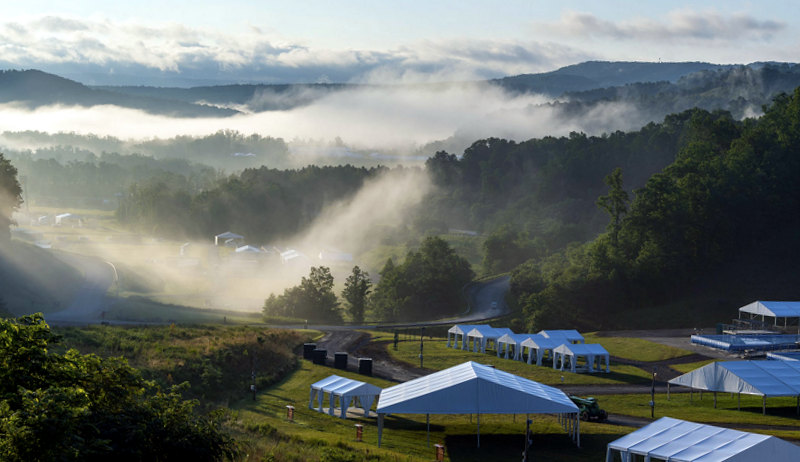
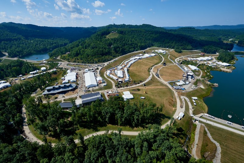
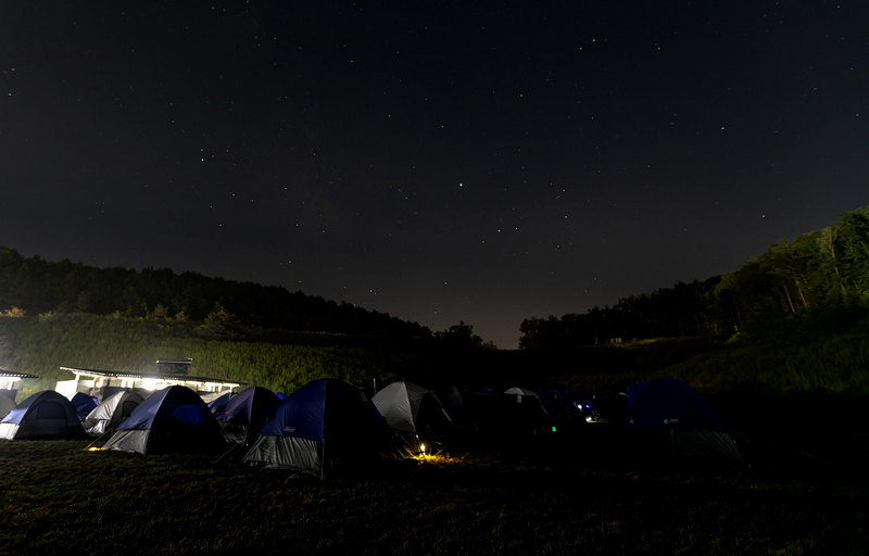
MOUNT HOPE, W.Va. — Thousands of scouts attend the Boy Scouts of America Jamboree in southern West Virginia, filling a virtual city of about 10,000 acres built around outdoor recreation at the edge of the New River Gorge National Park and Preserve.

The scouts and their guests engage in the many outdoor activities for which the New River Gorge region in West Virginia is known—hiking, biking, caving, kayaking, rock climbing, and whitewater rafting on the New River within the adjacent New River Gorge National Park and Preserve.
-
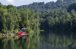
A quiet cove awaits campers in the backwaters at the Summit Bechtel Reserve, home of the Scouting America Jamboree. The reserve invites scouts, their families, friends, and guests to explore and lodge on site.

However, before the Summit Bechtel Scout Reserve was established, the area was part of a wilderness known by many locals as the “Garden Grounds,” into which few people roamed. Many legends of the place are recited around campfires today.
Historian Scott Worley says he’s heard tales of the Garden Grounds all his life. Folks feared becoming lost within, he says, and some were lost, in fact, only to be found later, bewildered or dead of exposure.
Worley said others told stories of strange beasts said to lurk in its most remote sections. “I’ve heard tell of a bigfoot-like wildman said to roam the area,” he said. Many mention the Garden Ground Monster.
Read: Bigfoot sightings cluster in southern West Virginia.
“And then there were stories of bodies being found there or—in jest, I’m sure—of it being a great place to hide bodies.”
Because of its inaccessibility, the area was also recognized as ideal for secreting illegal distilleries. Larry Beverly, who grew up in Mount Hope, recalled meeting moonshiners when he was young, working at his grandfather’s store.
“We used to deliver cracked corn and red-top malt to two customers from my grandfather’s store,” Beverly said.
“I delivered in an old International Scout and my grandfather’s old Chrysler. I’d take bags and bags of corn out there, though both customers had only one chicken. They must have been very well fed.”
Notable UFO sighting at the Garden Ground
The night sky above the grounds was also associated with interplanetary mysteries. Worley recalls: “There were also tales of strange lights in the sky.”
In 1950, the mayor of nearby Mount Hope reportedly sighted an unidentified flying object, one of the first sightings reported in the U.S. A time capsule and monument marked the vantage at the mayor’s residence high atop Ridge Street but were removed by later owners.
How Garden Ground Mountain was named
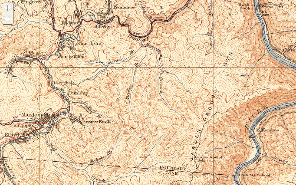
Another mystery surrounds the naming of “Garden Grounds,” which takes its name from Garden Ground Mountain, a ridge that follows the rim of the New River Gorge at the eastern extent of the reserve. But the name is atypical. The phrase “garden ground” is unusual. It appears in few places other than in a poem by Robert Louis Stevenson.
About The Sheltered Garden Ground
About the sheltered garden ground
The trees stand strangely still.
The vale ne’er seemed so deep before,
Nor yet so high the hill.
An awful sense of quietness,
A fulness of repose,
Breathes from the dewy garden lawns,
The silent garden rows.
As the hoof beats of a troop of horse
Heard far across a plain,
A nearer knowledge of great thoughts
Thrills vaguely through my brain.
I lean my head upon my arm,
My heart’s too full to think;
Like the roar of seas, upon my heart
Doth the morning stillness sink.
Local historians generally support the idea that “Garden Ground Mountain” was named for the many gardens opened in the forest by immigrants in the late 1800s. Why would anyone garden in such a remote area? Before the mainline of the Chesapeake & Ohio Railway opened the gorge in 1873, it was very remote, but at that time, the edges of the mountain along the gorge and the new railroad became more accessible.
Stevenson’s poem would, by then, have attained popularity and would have been familiar to settlers in the area. Could it be that his poem inspired the naming of the mountain?
Looking for mysteries to solve while you’re visiting the summit? There are plenty, but four legends and legendary spots will help satiate your interest.
President Taylor’s Cousin’s Hat Factory
Little is known about a hat factory now part of one of the most remote reaches in the Garden Grounds area. It operated out of a barn-like wooden building on a ridge of farmland overlooking the river about a mile east of the reserve.
According to the late historian Shirley Donnelly, the factory and an adjacent weaving shop were owned by Ben Taylor—a cousin of U.S. President Zachary Taylor—who settled the area before the Civil War.

The hats were carried by wagon to Mount Hope and then exported to larger U.S. cities by rail. Archeologists working with the park service hope to survey the area, where finding a trove of hatpins might confirm its location. The National Park Service has expressed interest in opening a trail east of the reserve and through the Hat Factory area.
Thurmond and the Poker Game
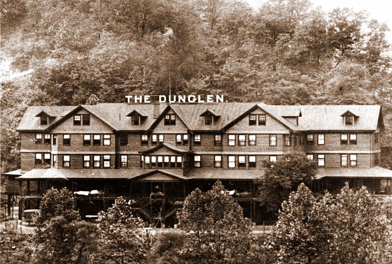
Historians continue to debate whether the world’s longest poker game was played at Thurmond. According to some sources, the legendary game lasted 14 years and was played in the early 1900s at the 100-room Dun Glen Hotel. Many versions claim Ripley’s Believe it or Not! and the Guinness Book of World Records; however, neither organization confirms that it reported on the matter, and Guinness records were not published until 1955, twenty-five years after the hotel had burned.
Most agree that the tale of the Thurmond Poker Game is a kind of fable. It might never have happened, but it is undeniable that gambling was a popular pastime at the hotel. Thurmond, a railroad boomtown settled by Captain William Thurmond in the 1870s, was a “dry” town in which liquor was disallowed, but across the river, the Dun Glen permitted the consumption of alcohol and activities such as card playing and gambling.
Though the hotel is long gone, the Thurmond National Historic District and its visitor center, now an Amtrak stop, are popular tourist destinations. The district contains many preserved structures from the town’s heyday, and rangers are often on hand in the warm months to guide tours and answer questions.
The Indian Warpath
One of the most important prehistoric trails to traverse the Appalachian Mountains wandered through the southern reaches of the reserve. Known locally as “the Warpath,” it was part of a system of trails that traveled between the Ohio Valley and the Atlantic seaboard. Frontier heroine Mary Draper Ingles famously traveled parts of this trail system during her capture and escape from the Shawnee in 1755. Her path may not have passed through the reserve, but apparently, she followed the river along the foot of Garden Grounds Mountain on her return through the wilderness.
The Warpath may be better known for its westward point of beginning at the Paint Creek Trail at present-day Pax, five miles west of the reserve. Their warriors had ritualistically painted a grove of trees to represent foes. (Read: Legend of Painted Trees and Indian Warpath based on truth).
Traveling eastward, their warpath crossed Packs Mountain and descended into the upper vale of Dunloup Creek at present-day Mount Hope. A series of burial mounds and an ancient stone earthwork along the creek testified to the presence of a prehistoric village, though clues were likely destroyed when the town developed. Parts of the earthwork are believed to have been incorporated into the foundations of buildings now in its national historic district. (Read: Prehistoric mystery underlies ‘Egypt’ in southern W.Va.)
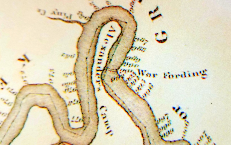
From Mount Hope, the trail traveled west through the southern reaches of the reserve and over the southern end of Garden Ground Mountain. It descended to a ford on the New River, mapped in the late 1800s as the “Warford.” Beyond the ford, the trail followed the New River upstream through the bottoms at Prince, then climbed “War Ridge,” where arrowheads were found in significant numbers by early European settlers.
In the highlands beyond, in the Little Levels near present-day Meadow Bridge, the trail forked and continued east toward the Big Levels and what’s now Lewisburg and south toward the New River Valley and what’s now Hinton.
Batoff Mountain
Just south of Garden Grounds Mountain, Batoff Mountain is regarded with some apprehension, both because of the winding road that descends the flank of the mountain and the evil-sounding name, “Batoff,” which sounds like “Bad off.”
Locals used to say you were “bad off” if you had to cross the mountain at night or during a storm. Even today, an out-of-stater will likely be impressed with the curves two-lane W.Va. Route 41 takes. It wanders through five significant curves as it drops more than 1,000 feet over three miles to the New River.
Battoff Mountain takes its name from the French word “batteaux,” a kind of flat-bottomed boat that, according to one version of the legend, could handle much of the upper New River’s white water but would wreck on the rapids at the foot of the mountain. In the 1950s, these rapids became part of a small army facility established to test bridge building in white water circumstances and are now the Army Camp Camping Area.
Do you know of a Garden Grounds legend we have yet to tell? Facebook users can submit a comment in the form below. You may also subscribe to our newsletter for updates.