


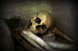
One of the most appealing of all Appalachian legends is that of the tale of the Lost Silver Mine of Johnathan Swift. Almost 200 years after the alleged events transpired, treasure hunters continue to search for the vein of silver that Swift claimed to have lost.
Many believe Swift's mine was located deep in eastern Kentucky, in southwest Virginia, or in eastern Tennessee. However, one reference published in 1976 in the W.Va. Heritage Encyclopedia suggests that some of the treasure was located near the forks of the Big Sandy River on the Kentucky-West Virginia border.
No geologist has confirmed that silver-bearing strata are present in West Virginia, though accounts of such have notably occurred in Jackson County, some 75 miles from the nearest locale discussed in the following account.
Swift's Mines
There are many stories of lost silver and gold mines in West Virginia. One such is that of an engineer named John Swift, who wrote in his journal that he was in the employ of the French at Fort Duquesne when General Braddock was defeated [July 9, 1775]. He claimed to have stolen 25,000 Engish pounds which were abandoned when the English retreated.
Swift claimed he mined silver on a river—possibly the Big Sandy—and to have coined "dollars and crowns" with the metal he extracted. His journal gives the location as follows:
"Description of the place and country adjacent to the creek that the furnace is on: Heads south-west and runs north-east; abounds with plenty of laurel and is so very cliffy that it is almost impossible to get a horse near the place; so extremely rough that we never took our horses more than six or seven miles of the place. There is a thicket of holly a fourth of a mile below the small lick, and another that we called Lick Creek. The branch forks about three miles below the furnace and the left-hand creek we called furnace creek. Below the fork, the creek is a small stream running generally north-east. Below the fork and the holly thicket, you will find many names on a beech tree in the year '67. (1767-ed.) About a mile below you will find Mr. Monday, Mr. Jefferson, and Mr. Gust's names in the year '67, '62, and '65. (1767, 1762 and 1765-ed.).
"Between the small lick and the furnace is a remarkable rock. It hangs quite over the creek, and the water runs under it. Mountains covered with laurel, and over watercourses there is so much laurel that a man cannot get along without great difficulty. Most of the mountains and hills have but little timber but are poor and barren. North of the furnace is a large hill seven or eight miles in length and which abounds in good timber, but south there is no timber worth notice.
"Furnace creek forks about three miles above the lick, and in the forks, on a point, you will find three white oaks from one stump. In each is a smart chop with a tomahawk. We sometimes went to a salt spring up the right-hand fork and came this way back, which was the cause of marking those trees. Location of the place 38 degrees 2 minutes N., longitude 80 degrees 6 minutes 19 seconds West.
"To find the kegs, set compass on the west side of the furnace under the rock house, thence due west 50 poles to a tree growing thus, (here a figure representing a crooked, leaning tree appears.) Set compass at second bend, run due south 20 poles. You will find a tree with a large limb on the south side. Under this limb, we buried four ten-gallon kegs full of dollars and crowns.
"To find the creek — you will know the creek by its being very cliffty. The creek forks two or three miles from the river and below the mouth of the creek there is a remarkable gap in the rock and at the fork of the creek are three points, two below and one in the forks. A short distance below the forks there are two notable rocks which stands up by itself with a pine growing on the top. Large rocks in the bed of the creek. In many places our names are cut on trees on the creek. There was some cane about and below the fork. The creek rises southwest and runs northeast. If you find these descriptions you ought to find every other object. The rock house is three miles from the forks of the creek and the ore is three miles from the furnace. The furnace is under the rock house. To go from the furnace to the ore climb up over the rock house and go in a south-east direction without crossing any stream, go to the top of the ridge and you will find the mine. The ore runs S.E. to N.S."
The journal also states that some treasure was hidden at the forks of Sandy. It is believed that the description of the mine is faulty because the observations of longitude and latitude were taken with a common compass and that the longitude was reckoned from Paris rather than from Greenwich.
Read more: Revisiting the tale of West Virginia’s lost Branch Mountain Treasure; Could a pirate's treasure on the Ohio River be lost for good?
There is a tradition that as an old man Swift met with reverses and returned from France to re-locate his mine, but he was almost blind and was unable to discover the path. According to the story, he later sent a relative with a map, but the man apparently ascended the Little Kanawha rather than the Big Sandy and completely lost his way. It is said that he was living at the home of Col. William Haymond, near Bulltown, and that his trunk was taken by Haymond in lieu of payment when the young man was unable to meet his obligations for board and lodging. In the trunk the journal and map were found.
In 1898 a story written by C. Pierson and published in the Clay County Star recounted the above and added that the description of the mine and the map had been stolen from Haymond and eventually came into the possession of the writer. Several attempts had been made to find the mine by that time. The article also mentioned a tradition that a man named Sam Mullens had found the mine and had taken out a quantity of silver "many years ago."
A copy of the article was made by C. W. Bell, of Zela, from a file of the paper lent to him by William P. Gould, of Fort Meyers, Florida, who required an indemnifying bond of $500 with good security for its safe return, and Pierson took his information from that story.
Could a clerk’s body remain in watery grave beneath the Ohio River?
Might the body of an unfortunate clerk lie buried in a vault beneath the Ohio River? If the full tale of the Wreck of the Kanawha in the early 1900s is true, there’s a chance it could—and that a substantial sum of money is buried with him. Find out more about the tragic event.


Facebook Comments