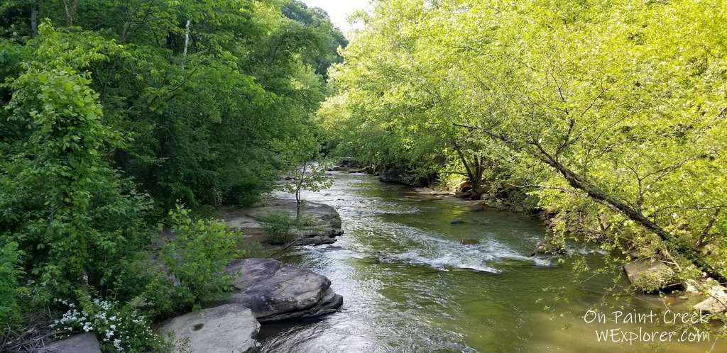
Older folks who live in the valley of Paint Creek may recall legends about how the stream was named: an ancient warpath followed it through the mountains, and warriors celebrated their battles by painting trees along the trail a bloody red.

According to late archaeologist Sigfus Olafson, the stories were true. The route was actually among the most important trails in the Appalachian wilderness, and warriors painted two groups of trees along the stream and held war dances there.
Local tradition as recorded by local historians of the last century,” he wrote, “says that the Indians gathered here prior to their raids on the New River settlements and painted these trees to represent their enemies or those whom they intended to attack and held their war dances around them
“Since similar practices were not uncommon among the Indians of the eastern woodlands, this tradition in all likelihood is true.”
He surmised that the “Paint Creek Trail” (as Virginian settlers had named it in the late 1700s) may have first been used as a warpath by the Iroquois of upstate New York in the 1600s. They followed it south during their wars against the Catawba and other tribes in Virginia and North Carolina. Late, in the 1770s, the trail was used by the Shawnee of the Ohio Country in their raids against Virginians in the valleys of the New and Greenbrier rivers.
While exploring the Ohio River near Wheeling in 1770, George Washington wrote in his journal that he had encountered a group of 60 warriors of the Six Nations (the Iroquois) who were journeying south to battle the Catawba in the Cherokee country. Above Letart Island, he noted the beginning of a “Warrior’s Path” that traveled across the low hills between the Ohio and the Kanawha and must have followed the Kanawha southward.
Further south, beyond Washington’s knowledge, the trail became difficult as it approached the narrow canyon now known as the New River Gorge. Here it split into two routes that traveled the highlands to either side of the gorge.
- The eastern route left the Kanawha River at the mouth of Kelley’s Creek and followed a string of small valleys to present-day Ansted, where it set out across the level uplands toward the Greenbrier Valley. In 1774, Andrew Lewis led militia along this route to the Battle of Point Pleasant.
- The western route turned south from the Kanawha and ascended along the Paint Creek into the highlands at present-day Beckley. From there it crossed Great Flat Top Mountain and descended into the valley of the Bluestone River to meet the Kanawha again, now as the New. It was along the route that Mary Draper Ingles was led as a Shawnee captive.
Though the land through which the trail wandered is rugged, it was peculiarly suited for such a route, Olafson pointed out. “This stream, about thirty miles long, runs through a very rough and mountainous region, but in spite of this type of terrain it is quite straight and has an unusually regular grade.”
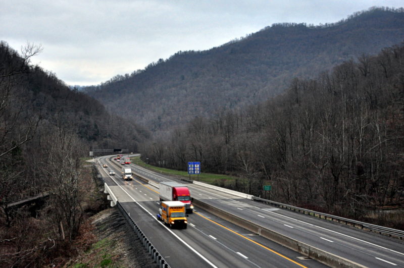
In fact, the valley of Paint Creek is so handy as a mountain passage that the West Virginia Turnpike was opened along part of the course during the 1950s. No better route has been found, and Interstate highways 77 and 64 still follow the same path.
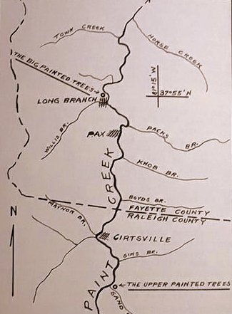
Though few remnants of the trail remained in the mid-1800s, Olafson wrote that he was satisfied as to the location near Pax of the famous painted trees for which the trail was named. This he based on the number of early records that used the trees as landmarks.
“Surprisingly, it was found that there were two painted tree sites on Paint Creek. One of these, sometimes called the “Big Painted Trees,” was in a fair-sized bottom on the west side of Paint Creek immediately below the little village of Long Branch,” he said.
The bottom is well suited for Indian encampment and is the point where the Coal River path, a more direct but more difficult route to the Indian towns on the Scioto, joined the main path on Paint Creek, which suggests that war parties from different areas may have met here by prearrangement.
“The other site referred to in surveys as ‘the Upper Painted Trees,” was some three-and-a-half miles further up Paint Creek at the mouth of Sand Fork [Sand Branch] and about a mile above the community of Cirtsville. It appears to have been of lesser importance as it was infrequently referred to in the surveys.”
The Paint Creek Scenic Trail now follows the Paint Creek from Beckley to its mouth on the Kanawha at Pratt.
EDITOR’S NOTE: Olafson’s four-page work “The Painted Trees and The War Road” is contained in the West Virginia Archaeologist issue of September 1958, the only copy of which is in public circulation is kept in the Mason County Public Library at Point Pleasant.
Sign up to receive a FREE copy of West Virginia Explorer Magazine in your email weekly. Sign me up!
Hmm it seems like your blog ate my first comment (it was extremely long)
so I guess I’ll just sum it up what I had written and
say, I’m thoroughly enjoying your blog. I as well am an aspiring blog blogger
but I’m still new to everything. Do you have any helpful
hints for novice blog writers? I’d really appreciate it.