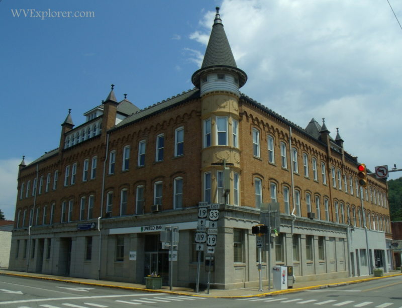
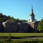
Weston, West Virginia (WV), the county seat of Lewis County, was established in 1818 as Preston. The town’s name was change to Flesherville in 1819, and to Weston later that same year. Weston is located on the West Fork River. The Weston & Gauley Bridge Turnpike was extended southward from Weston to the Kanawha Valley at Gauley Bridge, in 1849. The Trans-Allegheny Lunatic Asylum was opened in Weston in 1864.

Lodging near Weston, West Virginia
Parks & Public Recreation
Stonewall Jackson Lake State Park and the Stonewall Jackson Lake Wildlife Management Area are located approximately five miles south of Weston, and the Stonecoal Lake Wildlife Management Area is located 10 miles to the southeast. Jacksons Mill, West Virginia, the childhood home of General Stonewall Jackson and site of Jacksons Mill State 4-H Camp, is located five miles north of Weston.
Photos of Weston & Vicinity

[vc_message style=”square” message_box_color=”mulled_wine” css_animation=”fadeIn”]Weston is a favorite haunt of ghost hunters and is numbered among the most haunted locales in West Virginia. According to West Virginia Ghosts, a handful of Weston hauntings have become legendary.[/vc_message]
Location
Weston is located at the junction of highways US-19 and US-19 approximately two miles northwest of the junction of the I-79 and WV-33 expressways, seven miles southwest of Jane Lew, West Virginia, 15 miles west of Buckhannon, West Virginia, 20 miles northeast of Burnsville, West Virginia, and 30 miles northeast of Glenville, West Virginia.
Map of Weston, West Virginia
Regional Information
Weston is located in the Monongahela Valley Region in north-central West Virginia near the Heartland Region.