
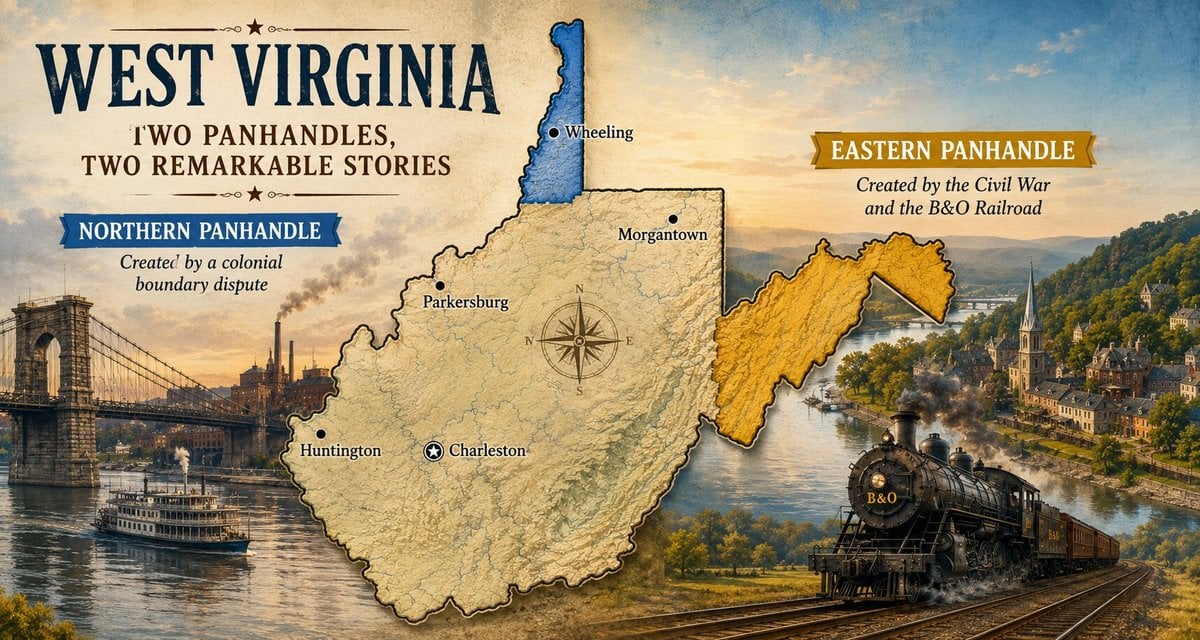
WHEELING, W.Va. — A glance at a map of West Virginia raises an obvious question. Why does the Mountain State have two narrow strips of land reaching toward opposite corners of the eastern United States?

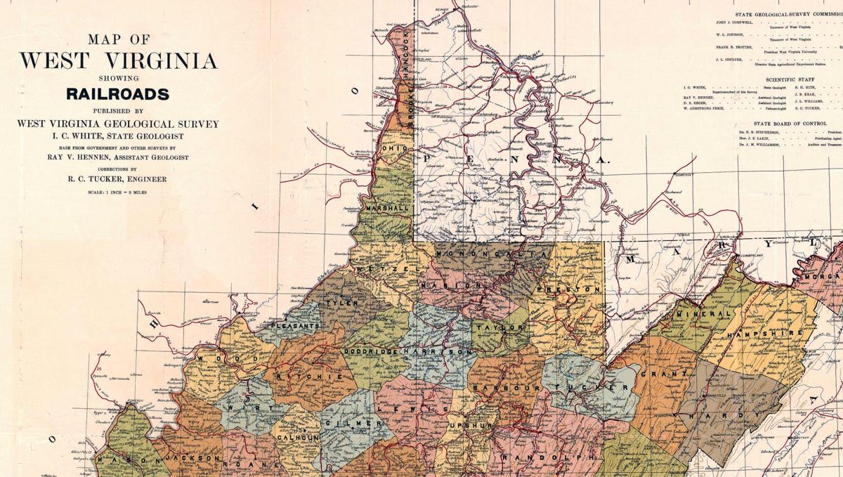
One extends northward for more than 60 miles between Ohio and Pennsylvania. The other stretches eastward from the Allegheny Front to the doorstep of Washington, D.C.
Though they look vaguely similar on a map, the northern and eastern panhandles came into being for entirely different reasons. One owes its existence to an 18th-century boundary dispute between Virginia and Pennsylvania. The other was shaped by the Shenandoah Valley, the Civil War, and, perhaps most importantly, the Baltimore & Ohio Railroad.
Together, they tell two remarkable stories that explain not only West Virginia’s unusual outline but also how geography, transportation, and politics combined to create America’s 35th state.
Northern Panhandle was created by a colonial land dispute
The story of the Northern Panhandle begins long before West Virginia existed. During the colonial period, both Virginia and Pennsylvania claimed much of the same frontier. Each colony issued land grants, encouraged settlement, and asserted authority over territory that included present-day northern West Virginia and southwestern Pennsylvania.
“Pennsylvania believed they claimed the land in western Pennsylvania, and Virginia thought that that was part of Virginia,” Weirton historian Paul Zuros explained to West Virginia Explorer writer Amanda Hinchman in an earlier interview. “You can imagine that this was a problem for both states.”
The disagreement became so significant that Virginia established Yohogania County in 1776, claiming an enormous area that included present-day Hancock and Brooke counties as well as modern Pittsburgh and surrounding portions of Pennsylvania.
“It’s a vast amount of land that Yohogania County is sort of claiming,” Zuros says. “That would mean Pittsburgh would have been squarely in Virginia at that particular moment in history.”
The competing claims became so contentious that the Continental Congress promised to settle the dispute after the American Revolution.
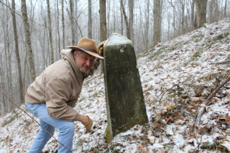
That task eventually fell to surveyor Andrew Ellicott. Working from the western end of the Mason-Dixon Line, Ellicott extended a new boundary northward in 1785, creating what became known as the Ellicott Line. Virginia accepted the survey. Pennsylvania accepted it as well.
The new boundary permanently defined the western edge of Pennsylvania while preserving a narrow strip of Virginia along the Ohio River.
“Both states accepted that line,” Zuros says. “That’s why we’ve got the Ellicott Line on West Virginia’s eastern border and then the Ohio River on West Virginia’s western border.”
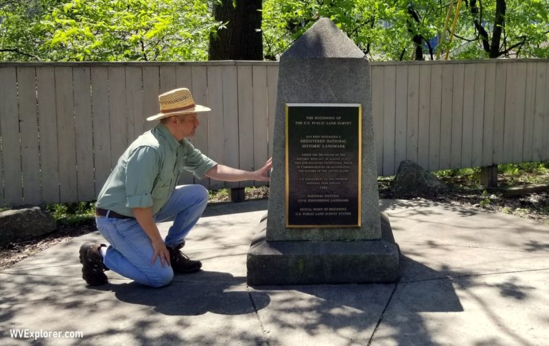
The survey had consequences far beyond today’s state line. The Ellicott Line became the Point of Beginning for federal surveys across the Northwest Territory, influencing how millions of acres west of the Ohio River would eventually be divided and settled.
“It was vitally important—not only for West Virginia and Virginia but also for the Northwest Territory,” Zuros says.
The remaining lands of Yohogania County were absorbed into Ohio County, later giving rise to Brooke County in 1796 and Hancock County in 1848. Together, those counties formed the narrow northern extension that would become part of West Virginia when the new state entered the Union in 1863.
Rivers, roads, and industry shaped a distinct region
Geography soon reinforced the panhandle’s unique identity. Bounded by the Ohio River on one side and Pennsylvania on the other, the region developed stronger commercial ties to Pittsburgh and the growing Midwest than to eastern Virginia.
“It was something you see throughout West Virginia,” Zuros says. “We didn’t have the same culture as the people in the eastern part of Virginia. We didn’t have these huge plantations or as many people. It was just a little different from what was going on in the eastern part of the state.”
Its strategic location only increased its importance. The National Road crossed the Ohio River at Wheeling, and railroads soon linked the region to eastern cities and expanding markets in the Midwest.
“We’ve got the Ohio River, which was the major highway at one time, and we’ve got the railroads connecting us to the east and west,” Zuros says. “We’re kind of in the center of it all.”
Industrialization transformed the panhandle during the late 19th and early 20th centuries. Steel mills rose along the river, immigrants from across Europe established thriving neighborhoods, and Weirton Steel eventually became West Virginia’s largest employer.
Although much of that heavy industry has faded, its legacy remains visible in the architecture, neighborhoods, churches, and family-owned restaurants that continue to define communities throughout the region.
Even today, many residents work across state lines in Ohio or Pennsylvania while choosing to live in West Virginia.
“We do have people who work and spend their time in Pittsburgh but live in West Virginia because the property taxes are better,” Zuros says. “You’ve got a better quality of life here. It’s a lower cost of living here as well.”
The Eastern Panhandle followed a different path
If the Northern Panhandle owes its existence to surveyors, the Eastern Panhandle owes much of its modern shape to transportation. Long before railroads crossed the Appalachians, Native peoples traveled well-established routes through the Shenandoah Valley.
“The history of the Eastern Panhandle of West Virginia is tied to the movement of peoples up and down the Shenandoah Valley, which began long before the arrival of Europeans,” says Benjamin Bankhurst, associate professor of history at Shepherd University.
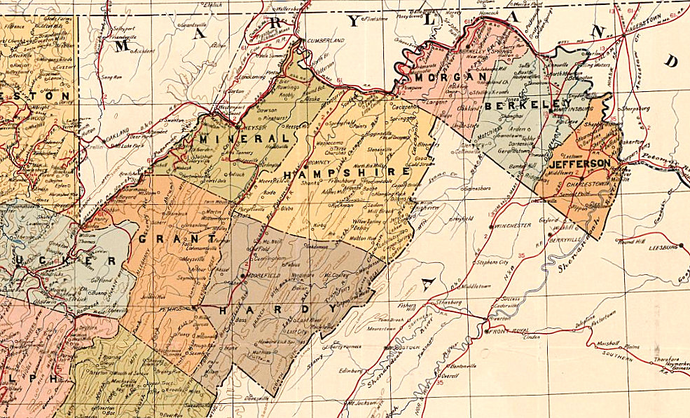
“The Shenandoah is home to several prominent roads that predate the arrival of Europeans, the most famous being the Great Wagon Road of the valley, which is now Route 11 and was part of a trail system for prehistoric peoples.”
When German and Scots-Irish immigrants reached North America during the 18th century, many found the best lands near Atlantic ports already occupied. Instead, they followed the Blue Ridge southwest through the Shenandoah Valley.
“The counties that make up the Shenandoah counties of West Virginia today played a really important role in helping funnel migrants into the rest of the state in the eighteenth century,” Bankhurst says.
Those migration routes established some of West Virginia’s oldest communities, including Shepherdstown, Charles Town, Berkeley Springs, and Harpers Ferry.
Unlike much of western Virginia, these communities developed close cultural and economic ties with the Mid-Atlantic, influences that remain visible today.
The Baltimore & Ohio Railroad changed the state border
Everything changed with the arrival of the Baltimore & Ohio Railroad. By the mid-19th century, the B&O had become one of the nation’s most important transportation corridors and one of the largest employers in the region.
When Virginia voted to leave the Union in 1861, the railroad suddenly became a strategic military asset. “It’s such an important piece of infrastructure,” Bankhurst says, “and there’s a broad acknowledgment that it’s going to be a feature that the Union is going to fight over.”

While many residents of Jefferson and Berkeley counties sympathized with Virginia, the Union had little interest in allowing the B&O Railroad to return to Confederate control. As western Virginians organized the Wheeling Conventions and created the Restored Government of Virginia, the legal foundation for a new state gradually took shape.
“The legal fiction of loyal Virginia served them well,” Bankhurst says. “Basically, the Wheeling government said they were the right government of Virginia.”
After the Civil War, Berkeley and Jefferson counties voted to join West Virginia, though the decision remained deeply controversial. Virginia challenged the transfer before the U.S. Supreme Court, arguing that the counties had never been legitimately separated.
Ultimately, the court ruled in favor of West Virginia. The railroad had prevailed.
“There is some spite here,” Bankhurst says. “Why should the Virginians, having committed treason, have those two counties back and have that critical feature, the B&O Railroad, back on their territory?”
Then he offers the explanation that many historians believe best summarizes the story.
“So that’s kind of why we are the way we are,” Bankhurst says. “To understand why that’s the case, it’s the railroad. In Jefferson County, we’re fond of saying, ‘It’s the railroad, stupid.’ That’s why we’re here—why we’re in West Virginia.”
Two gateways into West Virginia
Although the Northern and Eastern panhandles were created by very different events, they share an important role today. For many travelers, they provide a first impression of West Virginia.
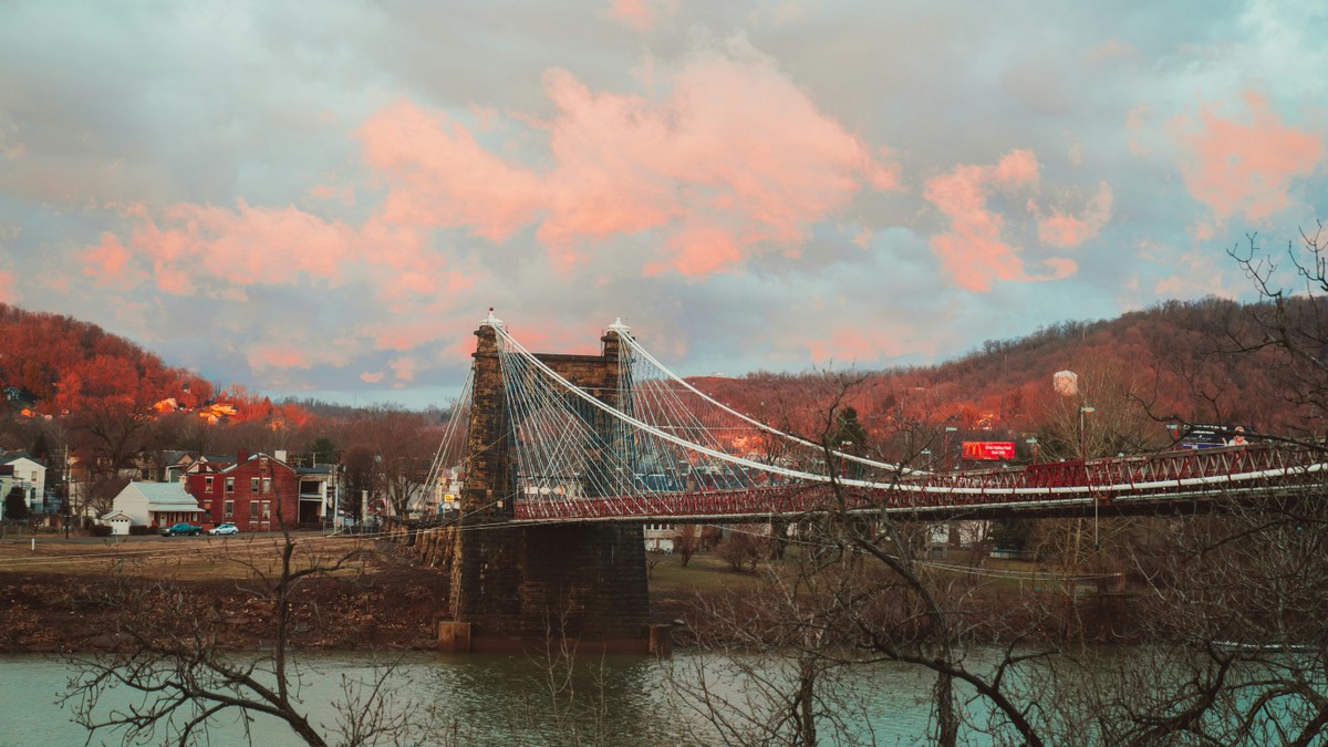
Visitors arriving from Ohio or western Pennsylvania in the northern panhandle often discover the state through Wheeling, Weirton, or Moundsville, where the broad Ohio River, historic suspension bridges, Victorian architecture, and reminders of the state’s industrial past create an introduction unlike anywhere else in West Virginia.
Those entering the eastern panhandle from Maryland or Virginia often encounter an entirely different landscape.
The eastern panhandle welcomes visitors with rolling farmland, historic villages, mountain gaps, Civil War landmarks, and the converging waters of the Potomac and Shenandoah rivers.
Communities such as Harpers Ferry, Shepherdstown, Berkeley Springs, and Charles Town have become destinations in their own right while serving as gateways to the rest of the Mountain State.
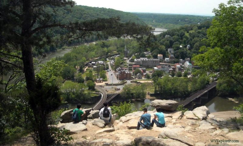
Each panhandle reflects the history that shaped it. One grew beside America’s inland waterways and the industries that followed them. The other developed along ancient travel corridors that later became wagon roads, railroads, and modern highways connecting the Atlantic seaboard with Appalachia.
Two regions, two cultures
The differences extend well beyond geography. In the Northern Panhandle, generations of immigration transformed communities into centers of steelmaking, glass production, and manufacturing. Italian, Croatian, Slovak, Greek, and many other immigrant traditions continue to influence local churches, neighborhoods, festivals, and restaurants.
The region’s proximity to Pittsburgh also shaped everyday life.
“Where I am in Hancock County, the county is only three miles wide between Pennsylvania and Ohio,” Zuros says. “The people here tend to follow more things from western Pennsylvania.”
That relationship continues today as many residents commute across state lines while choosing to make their homes in West Virginia.
The Eastern Panhandle tells a different story. Rather than steel mills and river commerce, its identity was shaped by fertile farmland, colonial settlement, and its long association with the nation’s capital.
Bankhurst says the region occupies a unique cultural crossroads.
“The answer to that question is both,” he says when asked whether the panhandle is Southern or Mid-Atlantic. “It’s a sort of coming together of these different histories and cultures.”
German immigrants left a lasting influence on agriculture, architecture, and local traditions. At the same time, the legacy of slavery, the Civil War, and proximity to Virginia remain deeply woven into the region’s identity.
“In that sense, the legacy of enslavement is very present,” Bankhurst says, “and it is a very Southern place as well.”
A place apart, yet unmistakably West Virginian
The Eastern Panhandle has often seemed different from the rest of the state. Bankhurst points to the aftermath of the Battle of Blair Mountain as one example.
Although the fighting occurred in Logan and Mingo counties hundreds of miles away, the treason trials were held in Jefferson County because officials believed its agricultural economy and distance from the coalfields made it a more impartial setting.
“That should lead people to scratch their heads,” Bankhurst says. “Why would this trial be so far away?”
Yet he believes that distinctiveness ultimately strengthens West Virginia rather than dividing it. “It’s distinct. It’s its own thing,” he says, “though it is, at this point, I think, also quintessentially West Virginian.”
The Northern Panhandle has long occupied a similarly unique position. Its residents often shop, work, and attend sporting events across state lines while maintaining strong ties to West Virginia. Its industries may have risen and fallen, but its historic river towns, scenic hillsides, and transportation heritage continue to distinguish it from the rest of the state.
“We’ve got a unique history and background,” Zuros says. “Come and visit, and experience what life is like here in the Northern Panhandle.”
Two different futures
Today, each panhandle is evolving in new ways. The Northern Panhandle continues to reinvent itself through heritage tourism, outdoor recreation, healthcare, education, and advanced manufacturing while celebrating its remarkable industrial past.
Meanwhile, Bankhurst says the Eastern Panhandle has become one of West Virginia’s fastest-growing regions as new residents arrive from the greater Washington metropolitan area seeking a different pace of life.
“We are very much in the gravitational order of the greater Washington area,” he says. “Our culture is now being sculpted by new arrivals seeking housing and working in Washington.”
Yet he believes the region’s identity remains defined not by one influence but by many. “We are a weird sort of gateway in which we’re the entrance to the rest of the state in many respects,” he says. “We’re the point where people will first arrive in West Virginia from the East. At the same time, from the perspective of being in the state, we’re also a portal out toward the greater D.C. area.”
“If I had to define the Eastern Panhandle of West Virginia,” he says, “it’s a place in between.”
More than unusual shapes on a map
West Virginia’s two panhandles are often treated as geographic curiosities—odd extensions of land that interrupt an otherwise compact state. Their history reveals something far more meaningful.
The Northern Panhandle exists because colonial surveyors finally resolved one of early America’s most contentious boundary disputes, preserving Virginia’s narrow foothold along the Ohio River.
The Eastern Panhandle exists because ancient migration routes became wagon roads, those roads gave way to one of the nation’s most important railroads, and the Civil War convinced national leaders that the Baltimore & Ohio Railroad was too important to surrender.
One owes its shape to the work of surveyors. The other owes its shape to soldiers, politicians, judges, and a railroad. Yet together they tell a single story.
They remind visitors that West Virginia was never shaped by geography alone. It was shaped by the movement of people, commerce, transportation, conflict, and generations of communities that found their own identities while helping to create the Mountain State.
Perhaps that is why the panhandles continue to fascinate travelers today. Far from being isolated corners of West Virginia, they remain two of its great gateways—one looking toward the Midwest, the other toward the nation’s capital —and both offering their own remarkable introductions to the history, culture, and character of the Mountain State.
Readers can explore each region in greater depth through WVExplorer’s histories of the Northern Panhandle of West Virginia and the Eastern Panhandle of West Virginia authored by Amanda Larch Hinchman.
165 years later and the amount of gaslighting of West Virginia history amazes me.
Wheeling had a lot of trade with the deep south, according to the late Wheeling historian Beverly Fluty. The first steamboat to leave Wheeling went down the Mississippi to New Orleans. West Virginians never identified with Pennsylvania or Ohio, you only have to look at the county vote map for the 1860 presidential election, it is a hard line for southern candidates, without exception, even down through Kentucky. The 1800 or so votes for Lincoln in WV were mostly non-native residents from northern states or immigrants. Two-thirds of the heads of households in Wheeling were not native West Virginans. The men who opposed Confederates in Grafton in May 1861 were Irish railroad workers, not native West Virginians. That is why Pierpont referred to them as “b’hoys”. As for slavery, West Virginia had enough slaves and plantations to be fully engaged in the practice. A Pennsylvania traveller sailing down the Ohio River in 1815 observed- “There is a plain contrast between the different sides of the river, arising from slavery being forbid on one, and tolerated on the other … On the [West] Virginia side, there were some good houses at remote distances from each other but accompanied by the negro quarters. On the other side neat cottages and comfortable cabins were to be seen at every little remove along the river …”
The annexation of the eastern panhandle was a pure land grab without regard for the residents, much as the 8 counties that never cast a vote to leave Virginia.
Showboat elections were used to provide cover. The first “elections” for offices in the Restored Government were not held until May 1862, and only 14,000 votes were cast. There were nearly 80,000 men of voting age in WV. I close with the words of Lt. Gov. Polsley and delegate J. Chapman Stuart.
Lt. Gov. Polsley Aug. 16, 1861 “If they proceeded now to direct a division of the State before a free expression of the people could be had, they would do a more despotic act than any ever done by the Richmond [Secession] Convention itself”.
Constitution delegate Chapman J. Stuart, Dec. 10, 1861- “Now, Mr. President, to show you, and it needs but to look at the figures to satisfy the mind of every member, that even a majority of the people within the district composed
of the thirty-nine counties have never come to the polls and expressed their sentiments in favor of a new State. In a voting population of some 40,000 or 50,000 we see a poll of only 17,627 and even some of them were in the [Union] army.”