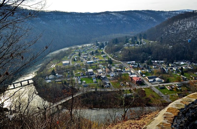
Rowlesburg, WV (West Virginia), a community on the Cheat River in southern Preston County, was chartered in 1858 and named for James Rowles, an engineer who surveyed the route of the Baltimore & Ohio Railroad. Rowlesburg is situated on a bend in the valley of the Cheat River opposite the mouth of Saltlick Creek.
Lodging near Rowlesburg, West Virginia
Parks & Public Recreation
The near reaches of the Briery Mountain Wildlife Management Area are located roughly two miles north of the community on Briery Mountain.
Location
Rowesburg is on highway WV-72, three miles north of its junction with US-50 at Macomber, West Virginia, and 13 miles south of the county seat at Kingwood, West Virginia.
Map of Rowlesburg, West Virginia
Regional Information
Rowlesburg is located in the Monongahela Valley Region in northern West Virginia near the Allegheny Highlands Region.