
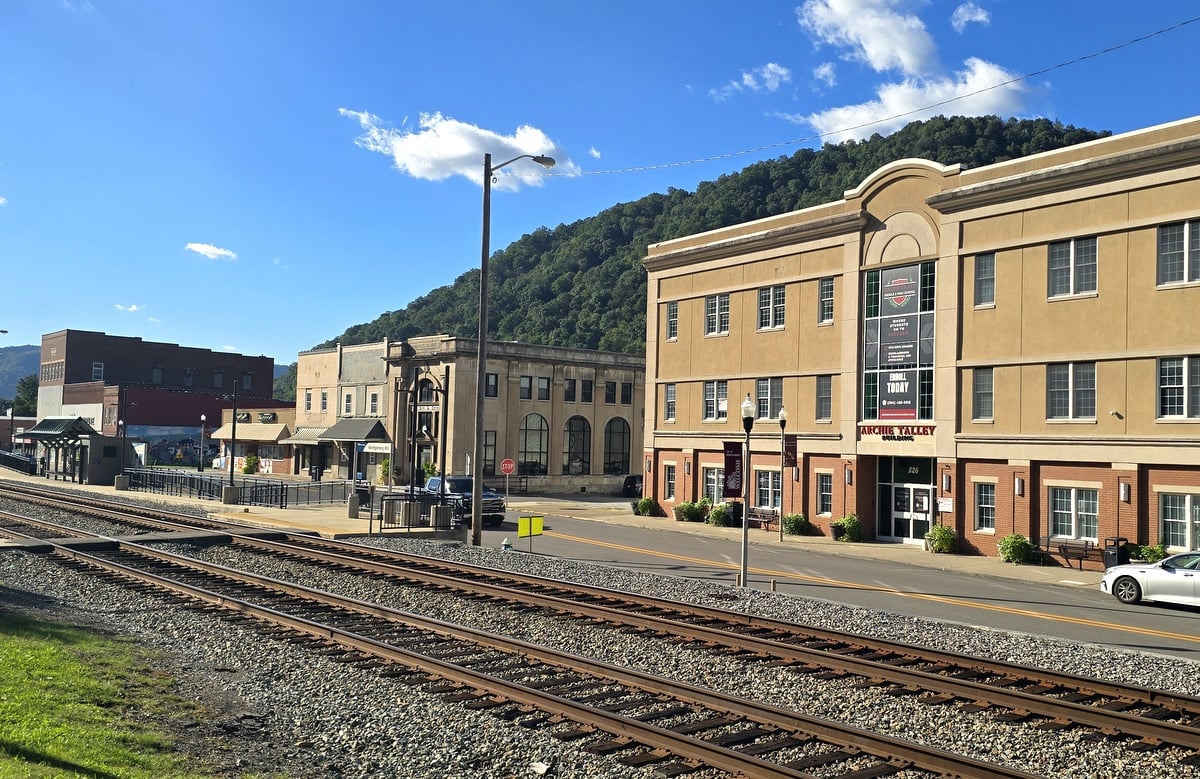
Montgomery, West Virginia, is a small city in the upper Kanawha River Valley, about 30 miles southeast of Charleston, the state capital. Primarily in Fayette County, the community developed near the head of the commercially navigable Kanawha River and became an important center for railroads, coalfield trade, and education.

Montgomery has an unusually rich history. Its downtown, the Kanawha River, and the former college campus are concentrated within a narrow mountain valley, while nearby highways lead east toward Gauley Bridge, Hawks Nest State Park, and the New River Gorge region.
Montgomery is a city in transition. Its population has declined substantially since the mid-20th century, and the 2017 departure of West Virginia University Institute of Technology ended more than 120 years of higher education centered in the city.
Some former campus properties remain in use, while others are being removed or repurposed. The city and neighbor, Smithers, are increasingly looking to the river and recreational trails as part of the Kanawha Valley’s future. Proximity to the national park has helped increase economic viability, and the city is often counted among New River Gorge towns.
Map of Montgomery, West Virginia
Montgomery and the Kanawha River
The Kanawha River may be the best place to begin understanding why Montgomery developed where it did. The city occupies a narrow strip of relatively level land between the river and a steep section of the Appalachian Mountains near the upstream limit of the river’s commercial navigation system.
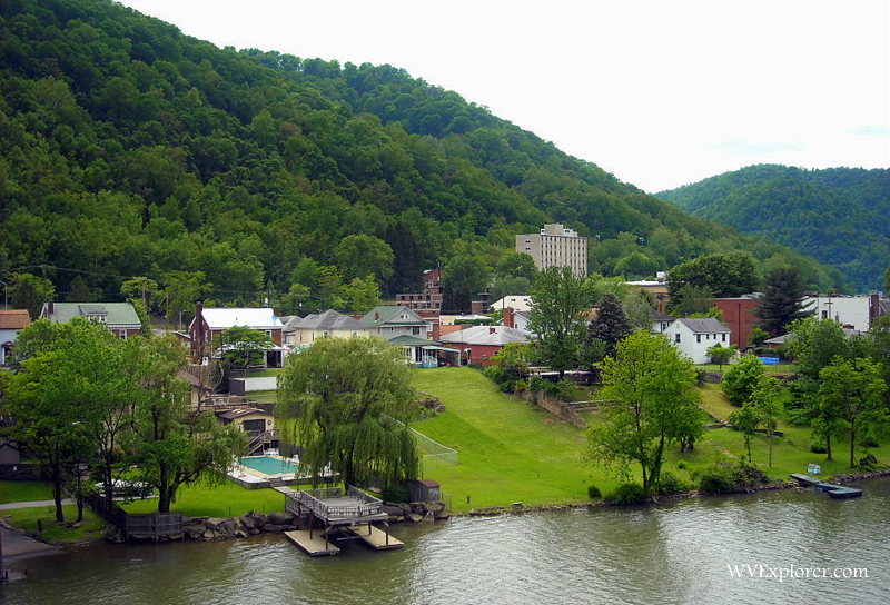
The London Locks and Dam are located about two miles downstream at river mile 82.8. Its upper navigation pool extends another 7.8 miles upstream to the head of navigation, according to the U.S. Army Corps of Engineers, placing Montgomery near the upper end of the navigable industrial waterway that extends downstream toward Charleston and the Ohio River.
The earliest community, known as “Montgomery’s Landing,” was home to a ferry operated by the Montgomery family across the Kanawha. The discovery of cannel coal in the region encouraged mining, but development accelerated after rail transportation reached the valley in the 1870s. Fayette County engineer I. J. Settle laid out additional lots in 1879, and the community became known for a time as “Coal Valley” before being incorporated as Montgomery in 1891.
This combination of river, railroad, and coalfield access turned Montgomery into a trading center for a much larger population scattered throughout the surrounding mountains. Architectural historian S. Allen Chambers Jr. notes that by 1911, as many as 26 coal operations within five miles employed approximately 15,000 men. The scale of its downtown reflects its importance to people who lived well beyond its municipal boundaries.
Historic downtown Montgomery
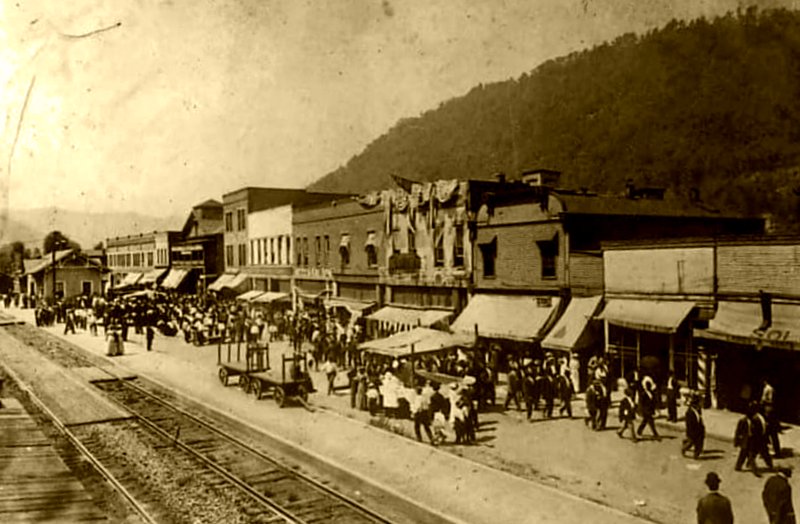
Montgomery’s commercial district developed between the railroad and the Kanawha River, where stores, banks, hotels, professional offices, and other businesses served residents and surrounding coal communities. Trains extending from Chicago to New York City still pass through downtown, and the close relationship between the railroad, the river, the mountains, and the commercial district remains one of its most distinctive characteristics.
The city supported a surprisingly active newspaper industry. According to the West Virginia Heritage Encyclopedia, publications over the years included the Plain Dealer, Pathfinder, Courier, Call, Messenger, Montgomery News, and Montgomery Herald, along with newspapers produced for the valley’s Black community.
The city reached its population peak in 1950, when 3,484 people lived there. Its population subsequently declined, as did that of many communities in the surrounding coalfields, as technology reduced mining employment. The 2020 census counted 1,275 residents.
Visitors today will find remnants of the historic commercial center alongside occupied businesses, vacant properties, empty lots, and sites. Many older buildings have been demolished. The setting nevertheless remains impressive, with forested mountains rising immediately behind a downtown built to serve a much larger regional population.
Black history in Montgomery
Montgomery became an important center of African American life and education as Black workers and their families moved into the state’s industrial regions in the late 19th and early 20th centuries. Employment in the coal mines and on the railroads helped sustain churches, schools, fraternal organizations, newspapers, and other institutions created by Montgomery’s Black community.
The first public school for Black children in Fayette County opened in Montgomery in 1879. As enrollment grew, the school added secondary grades, and students moved into Simmons High School in 1923. After that building burned in 1926, classes temporarily met in a lodge hall and local Black churches until a new school opened in 1928.
The high school became a regional institution. Black students traveled by train from communities as distant as Edmond, Winona, and Paint Creek, and a dormitory accommodated those who lived too far to commute. By the time the school closed following integration in 1956, 1,037 students had graduated.
Another enduring Black institution, Bright Hope Lodge was organized in 1889 and established a hall on Third Avenue. Like other fraternal organizations of the period, it provided social connections and assistance to members and families facing unemployment, poverty, illness, or death. The present lodge building dates to 1962 and is included on the National Park Service’s African American Heritage Auto Tour.
The city supported an African American press. Historical accounts identify the Pioneer and Mountain Eagle as newspapers associated with the city’s Black community, though surviving sources differ on some details of their publication histories.
That heritage remains an important part of identity. Of 1,275 residents counted in the 2020 census, 183 (or 14.4 percent) identified as Black or African American.
Montgomery becomes a college town
Education became as important to Montgomery as coal and transportation. In 1895, land was set aside for a state educational institution, and Montgomery Preparatory School was established to prepare students for education at West Virginia University.
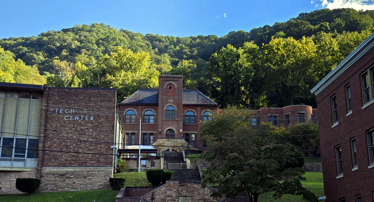
As educational needs changed, the preparatory school evolved into New River State College in 1931 and West Virginia Institute of Technology in 1941 before becoming part of West Virginia University as the West Virginia University Institute of Technology, widely known as “WVU Tech.”
Enrollment expanded significantly after World War II, as returning veterans attended college through the GI Bill. Engineering and technical education became particularly important, and by the late 1960s enrollment approached 2,500 students.
For a city of only a few thousand residents, the impact was considerable. Students rented apartments, ate in restaurants, and shopped downtown, while faculty and staff lived throughout the area. Academic buildings, residence halls, laboratories, and athletic facilities spread across campus, establishing the college as one of Montgomery’s dominant physical features.
The West Virginia Heritage Encyclopedia records that the community had already fought to preserve the school in the 1930s, when an effort was made to eliminate the college. Local residents and supporters successfully lobbied state officials to keep the institution in Montgomery. The relationship ultimately endured for more than a century.
The former WVU Tech campus
West Virginia University announced in 2015 that the college would relocate to the former Mountain State University campus at Beckley, an hour’s drive south. The transition was completed in 2017, ending approximately 120 years of WVU Tech’s presence in Montgomery.
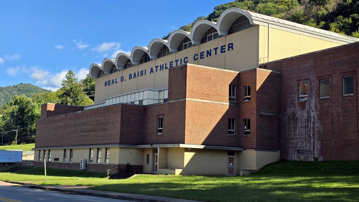
Montgomery’s economic and population decline had begun decades before the university moved. The city’s population had already fallen from 3,484 in 1950 to 1,638 in 2010. Tech’s departure therefore did not cause Montgomery’s long decline, but it removed a major institution and source of economic activity from a community that had already shrunk significantly.
Much of the former campus remains visible, allowing visitors to appreciate the physical scale of the college that once operated here. BridgeValley Community and Technical College continues to maintain its Montgomery campus in Davis Hall at 619 Second Avenue.
Other parts of the former campus are disappearing. A Bridge Valley facilities plan called for reducing its Montgomery holdings from approximately 298,000 square feet to 93,000 square feet, with Westmoreland Hall, the GRID engineering laboratory, Pathfinder engineering classroom building, and Ratliff Hall slated for demolition unless alternative owners could be found.
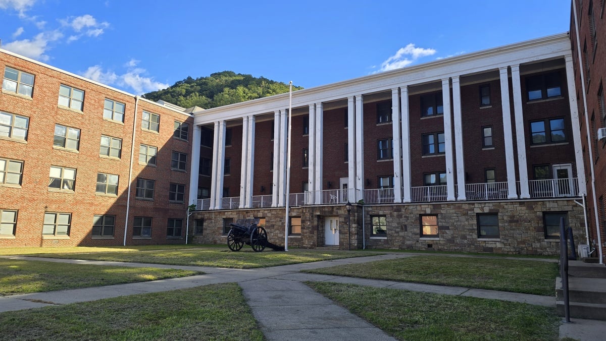
The West Virginia Higher Education Policy Commission subsequently solicited bids for building and site demolition in Montgomery in 2025 and awarded the contract to Reclaim Company LLC. State higher-education budget documents for fiscal 2027 also identify the demolition of three Montgomery buildings as a BridgeValley project.
During a September 2026 visit, West Virginia Explorer found the former campus visibly changing as demolition proceeded, while other substantial academic and athletic buildings remained. WVU also continued, as recently as 2025, to report plans to transfer parcels of vacant former campus land to the City of Montgomery.
Higher education did not disappear from Montgomery with WVU Tech’s departure. BridgeValley continues to operate its Montgomery Campus in Davis Hall, where students receive instruction and academic services. However, its presence is smaller than the former WVU Tech campus, and BridgeValley has been consolidating its Montgomery facilities as other former college buildings are demolished or repurposed.
River Cities and outdoor recreation
Montgomery and neighboring Smithers increasingly share an identity as the “River Cities,” with community development efforts emphasizing the river and the recreational potential of the surrounding mountains. Montgomery lies between Charleston and Gauley Bridge, where the New and Gauley rivers join to form the Kanawha.
Several of the region’s best-known natural attractions are nearby. Kanawha Falls spans the river below Gauley Bridge, while Cathedral Falls drops beside U.S. 60. Continuing east leads toward Hawks Nest State Park, Ansted, and New River Gorge National Park and Preserve.
Montgomery also lies along a broader corridor of African American heritage sites interpreted by the National Park Service. Bright Hope Lodge in Montgomery is one of 17 stops on the agency’s African American Heritage Auto Tour through the New River Gorge region.
Exploring Montgomery today
Montgomery is best explored as a historic Upper Kanawha Valley community rather than a conventional resort town. The river, railroad, historic commercial center, and former college campus are concentrated in a small area, making several periods of the city’s development visible at once.
Travelers should also expect to encounter evidence of Montgomery’s long economic contraction. Historic buildings survive downtown, but vacant structures, empty lots, and demolished properties are part of the present landscape. The former college campus likewise contains buildings that remain in use alongside properties undergoing demolition or awaiting new uses.
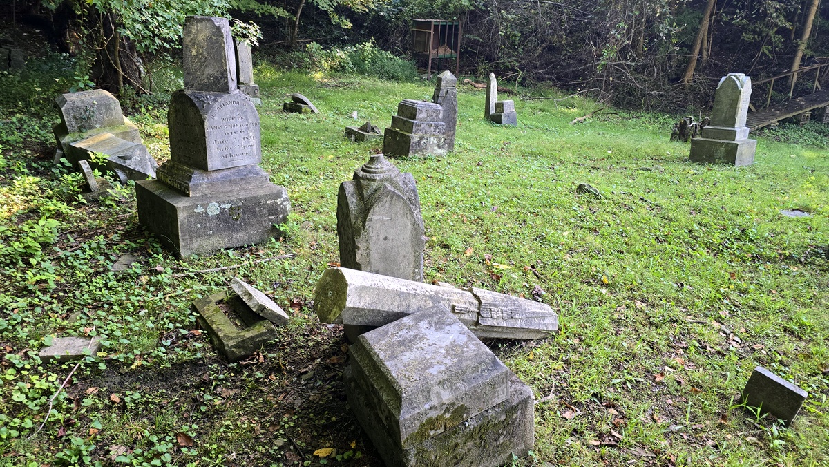
The historic Montgomery cemetery offers another link to the community’s early families. During WVExplorer.com’s September 2026 visit, several older monuments were found toppled or broken among upright stones on the wooded grounds.
Montgomery’s interest lies partly in these accumulated layers. A river landing became a railroad and coalfield trading center. That center became a college town. Black residents built schools, lodges, churches, and newspapers that served communities well beyond the city. A college that began in the 19th century eventually grew into an institution whose campus occupied a substantial portion of the town.
Today, Montgomery and Smithers are again looking toward the Kanawha River as they seek new opportunities in recreation and tourism. More than two centuries after settlement began around a river crossing, geography still shapes Montgomery’s future.
Common questions about Montgomery, West Virginia
Where is Montgomery, West Virginia?
Montgomery is located along the Kanawha River in the Upper Kanawha Valley, about 30 miles southeast of Charleston. Most of the city is in Fayette County, with a smaller portion in Kanawha County. Smithers is directly across the river, while Gauley Bridge and the New River Gorge region lie farther east.
What is Montgomery, West Virginia, known for?
Montgomery is historically known as a coalfield trading and railroad center and as the longtime home of WVU Tech. The city also has an important African American history, including Simmons High School, Bright Hope Lodge, and early Black newspapers. Its location near the head of commercial navigation on the Kanawha River helped shape its early development.
Is Montgomery near the New River Gorge?
Yes. Montgomery is northwest of New River Gorge National Park and Preserve and lies along a natural travel corridor between Charleston and the New River Gorge region. U.S. 60 east of Montgomery leads toward Gauley Bridge, Kanawha Falls, Cathedral Falls, Hawks Nest State Park, and Ansted.
What happened to WVU Tech in Montgomery?
WVU Tech moved from Montgomery to Beckley, with the transition completed in 2017. The institution and its predecessors had operated in Montgomery since the 1890s. BridgeValley Community and Technical College continues to operate a Montgomery campus, while other former WVU Tech properties have been reused, transferred, vacated, or demolished.
Why did WVU Tech leave Montgomery?
West Virginia University cited persistent enrollment challenges, the cost and condition of Montgomery facilities, and the opportunity to use the former Mountain State University campus in Beckley. Montgomery had already been losing population for decades when the move occurred, though state officials acknowledged that losing the institution would create additional economic challenges for the Upper Kanawha Valley.
Why did Montgomery become an important town?
Transportation and geography were crucial. Montgomery developed near the head of commercial navigation on the Kanawha River, gained railroad connections as the coalfields expanded, and became a commercial center for surrounding mining communities. The establishment and growth of the college that became WVU Tech added another major economic and cultural institution.
What is the Black history of Montgomery?
Montgomery became an important center of Black education and community life during the coalfields’ industrial development. Fayette County’s first public school for Black children opened there in 1879, and Simmons High School later served students from communities throughout the region. Montgomery also supported Black churches, fraternal organizations such as Bright Hope Lodge, and African American newspapers.
What attractions are near Montgomery?
Nearby destinations include Kanawha Falls, Cathedral Falls, Gauley Bridge, Hawks Nest State Park, and attractions throughout the New River Gorge region. The Kanawha River and developing River Cities recreation projects also offer outdoor recreation in and around Montgomery.
Is Montgomery worth visiting?
Montgomery is especially interesting for travelers interested in West Virginia history, railroad and coalfield communities, African American heritage, architecture, and the changing communities of the Upper Kanawha Valley. Its river, railroad, downtown, and former college campus make several important chapters of West Virginia history visible within a remarkably compact area.
Lodging near Montgomery, West Virginia
Location
Montgomery is located on Highway 61 across the Kanawha River from US-60 and approximately 30 miles southeast of Charleston, West Virginia, and 14 miles west of Gauley Bridge, West Virginia.
Regional Information
Montgomery is located in the Metro Valley Region in southern West Virginia near the New River Gorge Region.